The best forest managers? Indigenous peoples, study says.
New research from the Swedish University of Agricultural Sciences has identified a key to successful forest restoration: long term, local governance by Indigenous peoples or local communities. The more formalized the land tenure rights, the better the outcomes. Research shows that Indigenous and rural communities are the best stewards of the forests they live in, but the study’s novel finding is that community-managed forests yield better, more positive results for both environmental and social outcomes.
“Where people depend upon forest resources for a range of livelihood benefits, like firewood, timber, food, various things, they often have an incentive to take care of those forests. It’s really quite simple,” said lead author Harry Fischer. “When you give communities the opportunity to manage in those ways, you will often see better outcomes.”
Forest restoration is a critical tool for global climate change mitigation, and is particularly important to the 1.8 billion people living in, and relying on, forests for their livelihoods. Restoration projects have historically prioritized environmental outcomes like planting trees to improve biodiversity, or monetizing carbon sequestration through carbon credit schemes. But typically, those interests take precedence over the interests of local communities. The authors argue that a locally-focused, rights-based approach means that those interests don’t have to be mutually exclusive.
The study analyzed data collected by the International Forestry Resources and Institutions over three decades, from 314 community-managed forests, across 15 nations in Asia, Africa, and Latin America. Researchers wanted to understand what the best forests had in common in order to better inform future restoration efforts. The study focused on tropical ecosystems because of the high prevalence of forest restoration efforts in these regions, like the Trillion Trees project and other tree planting initiatives. Common measures of successful forest restoration include healthy biodiversity, like planting trees or stopping deforestation, climate change-mitigation services, like carbon sequestration and carbon credits, and improved livelihoods for local communities in the form of access to forests for food and housing. But the forests with the best results across all three measures were the ones where local communities determined the rules for forest management.
Fischer and the other researchers’ critique of those efforts is that they are target-based. Forest projects focused on planting trees or selling carbon credits saw benefits concentrated in those areas, but poor performance in other areas, particularly when it comes to improving the livelihoods of local peoples. That means that while those projects may be good on paper for international conservation groups or investors, they don’t provide positive spillover effects to the people that live there.
“What we’re saying in our study is, OK, planting trees is not bad,” Fischer said. “Giving power to local people is going to be more effective over the long term. If they have power, the interventions are going to be more legitimate. They’re going to have more local buy-in for that.”
But that transfer of power isn’t being applied. Additional reports show that the world remains off track from reversing forest degradation and meeting decarbonization goals — in part due to a failure to work with Indigenous peoples or local communities, or recognize their rights. A study earlier this month from the Forest Declaration Assessment, a nonprofit that tracks forest conservation efforts, analyzed the National Biodiversity Strategies and Action Plans of 27 countries with substantial forest ecosystems and Indigenous populations. According to the study, those plans to establish national conservation efforts had gaps where Indigenous peoples were performatively included or completely left out. Less than a third of those countries engaged Indigenous peoples when developing their plans.
Levi Sucre Romero, coordinator of the Mesoamerican Alliance of Peoples and Forests and co-chair to the Global Alliance of Territorial Communities, says this low rate of inclusion is one of the critical issues on the table at COP28 in Dubai.
“This implies that decisions are still being made from desks, from cities, for an issue as crucial as forests and those of us who are living and protecting those forests are not taken into account,” Romero said. “The world’s rulers must hear that they can no longer continue making promises about the problem of climate change if they are not going to fulfill them.”
Fischer says that a forest restoration approach that prioritizes local livelihoods instead of making them a secondary benefit will take time — but on average will generate the best results for both environmental and social concerns.
“If we’re going to have participation, let’s do it in a way that really sort of redistributes power over a long, long period,” Fischer said. “[Then], people are able to really manage and get practice, and these practices get institutionalized over time.”
Condit Dam is gone. The fate of the land around it remains in question
The Lower White Salmon Coalition is pushing a new plan for conservation of fish and wildlife habitat. Will its PacifiCorp landowners listen?
Land ho! Removal of the Condit Dam opened sections of the White Salmon River to recreation. But left decisions about surrounding property unresolved Photo: Wet Planet
By Kendra Chamberlain. November 27, 2023. Even before PacifiCorp began removing the 125-foot-tall hydroelectric Condit Dam in southwest Washington in 2011, speculation ran rampant about how the power company would dispose of the approximately 500 acres of land along the White Salmon River where the dam stood.
The dam’s removal left behind a giant, dried lakebed after the waters of the Northwestern Lake reservoir behind it were sent downriver.
Since then, questions and anxiety about the future of the land have only increased. PacifiCorp has yet to announce a decision regarding its intentions.
The lakebed and six-mile stretch of river in question, surrounded by protected Wild and Scenic designated land, has become popular among recreationalists: the newly restored river offers some of the best whitewater paddling in the state, and the area contains an established trail system.
Now, the Lower White Salmon Coalition (LWSC) has released a community-backed Vision Plan for the land. Not surprisingly, conservation is the group’s top priority.
Gone, not forgotten: Condit Dam created electricity and blocked fish and other passage on the White Salmon River for a century. It was demolished in 2011. Photo: Wikimedia Commons
The LWSC was formed in 2016, amid concerns about how and when PacifiCorp might divest its land holdings in the Washington counties of Skamania and Klickitat. Its more than a dozen member organizations include Friends of the Columbia Gorge, Mid-Columbia Fisheries Enhancement Group, Mt. Adams Resource Stewards and Underwood Conservation District.
PacifiCorp had previously offered land leases for the construction of lakefront cabins. After the dam’s decommissioning, the lake is all but gone and cabin owners aren’t sure what PacifiCorp plans to do with the land underneath the cabins.
In 2019, the coalition was caught by surprise when PacifiCorp sold a 39-acre parcel to a developer that clear-cut a wooded area and built residential housing.
“No one knew that parcel existed except them,” LWSC member Pat Arnold told Columbia Insight, adding that the parcel contained high-value habitat. Arnold is also Chair of the Board of the Friends of the White Salmon River.
Lake bed land a priority
The LWSC has spent the intervening years developing its own plan for the land, with the hopes that the group will have a seat at the table of future decision-making.
The planning process included developing committees, conducting public surveys, holding discussions with adjacent landowners and meetings with stakeholders to identify a broad community-backed strategy for the land.
A grant from the U.S. National Park Service’s Rivers, Trails and Conservation Assistance Program helped fund the process.
PacifiCorp has already agreed to a Right of First Offer with the Yakama Nation for up to 289 acres from the former dam site south to the mouth of the river. Yakama Nation Fisheries staff, who have begun habitation restoration in parts of the lake bed, participated as observers in LWSC’s planning process and offered feedback to the coalition.
Map: NPS Rails, Trails, Conservation Assistance Program
The LWSC would like to see the return of native riparian vegetation along the river corridor and salmon spawning areas protected. It also wants assurances that public access and recreational use of the area will remain in the future.
Arnold said the coalition is particularly concerned with the lake bed parcels, because that land would most likely draw developer interest.
“It’s very important for the coalition overall to see those parcels go into conservation ownership,” said Arnold. “The plan has areas where we feel we had a strong consensus and then some areas where we might not have such a strong consensus. But the conservation of those lake bed parcels is absolutely imperative [for the community].”
PacifiCorp has no obligation to take LWSC’s Vision Plan into consideration. But the groups have been in contact.
“We were in communication with PacifiCorp at the beginning of our NPS technical assistant grant,” said Arnold. “We needed to make sure we could access the land for the purpose of the developing the Vision Plan. They were okay with that. We met a couple of times. … We have asked to meet with them to discuss the Vision Plan, but do not have a date yet.”
Despite the lack of commitment, the LWSC remains cautiously optimistic.
“For no particular good reason, we feel that PacifiCorp is on board with the conservation emphasis of the Vision Plan,” said Arnold. “They did their due diligence years ago about finding which parcels could be sold profitably, and apparently after they sold the 39 acres there were not any more, without short platting and such. … We’re just hoping that we can continue to be a voice for what we feel is a pretty clear consensus as discussions go on.”
The Pacific Northwest’s only nonprofit, non-advertiser-driven news source devoted to environmental issues affecting the Columbia River Basin, Columbia Insight depends on support from readers like you. You can help us continue investigating critical stories by donating here.
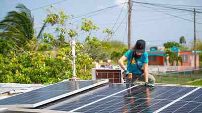
Where could millions of EV batteries retire? Solar farms.
On a 20-acre parcel outside the tiny Southern California town of New Cuyama, a 1.5-megawatt solar farm uses the sun’s rays to slowly charge nearly 600 batteries in nearby cabinets. At night, when energy demand rises, that electricity is sent to the grid to power homes with clean energy.
To make renewable energy from intermittent sources like solar and wind available when it is most needed, it’s becoming more common to use batteries to store the power as it’s generated and transmit it later. But one thing about the Cuyama facility, which began operations this week, is less common: The batteries sending energy to the grid once powered electric vehicles.
The SEPV Cuyama facility, located about two hours northeast of Santa Barbara, is the second hybrid storage facility opened by B2U Storage Solutions. Its first facility, just outside Los Angeles, uses 1,300 retired batteries from Honda Clarity and Nissan Leaf EVs to store 28 megawatt-hours of power, enough to power about 9,500 homes.
The facilities are meant to prove the feasibility of giving EV batteries a second life as stationary storage before they are recycled. Doing so could increase the sustainability of the technology’s supply chain and reduce the need to mine critical minerals, while providing a cheaper way of building out grid-scale storage.
“This is what’s needed at massive scale,” said Freeman Hall, CEO of the Los Angeles-based large-scale storage system company.
The Cuyama facility includes 1.5MW of solar power and 12MWh of storage utilizing second-life Honda EV batteries.
Courtesy of B2U Storage Solutions
Electric vehicle batteries are typically replaced when they reach 70 to 80 percent of their capacity, largely because the range they provide at that point begins to dwindle. Almost all of the critical materials inside them, including lithium, nickel, and cobalt, are reusable. A growing domestic recycling industry, supported by billions of dollars in loans from the Energy Department and incentives in the Inflation Reduction Act, is being built to prepare for what will one day be tens of millions of retired EV battery packs.
Before they are disassembled, however, studies show that around three quarters of decommissioned packs are suitable for a second life as stationary storage. (Some packs may not have enough life left in them, are too damaged from a collision, or otherwise faulty.)
“We were seeing the first generation of EVs end their time on the road, and 70 percent or more of those batteries have very strong residual value,” said Hall. “That should be utilized before all those batteries are recycled, and we’re just deferring recycling by three, four, or five years.”
Extending the useful life of EV batteries mitigates the impact of manufacturing them, said Maria Chavez, energy analyst at the Union of Concerned Scientists.
“The whole point of trying to deploy electric vehicles is to reduce emissions and reduce the negative impacts of things like manufacturing and extractive processes on our environment and our communities,” Chavez told Grist. “By extending the life of a battery, we reduce the need for further exploitation of our natural resources, we reduce the demand for raw materials, and we generally encourage a more sustainable process.”
Just as batteries have become crucial to reducing emissions from transportation, they’re also needed to fully realize the benefits of clean energy. Without stationary storage, wind and solar power can only feed the grid when the wind is blowing or the sun is shining.
“Being able to store it and use it when it’s most needed is a really important way to meet our energy needs,” Chavez said.
The use of utility-scale battery storage is expected to skyrocket, from 1.5 gigawatts of capacity in 2020 to 30 gigawatts by 2025. EV packs could provide a stockpile for that buildout. Hall said there are already at least 3 gigawatt-hours of decommissioned EV packs sitting around in the United States that could be deployed, and that the volume of them being removed from cars is doubling every two years.
“We’re going from a trickle when we started four years ago to a flood of batteries that are coming,” he said.
B2U says its technology allows batteries to be repurposed in a nearly “plug and play fashion.” They do not need to be disassembled, and units from multiple manufacturers — B2U has tested batteries from Honda, Nissan, Tesla, GM, and Ford — can be used in one system.
The packs are stored in large cabinets and managed with proprietary software, which monitors their safety and discharges and charges each battery based on its capacity. The batteries charge during the day from both the solar panels and the grid. Then B2U sells that power to utilities at night, when demand and prices are much higher.
Hall said using second-life batteries earns the same financial return as new grid-scale batteries at half the initial cost, and that for now, repurposing the packs is more lucrative for automakers than sending them straight to recyclers. Until the recycling industry grows, it’s still quite expensive to recycle them. By selling or leasing retired packs to a grid storage company, said Hall, manufacturers can squeeze out more value out of them.
That could even help drive down the cost of electric vehicles, he added. “The actual cost of leasing a battery on wheels should go down if the full value of the battery is enhanced and reused,” he said. “Everybody wins when we do reuse in a smart fashion.”
B2U expects to add storage to a third solar facility near Palmdale next year. The facilities are meant to prove the idea works, after which B2U plans to sell its hardware and software to other storage-project developers.
At the moment, though, planned deployment of the technology is limited. B2U predicts only about 6 percent of decommissioned EV batteries in the U.S. will be used for grid-scale storage by 2027.
“People are skeptical, and they should be, because it’s hard to do reuse of batteries,” said Hall. “But we’ve got a robust data set that does prove reliability, performance, and profitability. We’re at a point where we really can scale this.”
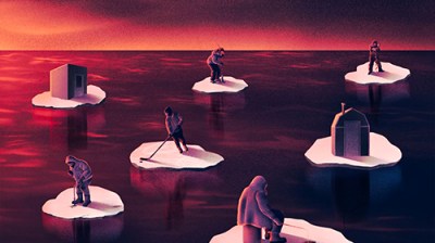
How does climate change threaten where you live? A region-by-region guide.
Every four years, the federal government is required to gather up the leading research on how climate change is affecting Americans, boil it all down, and then publish a National Climate Assessment. This report, a collaboration between 13 federal agencies and a wide array of academic researchers, takes stock of just how severe global warming has become and meticulously breaks down its effects by geography — 10 distinct regions in total, encompassing all of the country’s states and territories.
The last report, which the Trump administration tried to bury when it came out in 2018, was the most dire since the first assessment was published in 2000. Until now.
The Fifth National Climate Assessment, released on Tuesday by the Biden administration, is unique for its focus on the present. Like previous versions, it looks at how rising temperatures will change the United States in decades to come, but it also makes clear that the rising seas, major hurricanes, and other disastrous consequences of climate change predicted in prior reports have begun to arrive. The effects are felt in every region. In the 1980s, the country saw a billion-dollar disaster every four months on average. Now, there’s one billion-dollar disaster every three weeks, according to the assessment. All of the many extreme weather events that hit the U.S., from the tiniest flood to the biggest hurricane, cost around $150 billion every year — and that’s likely a huge underestimate.
“Climate change is here,” said Arati Prabhakar, director of the White House Office of Science and Technology Policy in the Biden administration during a briefing on the report. “Whether it’s wildfires or floods or drought, whether it’s extreme heat or storms, we know that climate change has made its way into our lives and it’s unfolding as predicted.”
The report outlines steps every level of government can take to combat the climate crisis. And it takes stock of progress that has been made over the past four years. There’s good news on that front: President Joe Biden and Democrats in Congress have managed to pass historic climate measures that are expected to reduce the country’s carbon footprint between 32 and 51 percent by 2035, putting the U.S. closer to meeting its emissions targets under the global climate treaty known as the Paris Agreement. A number of cities and states have passed climate policies that can serve as a blueprint for what actions the rest of the country, and indeed the world at large, needs to take in the coming years. California’s clean car program and the Northeast’s regional carbon cap-and-trade program are two examples.
National Climate Assessment: Explore the key solutions from each region
Despite this progress, climate impacts — oppressive heat domes in the Southeast that linger for weeks on end, record-breaking drought in the Southwest, bigger and more damaging hurricanes in the Atlantic basin, wildfires of unusual duration and intensity along the West Coast — are accelerating. That’s the nature of human-caused climate change: The consequences of a century and a half of burning fossil fuels are arriving now. Even if we stopped burning oil and gas tomorrow, some degree of planetary warming is baked in.
This reality, the report says, leaves the country no choice but to adapt, and quickly. “We need to be moving much faster,” the Biden administration said. “We need more transformative adaptation actions to keep pace with climate change.”
The Grist staff, located all over the country, reviewed the assessment to provide you with the most important takeaways for your region. Here they are.
One of the joys of living in Alaska is being able to walk through thick brush without fearing that a tiny, eight-legged critter could latch onto you at any moment and give you a debilitating illness like Lyme disease (though, sure, grizzly bears are a worry). According to the assessment, that’s about to change: The western black-legged tick is creeping north, and it’s poised to establish a new home in the country’s largest state.
As Alaska warms two or three times faster than the rest of the world, it’s making life harder for many of the 730,000 people who live there, particularly Indigenous and rural residents who rely on hunting and fishing for food. Crabs are sweltering in the Bering Sea. Salmon are disappearing, leaving fish racks and freezers empty in Yup’ik and Athabascan villages along the Yukon River. Melting sea ice, extreme ocean warming, and toxic algae blooms are unraveling food webs, killing seabirds and marine mammals. It’s not pretty.
And it’s not all happening at sea. The ground beneath Alaskans’ feet is collapsing. Eighty percent of the state sits on permafrost, much of which is thawing. In Denali National Park, a melting underground glacier triggered a landslide in 2021 that forced the park’s main road to close for a few years. Add freak storms, flooding, and erosion to the mix, and Alaska Native communities face nearly $5 billion in infrastructure damage over the next 50 years, the report says.
There are a few bright spots. Higher elevations could see more snow, not less, and Alaska’s growing season is getting longer — a boon for a fledgling agricultural industry. Still, if you migrate north to start a farm, don’t think you’ll have found a refuge from wildfires, even in the Arctic. Just Google “zombie fires.”
Hawaiʻi, Guam, American Sāmoa, the Northern Mariana Islands, the Republic of Palau, the Federated States of Micronesia, the Republic of the Marshall Islands
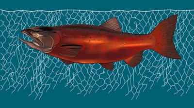
Every month on the sixth day after a new moon, generations of Palauans have ventured out under the hot late-afternoon sun to toss their nets into seagrass meadows to capture rabbit fish.
In 2021, the low tide didn’t come. Neither did the fish. The Indigenous fishers in Palau were left waiting, wondering if the higher tide would ever ebb.
It’s not yet clear whether climate change is to blame. But what is clear from the climate assessment is that rising sea levels, worsening storms, and other climate-related effects will transform the lives of nearly 1.9 million people who live in the states, nations, and territories that make up the U.S.-affiliated Pacific islands, many of them Indigenous peoples who have contributed little to climate change yet are bearing the worst of its impacts.
Low-lying atolls in the Marshall Islands are already disappearing. The islands that remain risk losing their drinking water as saltwater intrudes on thin freshwater aquifers. In American Samoa, tuna canneries could see as much as a 40 percent drop in their catch by 2050 compared with the 2000s, according to the report, if carbon emissions don’t fall fast enough.
In Hawaiʻi, a 3.2-foot rise in sea level could displace 20,000 people and cost $19 billion. That same scenario would affect 58 percent of the built environment on the island of Guam.
Maui residents still reeling from the horror of August’s wildfires can expect more drought on the leeward coast that could provide tinder for more flames. Already, fires burn a greater proportion of land area in U.S.-affiliated Pacific islands than on the continental U.S.
Health care, already a longstanding challenge in the islands, is expected to get worse, as temperatures rise and mosquito-borne diseases like dengue and Zika proliferate. One study found 82 percent of heat deaths in Honolulu can already be attributed to climate change.
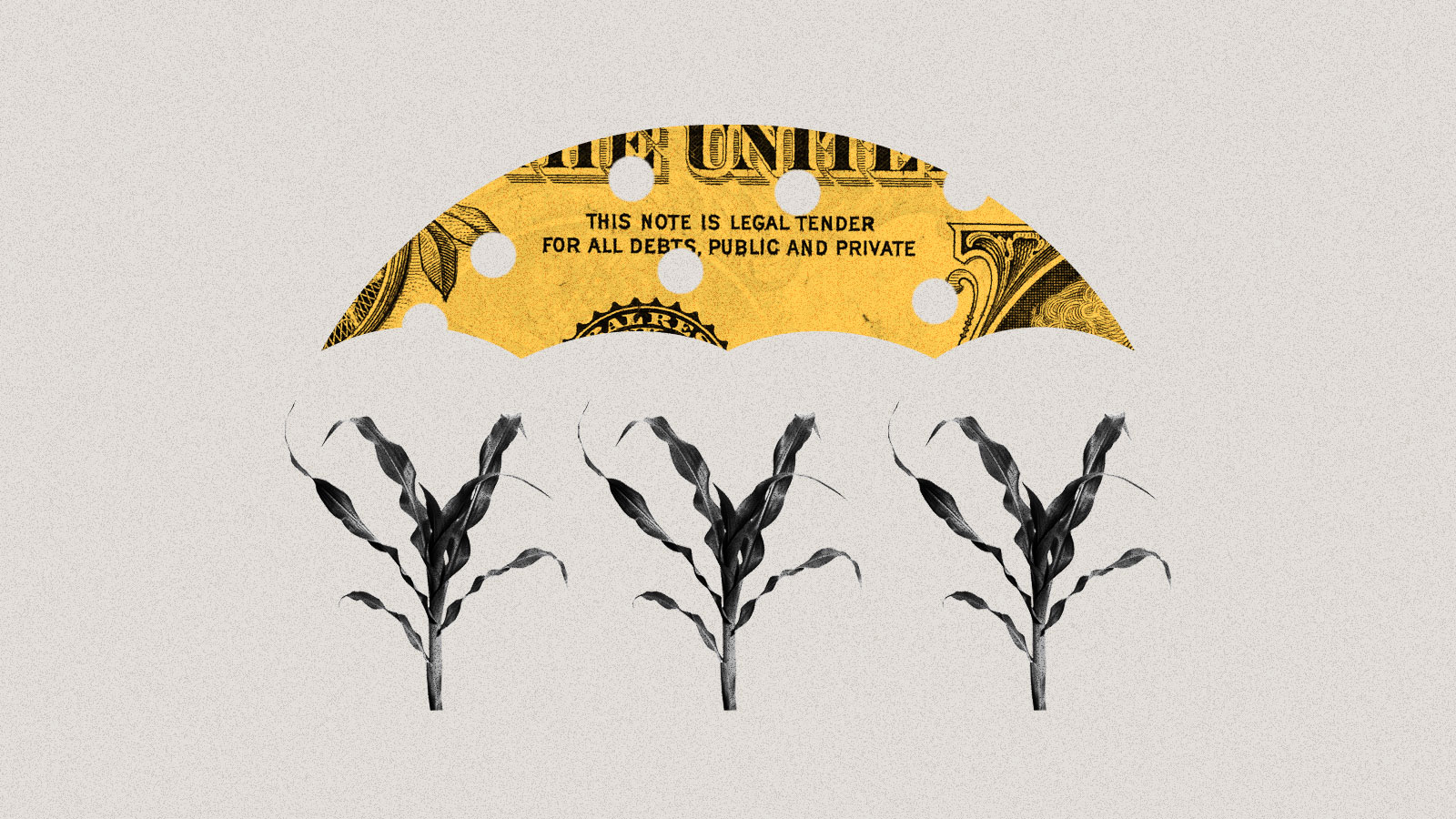
If you’ve ever driven through Iowa, Illinois, or Indiana, you won’t be surprised to learn that the region produces almost a third of the world’s corn and soybeans. In fact, there are so many crops getting irrigated, water is evaporating off them and cooling summer days in parts of the Midwest, like central Wisconsin, countering some of the warming from climate change. But rapid swings between flooding and drought, along with the spread of corn earworms, Japanese beetles, and other pests, are hurting these staple crops and the farmers who grow them. Climate change, the report says, has also led to smaller harvests of wild rice, a staple that’s central to the identity of the Indigenous Anishinaabe.
The region is getting more rain, and that’s promising for wheat production, but bad news for aging dams, roads, bridges, and wastewater facilities, which are already getting overwhelmed by water. The amount of precipitation during the 1 percent of rainiest days in the Midwest has increased by 45 percent since 1958, the report says.
The Great Lakes, the crown jewel of the Midwest, are among the fastest-warming lakes in the world, with climate change stressing out an ecosystem already plagued by toxic algae and invasive species and also reducing populations of walleye and trout. Warmer winters mean there’s less ice atop lakes and ponds, threatening traditions like ice fishing from Minnesota to Michigan.
Those less-harsh winters are also expanding the ranges of disease-carrying ticks and mosquitoes. Lyme disease has exploded in the Midwest to the point that it’s now endemic, and by 2050, the Ohio Valley may see more than 200 cases of West Nile virus every year. Another once-rare phenomenon that’ll become more common: wildfire smoke. Midwesterners got a preview this summer when smoke poured in from the fires in Canada, inundating Illinois, Michigan, and Ohio with “very unhealthy” air.
Connecticut, Delaware, Maine, Maryland, Massachusetts, New Hampshire, New Jersey, New York, Pennsylvania, Rhode Island, Vermont, Washington, D.C.,West Virginia
When it comes to climate-fueled flooding, the 67 million residents of the U.S. Northeast are especially at risk, and the region’s aging stormwater and sewage infrastructure only makes matters worse. This summer, historic flooding in New York, Vermont, and Massachusetts killed multiple people and caused hundreds of millions of dollars in damage, a preview of flooding-related dangers to come. Extreme precipitation events have increased 60 percent across the entire region, which the report says could be due to a combination of more tropical storms and a warmer, wetter atmosphere. No other region in the U.S. has seen such a marked increase in rainfall.
But climate impacts within the Northeast extend far beyond flooding. Days when real-feel temperatures are over 100 degrees Fahrenheit will triple by 2050 under an intermediate warming scenario, the report said, and communities that lack access to reliable and affordable air conditioning will see their health and general well-being decline as a result.
The report also warns that states along the coast will have to confront the effects of warming water on marine species, fish stocks, and tourism — if they aren’t doing so already. In the Gulf of Maine, for example, lobster, oysters, and other shellfish are expected to decline. Animals that can migrate, such as right whales, will abandon the gulf for cooler waters north of the state. Sea bass, some types of squid, and other temperate marine species, on the other hand, will flourish. Warming winter nights are allowing damaging forest pests, such as the emerald ash borer and the woolly adelgid, to extend their ranges into colder latitudes and plague new ecosystems.
Rising seas along the coastline will push homes and infrastructure inland, raising the controversial question of who gets to leave and who can stay. Already, home buyout programs and multibillion-dollar flood protection initiatives are underway in New Jersey and New York.
— Zoya Teirstein
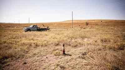
Northern Great Plains
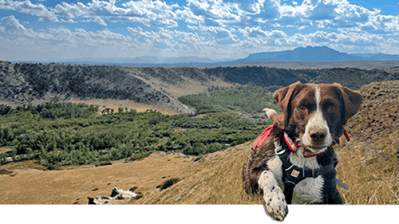
Reservation Dogs: Strange diseases are spreading in Blackfeet Country. Can canines track down the culprits?
Montana, Nebraska, North Dakota, South Dakota, Wyoming
In parts of the country like southwestern Nebraska, it’s not uncommon for baseball-sized hail to fall from the sky during thunderstorms in the summer months. Unfortunately for people in the northern Great Plains, it’s likely to get worse: The region will experience the largest increase in hail risk, according to the report, along with more storms. By 2071, days with hail of two inches in diameter or more could increase threefold and cover almost nine times more ground. Hail that size can smash windows, dent cars, and cause severe injuries.
The report highlights a shift in the region’s water, so vital for the landlocked landscape spanning Montana, Wyoming, Nebraska, and the Dakotas. Decreasing snowpack could cut short winter tourism seasons and reduce available surface water, putting more stress on limited groundwater. At the same time, more flooding and extreme weather could hit communities with the fewest resources to respond. Two storms in 2018 destroyed nearly 600 homes on the Pine Ridge Indian Reservation, with half not repaired a year later.
Hotter temperatures have already limited harvests of traditional foods and medicine used by many indigenous nations. That includes wild turnips and chokecherries, culturally significant plants for the Lakota people. Rising temperatures have also dried the soil, raising wildfire risks. In the Great Plains grasslands, the number of wildfires has already more than doubled since 1985. Forest fires in Montana and Wyoming have shot up almost ninefold since the 1970s. All these trends are likely to get worse.
But these problems might not be enough to scare off newcomers trying to get away from droughts and wildfires elsewhere in the country. The report suggests that fewer cold snaps and a longer growing season in the Great Plains could lure people migrating from other regions in search of a new place to live.
Climate change might be putting an end to “Juneuary,” the term for the Northwest’s chilly early summers. Take the infamous “heat dome” that smothered Washington and Oregon in late June 2021. The searing heat melted electrical equipment in Portland, buckled roads outside Seattle, and led to nearly a thousand deaths in the two states (and British Columbia). Without climate change, a heat wave that intense would’ve been “virtually impossible,” according to one study cited.
The report says the Northwest can expect hotter heat waves — and more deaths. Heat and wildfire smoke in the region have already led to thousands of deaths since 2018, when the last National Climate Assessment was published. Extreme heat is worse in formerly redlined neighborhoods like the Albina neighborhood in Portland, where temperatures can reach 13 degrees Fahrenheit hotter than the rest of the city.
Most of the region’s drinking water has come from melting snow, stored in mountain ranges like the Cascades that run through Washington and Oregon, or the Sawtooth range in Idaho. But warmer winters are turning more snowstorms into rainstorms, leading to destructive floods in the winter and dry rivers in the summer. Glaciers are melting, even atop iconic Mount Rainier.
On the coast, rising waters pose problems. The town of Taholah on the Quinault Reservation along Washington’s northwest coast could see the ocean climb as much as 1.2 feet by 2050. The Quinault Indian Nation recently started to move many of its homes and government buildings farther inland. The report warns that the cost and complexity of managed retreat might make it difficult for other coastal communities.
Diminishing streams could be troublesome for numerous hydroelectric dams. Local and state governments might need to find new sources of energy to power the region’s electric cars and brand-new air conditioners — without relying on the fossil fuels that got us into this mess.
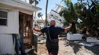
Alabama, Arkansas, Florida, Georgia, Kentucky, Louisiana, Mississippi, North Carolina, South Carolina, Tennessee, Virginia
The sunny and fast-growing Southeast is on a collision course with climate change. Its cities have gobbled up more than 1.3 million acres of exceptionally biodiverse land since 1985, and more than a million people have moved to Florida alone since 2018. These newcomers are sitting ducks for worsening disasters, especially floods. The Southeast has seen almost two dozen hurricanes make landfall since 2018, and these monster storms are ballooning to full strength much faster as they cross a hotter Gulf of Mexico. The slow creep of sea-level rise has also led to more frequent tidal flooding in coastal cities like Miami. That’s bad news for the millions of people who have bought waterfront homes over the past few decades.
To say the region is ill-prepared for this era of climate disaster would be an understatement. Many Southeastern cities are plagued with flimsy manufactured housing, antiquated drainage systems, and decades-old power grids. Heat stroke will become a bigger danger for outdoor workers, and more blackouts will knock out life-saving AC units in big cities. Louisiana saw more than 20 such events between 2011 and 2021. Warmer spring temperatures will also increase pollen counts in cities like Atlanta, worsening air quality. All these impacts will be more dangerous for the region’s Black residents, who live in hotter and more flood-prone places than their neighbors.
The region’s declining rural areas also face existential threats, as industries find themselves unprepared for a warmer world. Farmers of cash crops such as citrus and soybeans, for instance, are fighting a four-front war against drought, flooding, heat, and wildfires, which all reduce annual yields. Extreme weather will continue sapping these moribund economies, leading to more out-migration and urban growth.
— Jake Bittle
Southern Great Plains
Abandoned in Osage A century after the events of “Killers of the Flower Moon,” abandoned oil wells litter the Osage Nation.
Kansas, Oklahoma, Texas
The southern Great Plains encompasses a stunning variety of terrain, from the windy plains of Kansas to the swamps of East Texas. In some parts of the region, annual precipitation is as low as 10 inches, and in other parts it’s as high as 50 inches. Accordingly, the impact of climate change looks very different depending on where you are. In the high plains of Oklahoma, drought has drained rivers and aquifers for rural communities, but residents of large Texas cities like Houston and Dallas have to worry about floods overwhelming asphalt streets and clogged storm drains.
Kansas and Oklahoma don’t face the risk of the billion-dollar disasters that plague Texas, but the report finds that earlier springs in those two landlocked states have “reduced plant growth and diminished productivity” for all-important wheat and sorghum crops. Lyme disease-bearing ticks have started to appear even in the depths of winter, when they’re supposed to be hibernating.
Energy is the backbone of the region’s economy, especially in Texas. This massive industry has helped accelerate climate change, and it’s also vulnerable to climate shifts: Hurricanes and increasingly large rain storms could knock out plants and refineries on the Gulf Coast. Agriculture and livestock, the other main industries, are also vulnerable to droughts: Dry spells in Kansas and Oklahoma have “increased labor demands for feeding, forcing producers to sell genetically valuable animals,” the report notes. These shifts could cost billions of dollars to the region’s economy.
The report also highlights threats to another mainstay of life in the South: football. Extreme heat and flooding could endanger athletes and force schools to postpone games. This already happened in 2021, when Hurricane Ida forced the Tulane University football team to play a game at the University of Oklahoma instead of at home in New Orleans.
— Jake Bittle
Southwest
The Water Brokers A small Nevada company spent decades buying water. As the West dries up, it’s cashing out.
Arizona, California, Colorado, Nevada, New Mexico, Utah
A succession of droughts, fires, and heat waves has thrown the Southwest’s economy into turmoil over the past decade, upending housing markets and stalwart industries like agriculture.
The most visible disaster in the region is wildfire. The already hot and dry Southwest is getting hotter and drier, which makes it easy for big fires to rage for weeks and even months, destroying thousands of homes. It also means that “fire season” now lasts roughly all year, as 2021’s Marshall Fire in Colorado demonstrated. The cost of putting out wildfires in California exceeded $2 billion that year, according to the report. As a result of all this damage, insurance costs are skyrocketing for everyone, even city dwellers who aren’t directly threatened by blazes.
On California’s coast, rising seas have eaten away at bluffs, causing stretches of road to collapse into the water. The authors of the report write that a rash of marine heat waves in the Pacific between 2013 and 2020 caused massive die-offs in the state’s salmon fishery and beached starving sea lions. Under the worst warming scenarios, the Pacific sardine fishery could migrate as much as 500 miles north.
In the desert, farms, ranches, and cities have drained reservoirs on big waterways like the Colorado River. Rural residents in California and Arizona are seeing their wells go dry during increasingly severe droughts, thanks in large part to thirsty nut and dairy farms that have sucked up groundwater. And drought has been even more challenging for the many Native American tribes. The Navajo Nation, for instance, lacks legal access to the Colorado River, so most residents haul their water by truck. Building new water infrastructure is more than 70 times as expensive on the reservation as it would be in the average U.S. town, according to the report
The climate impacts facing Puerto Rico and the U.S. Virgin Islands don’t differ wildly from those of the continental states: Storms will strengthen, coastlines will shrink, temperatures will rise, and rainfall will diminish.
What’s distinct about how the U.S. Caribbean territories will experience these hazards (apart from the islands’ location in a hurricane-prone ocean) are the economic and social conditions that have already made the region’s disasters more deadly — conditions that can be traced to the territories’ history as de facto U.S. colonies. More than 40 percent of Puerto Rico’s 3 million residents live below the poverty level, as do almost 20 percent of the 87,000 people living in the U.S. Virgin Islands.
After Hurricane Maria, which devastated Puerto Rico in 2017, mortality rates were higher for the elderly and those with the lowest household incomes. Studies found that nearly 3,000 excess deaths occurred after the storm because people lacked access to basic services.
That resource imbalance also shows itself in the dearth of necessary data available to assess current and future climate impacts in the region, especially in the U.S. Virgin Islands. The report is full of footnotes conceding that data was unavailable for the Caribbean territories.
Without improved social and economic resilience, U.S. Caribbean residents will continue to be uniquely vulnerable to storms, floods, and heat.
“We may be facing more extreme hurricanes, but if we have the capacity, the quality of life, the social conditions to be prepared, it wouldn’t be that catastrophic,” said Pablo Méndez-Lázaro, lead chapter author and associate professor of environmental health at the University of Puerto Rico. “If we keep having a huge amount of people living under the poverty level, with preexisting conditions, exposed to flood areas, we will face another María.”
No one was hurt, and no houses burned. But now, wildfire survivors in Washington face a new threat: debris flows. Wildfires can lessen the soil’s ability to absorb water, so when thunderstorms, rapid snowmelt, atmospheric rivers or rain falling on snow occur in a burned area, that can create a roaring earthen river. Debris flows can move quickly — 30 mph or more — sliding from the uplands to the valley floor in a matter of minutes.
Debris flows are more powerful and dangerous than mudslides and slower-moving landslides: They can sweep away boulders, trees and cars and destroy everything in their path, including roads and homes and the people who live in them. Last year, in Washington’s Okanogan County, two residents were rescued from their home after a debris flow. Another flow destroyed a cabin and sent a foot of water and mud into more than 30 structures. And in 2018, 23 people were killed when heavy rains triggered a debris flow in the burn scar of Southern California’s Thomas Fire.
United States Geological Survey (USGS) modeling indicates that, for perhaps the next five to seven years, there’s a high probability of debris flows in the mountains above Grotto and other communities along the South Fork of the Skykomish River Corridor. The USGS models were originally created using data from drier areas in Southern California, where debris flows have been happening for years after fires, and may be less accurate in Washington’s wet climate — particularly on the rainier side of the Cascade Range. And until recently, there’s been little research on how post-fire debris flows behave in Washington.
ONE MAY AFTERNOON, eight months after the fire, a team of researchers made their way up a soot-blackened hillside a few miles from Grotto. Ashy dirt crunched underfoot as they scrambled over and around trees that had been toppled by the fire. They were looking for the right tree to mount a game camera on in order to document future debris flows. They also wanted to check on the rain gauges they’d installed last fall, not long after the fire, when rainy weather and still-smoldering stumps had made setting up the equipment extra-tricky.
The Walker Creek Fire, which burned in the fall of 2021, created ideal conditions for a post-wildfire debris flow. The following summer, a slurry of mud, rocks and large woody debris damaged cars, roads and properties in central Washington.
Courtesy of the Washington State Department of Natural Resources
The Washington Geological Survey’s Wildfire-Associated Landslide Emergency Response Team is tracking recently burned sites in the state to understand when landslides occur and how much precipitation it takes to trigger them. “The missing piece is the exact time,” geologist Kate Mickelson said. The weather patterns, geography and vegetation of the Pacific Northwest are different from California’s, and these variations can influence when the earth slides.
“The missing piece is the exact time.”
In the Northwest, for example, debris flows can occur several years after a fire, while in California, they usually happen in the first two rainy seasons that follow. (Researchers think that might be because tree roots take longer to decay in the Pacific Northwest.) Generally, National Weather Service debris-flow warnings are triggered if a quarter-inch of rain falls in 15 minutes, or if one inch falls in an hour. Sometimes they’re issued for at least the first two years post-fire, either countywide or just for the area near a burn scar. The warning system’s thresholds can be tweaked to reflect the region. But in rainy parts of western Washington, heavy rain is not unusual, and scientists fear that issuing alerts all the time could numb people to the danger, making them less likely to evacuate.
After 15 minutes of hiking, the researchers found the perfect location for their camera: a standing tree perched just above a likely flow path, a few feet up on a mound of rocks. Finding the right spot is tricky; the tree must be close enough to a debris flow for it to trigger the camera to record, but not so close that the tree (and camera) get swept away. Mickelson and geoscientist Emilie Richard wrapped a strap around the tree’s trunk and mounted the solar-powered camera facing south, then took a few test pictures to make sure it was properly angled.
A post-wildfire debris flow in the burn scar of the Walker Creek Fire caused significant damage in central Washington in the summer of 2022.
Courtesy of the Washington State Department of Natural Resources
Game cameras, rain gauges and other tools can help scientists understand how much precipitation it takes to trigger debris flows in western Washington, and help the USGS fine-tune its modeling. Mickelson’s team has set up cameras in five and rain gauges in 11 recent burn scars around the state.In some locations, they also installed pressure transducers, devices that measure the water’s pressure on the earth. The devices are drilled into bedrock and can sense the rapid increases in pressure caused by a debris flow.
When the researchers returned in May to install the camera, they also checked on their other equipment. Luckily, all the rain gauges were still in place, so they downloaded the data and changed batteries that were low on juice after the cold winter months. The equipment they installed will monitor the sites for the next five years, noting real-time rainfall — unless, of course, everything gets taken out by a debris flow.
SITTING BAREFOOT in their front yard in May, amid lilac bushes and daisies, Grotto residents expressed their concerns. “We have to cross our fingers,” Lorenzo Vasquez said. “We’re screwed for mudslides,” Richard Walther, his neighbor, agreed. They’re worried that debris flows could reroute the creek between their homes and the mountainside, causing flooding or road damage. The Washington Geological Survey scientists hope their work will help residents prepare in the future. “We would like to be able to tell people, ‘This is your peak risk,’” Mickelson said. “We just don’t know that yet.”
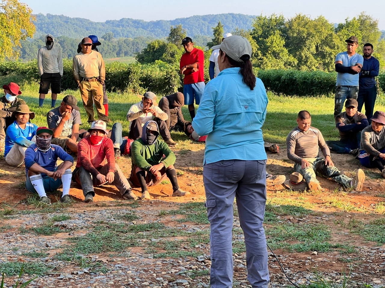
How Florida farm workers are protecting themselves from extreme heat
This story is part of Record High, a Grist series examining extreme heat and its impact on how — and where — we live.
On any given summer day, most of the nation’s farm workers, paid according to their productivity, grind through searing heat to harvest as much as possible before day’s end. Taking a break to cool down, or even a moment to chug water, isn’t an option. The law doesn’t require it, so few farms offer it.
The problem is most acute in the Deep South, where the weather and politics can be equally brutal toward the men and women who pick this country’s food. Yet things are improving as organizers like Leonel Perez take to the fields to tell farm workers, and those who employ them, about the risks of heat exposure and the need to take breaks, drink water, and recognize the signs of heat exhaustion.
“The workers themselves are never in a position where they’ve been expecting something like this,” Perez told Grist through a translator. “If we say, ‘Hey, you have the right to go and take a break when you need one,’ it’s not something that they’re accustomed to hearing or that they necessarily trust right away.”
Perez is an educator with the Fair Food Program, a worker-led human rights campaign that’s been steadily expanding from its base in southern Florida to farms in 10 states, Mexico, Chile, and South Africa. Although founded in 2011 to protect workers from forced labor, sexual harassment, and other abuses, it has of late taken on the urgent role of helping them cope with ever-hotter conditions.
It is increasingly vital work. Among those who labor outdoors, agricultural workers enjoy the least protection. Despite this summer’s record heat, the United States still lacks a federal standard governing workplace exposure to extreme temperatures. According to the Occupational Safety and Health Administration, or OSHA, the agency has opened more than 4,500 heat-related inspections since March 2022, but it does not have data on worker deaths from heat-related illnesses.
Most states, particularly those led by Republicans, are loath to institute their own heat standards even as conditions grow steadily worse. In lieu of such regulation, the Coalition of Immokalee Workers, through its Fair Food Program, has adopted stringent heat protocols that, among other things, require regular breaks and access to water and shade. Such things are essential. Extreme heat killed at least 436 workers of all kinds, and sickened 34,000 more, between 2011 to 2021, according to NPR. Some believe that toll is much higher, and efforts like those Perez leads are providing a model for others working toward broader and more strictly enforced safeguards.
“We look to [the Fair Food Program] for best practices in terms of how can agricultural employers already begin to implement these kinds of protections,” said Oscar Londoño, the executive director of WeCount, which has been pushing for a heat standard in Miami-Dade County. “But we also believe that it’s important to have regulations and forcible regulation that covers entire industries.”
The Fair Food Program works with 29 farms, which raise more than a dozen different crops, and the buyers who rely upon them. In exchange for guaranteeing workers basic rights, participating growers and buyers, including Walmart, Trader Joe’s, and McDonald’s, receive a seal of approval that signals to customers that the produce they are buying was grown and harvested in fair, humane conditions.
To protect workers, the guidelines require 10-minute breaks every two hours and access to shade and water. The program also extended the time frame during which those things must be offered, from five months to eight, reducing the amount of time that workers are exposed to the worst heat of the year. Growers also must be aware of the signs of heat stress and monitor workers for them. Such steps are vital, particularly in humid conditions, to prevent acute heatstroke and safeguard employees’ long-term health. Repeated exposure to extreme temperatures can cause kidney disease,heat stroke, cardiovascular failure, and other illnesses.
“Having time to rest and cool down is very important to reduce the risk of death and injury from heat stress, because the damage that heat causes to the body is cumulative,” said Mayra Reiter, director of occupational safety and health at the advocacy organization Farmworker Justice. “Workers who are not given rest periods to recover face greater health risks.”
A Fair Food Program educator leads a session at a farm in Tennessee. Courtesy of the Fair Food Program
Such risks were very real for Perez, who worked various vegetable farms around Immokalee and along the East Coast before becoming an educator and advocate. Because most farm workers are paid according to how much they harvest, few feel they can spend a few minutes in the shade sipping a beverage.
“The difficulty of the work makes you feel like it takes years off your life,” Lupe Gonzalo, a member of Coalition of Immaokalee Workers, wrote in a public blog post. High humidity makes things worse, and those who rely upon employer-provided housing often find no relief after a day in the fields because many accommodations lack air conditioning, she wrote.
Abusive conditions can compound the deadly conditions. A 2022 investigation by the Department of Labor revealed poor conditions, including human trafficking and wage theft, at farms across South Georgia. Two workers experienced heat illness and organ failure, and others were held at gunpoint to keep them in line as they labored.
Many were workers holding H-2A visas in a program that has its roots in the Mexican Farm Labor Program, launched in 1942, that sponsored seasonal agricultural workers from Mexico. (Currently, the U.S. Department of Homeland Security issues those visas.) Because of their reliance on employers for housing, visa sponsorship, and employment, many workers experience abuse, an investigation by Prism, Futuro Media, and Latino USA found earlier this year.
It doesn’t help that federal labor law, including the National Labor Relations Act, doesn’t cover agricultural workers in the same way it protects employees in other sectors, said James Brudney, a professor of labor and employment law at Fordham University. Additionally, language barriers, fear of retaliation, and workers who come from a variety of backgrounds and cultures keep many from speaking out.
Perez remembers having only bad options for dealing with adverse working conditions: Deal with it, complain and risk being fired, or quit. The Fair Food Program gives workers recourse he never had, and builds on protections against forced labor, sexual harassment, and other abuses it has achieved with workers, growers, and buyers, which have agreed not to buy from farm operators with spotty records, since 2011.
Workers are regularly informed of their rights, and violations can be reported to the Fair Food Program through a hotline for investigation. Heat-related complaints have grown increasingly common in recent years, and often lead to a confidential arbitration process. Such inquiries may lead to mandatory heat safety training and stipulations growers must abide by. Findings of more serious allegations, such as sexual harassment, can lead to a grower being suspended or even removed from the program. Such efforts protect workers, hold employers accountable, and allow the program to know what’s most impacting laborers, said Stephanie Medina, a human rights auditor with the Fair Food Standards Council.
“With the record heat, every summer has definitely, I think, gotten a lot more difficult for workers out there,” Medina said. “I think that is one of the reasons why we put so much emphasis on getting the heat stress protocols together and implemented in the program.”
Growers must report every heat-related illness or injury, which is investigated by Medina’s team or an outside investigator depending on severity. Her team visits every participating grower annually. Many of them go beyond the program’s requirements to ensure worker safety, by, say, providing Gatorade and snacks and regularly checking in on those who have experienced heat-related illness, she said. Workers, too, are being more assertive in protecting themselves, reporting any violations because they know they cannot be retaliated against.
Though no growers or farmer’s associations responded to Grist’s requests for comment, some at least appear happy with the organization’s work. “The Fair Food Program is giving us structure and is a tool for better understanding in a workplace that is multicultural and multiracial,” Bloomia, a flower producer and FFP participant, said in a statement on the program’s website.
Still, some farm workers’ organizations, while supportive of the program’s work, doubt that farm-by-farm solutions will ever be enough to protect a majority of farm workers. Jeannie Economos, of the Farmworkers’ Association of Florida, said comprehensive policy-level solutions are required. She noted that even in Florida nurseries, greenhouses, and other growers of ornamental plants employ thousands of people who are not yet covered by the Fair Food Program. Although they one day may be, federal, state, and local regulations are needed to ensure sweeping safety reforms.
“So what do we think of the Fair Food Program? It’s good,” she said. “But it’s not far-reaching enough.”
Other campaigns are working toward legislative solutions. An effort called ¡Que Calor! in Miami-Dade County, led by WeCount, has been pushing the issue for years, and in many ways is inspired by what the Coalition of Immokalee Workers has accomplished, Londoño told Grist.
“Miami-Dade is on the verge of passing the first county-wide [standard] in the country, and it would protect more than 100,000 outdoor workers in both agriculture and construction,” he said “In the absence of a federal rule, and in the absence of state protections, local governments can play a foundational role in piloting policies that states and the entire federal government can take on.”
¡Que Calor!, has, like the Fair Food Program, been led by workers. Including them in drafting policies can help ensure they are effective because “they know what their risks and the threats to their well being are better than anyone,” Brudney, the Fordham University professor, said
Yet even jurisdictions with strict labor laws can see their protections undercut because they often rely on employees, who may face reprisals, to report violations. Miami-Dade’s proposal skirts that by creating a county Office of Workplace Health with broad powers to receive complaints, initiate inspections, interview workers, and adjudicate investigations.
Amid such victories and a mounting need to protect workers, the Fair Food Program plans to expand its reach. It has cropped up at tomato farms in Georgia and Tennessee; crept up the East Coast to lettuce, sweet potato, and squash farms in North Carolina, New Jersey, Maryland, and Vermont; and sprouted on sweet corn farms in Colorado and sunflower farms in California. Organizers from the Fair Food Program have in recent weeks met with growers and workers in Chile eager to bring its efforts there.
The organization hopes to see its principals embraced more widely, and continues to pressure more companies, including Wendy’s and the Publix supermarket chain, to buy into the effort. Medina says such an effort will require staffing up, but she’s confident in its chances of success.
Many growers willfully neglect the rights and needs of workers, making such efforts essential, Perez said. The need for victories like those already seen on farms that work with the program will only grow more acute as the planet continues to warm. Even if federal heat standards are adopted, Perez believes local worker-led accountability processes will still be needed to ensure growers follow the law.
“What we see the Fair Food Program as is both a method of education and a way to share information with workers about these risks,” he said, “and at the same time as a tool for workers to protect themselves against the worst effects of climate change on a day to day basis.”
Non-profit says students’ need for food support has increased in past two months
Demand for food support among Tumwater students has increased in the past two months, Sierra Abrams of the non-profit TOGETHER! told Tumwater City Council. Abrams, director of TOGETHER!’s
In the Klickitat River Delta, a microcosm of Pac NW stakeholder clashes
Can salmon, steelhead, eagles, kiteboarders, Tribes, BNSF, the Forest Service and one tiny Washington town come together to share a unique piece of water?
Tricky spot: Kiteboarders around the Klckitat River Delta are attracting attention. Not all of it good. Photo: Jurgenhessphotography
By Bill Weiller. October 26, 2023. Just east of its origin in Vancouver, Washington, State Route 14 is one of the most scenic and historic highways in the Pacific Northwest, if not the entire country.
Forming a section of the Lewis and Clark Trail Scenic Byway, the highway winds through the entirety of the Columbia River Gorge.
Heading east, where SR 14 enters the tiny town of Lyle (pop. 269), most motorists steal glances over their right shoulders across the Columbia River to marvel at the towering bluffs around the Rowena Crest Viewpoint on the Oregon side of the Gorge.
With such spectacular scenery, it’s easy to miss another remarkable feature of the area—one that’s recently emerged as a flashpoint for stakeholder conflict, and become a microcosm of similar issues playing out around the Pacific Northwest, as an increasing number of interest groups, government agencies, tribal nations and private citizens vie for access to and control over public resources impacted by climate change and steadily growing public usage.
On the outskirts of Lyle, the Klickitat River flows into the Columbia River, creating the Klickitat River Delta.
Delta don: Lyle, Washington, is located on the banks of both the Columbia and Klickitat Rivers. Photo: Jurgenhessphotography
Just below a highway bridge that passes over the river, the delta spreads out across the Columbia River like a broad and shallow fan, creating the point of Klickitat River access for migrating salmon and steelhead, and the birds that feed on them.
These same conditions also happen to make the delta perfect for kiteboarders. Lots of kiteboarders.
Therein lies, at least for now, a major challenge for the town of Lyle, conservationists, recreationists, the land-owning BNSF Railway and various government entities.
As president of the Lyle Community Council, I’ve been involved for several years with a public process undertaken to resolve issues surrounding legal access to the Klickitat River Delta.
Though work is ongoing, issues around the delta have proven tricky to sort out.
Fish and wildlife concerns
Once used for cattle grazing as part of a Starr Ranch operation, the Klickitat River Delta became a focal point of conservation efforts when the U.S. Forest Service bought the ranchland in 1994.
The USFS also owns the spit of land that stretches into the delta.
Fish flight: Eagles converge on the Klickitat River Delta for winter feeding. Photo: Jurgenhessphotogrpahy
After its purchase of Starr Ranch land, the USFS constructed facilities and a loop trail leading to what it now accurately deems “a prime bald eagle viewing spot” in winter months. In winter, eagles from around the Pacific Northwest migrate to the area to feed on spawned-out salmon that wash up on the delta’s sand and gravel bars, making them easy pickings.
As I learned during an Oregon State University pilot class called Climate Stewards, which took place on the banks of the delta in September, salmon and steelhead migrating up the Columbia River are attracted to the delta’s cool waters.
Snow-melt water flowing into the Columbia from the Klickitat—which originates on Mount Adams in the high country of the Yakama Indian Reservation—makes the delta a vital cold water refuge for salmon and steelhead in the warming Columbia.
Three speakers in the Climate Stewards class—two from the Yakama Nation and one USFS staff—explained the challenges of maintaining the delta as a cold water refuge.
In recent years, the delta’s waist-deep waters have been warming. That’s a troubling trend for salmon and steelhead, which are sensitive to water temperatures.
What’s more, according to the USFS, it’s been a boon to freshwater bass, which prey on salmon smolts.
The Yakama Nation has championed federal research into deepening the channel by dredging the area where the Klickitat River flows into the Columbia. The hope is to keep water temperatures there relatively cool, and, thus, safer for salmon and steelhead.
Enter kiteboarders
The delta’s shallow, warming waters have also been a boon to another group—kiteboarders.
No one knows precisely when the delta became a magnet for kiteboarders—the area was the site of sailboarding speed trials in the 1980s, according to one local source—but their activity here has picked up considerably over the past decade.
“The Klickitat Delta has perfect launching conditions only found in two other locales … in the world,” according to Mike Evans, who works with the Columbia Gorge Wind & Water Association.
Those “perfect conditions” include a broad, shallow launch point leading to a wide body of water with reliable wind.
The undeveloped delta has been discovered.
Visitor data wasn’t collected during the 2023 summer recreation season, but Lyle Community Council members estimate that hundreds if not thousands of kiteboarders descended on the delta, likely even more so than in previous years when usage was heavy.
Part of that estimate is based on tickets for illegal parking issued by Klickitat County deputies.
Along the highway, a potholed, gravel turnout provides haphazard delta parking for about 15 vehicles. From there, one either runs across the busy highway then heads down a hill and across a set of railroad tracks to the delta, or (wisely) takes a footpath under the road then crosses the tracks to enter the site.
No signs mark the parking spot. No restrooms or other facilities are in sight. No fees are collected. Rashawn Tama of the USFS calls it an “unmanaged site.”
Many drivers resort to simply parking along the highway or in other unauthorized places.
Defiance: Kiteboarders are flying past the law. Photo: Jurgenhessphotography
The parking situation along SR 14 has also raised the hackles of the BNSF Railway, by some estimates the largest freight railroad in the United States.
BNSF owns tracks and a wide swath of land between the highway and Columbia River.
Despite visible signage forbidding the public from crossing the tracks, kiteboarders (and others) regularly trespass over railroad property in order to gain access to the delta.
The railroad has backed up its warnings to trespassers by issuing its own citations.
Adding intrigue, Klickitat County Prosecuting Attorney David Quesnel told the Lyle Community Council this summer he would not prosecute the railroad’s tickets. (BNSF did not respond to a request for comment for this story.)
Resolution efforts
It’s not clear what impact recreation is having on the fish and wildlife that depend on the Klickitat River Delta.
During the Climate Stewards class, one of the Yakama Nation speakers confirmed that the Tribe’s interest in the delta lies with conservation, not recreation. This presumably explained why the Tribe has shown little interest in engaging in conversations about access to the delta. (Yakama Nation Fisheries did not respond to a request for comment for this story.)
The effort to allow legal recreation in the Klicktat River Delta and settle ongoing access disputes will ultimately require cooperation from all interested parties. All voices are valid and should be heard and considered
In 2021, the Lyle Community Council formed a Delta Committee to resolve issues surrounding delta access. In the past year, participation has grown to include the USFS, kiteboarders, local citizens, Klickitat County, the Washington Utilities and Transportation Commission (which regulates the railroads) and Washington State Parks. To date, neither BNSF nor the Yakama Nation have joined official discussions.
Bringing BNSF to the table will likely require conducting a feasibility study that would recommend solutions. That process is costly.
Fan base: Cool water flowing from the Klickitat (seen here in light green) into the Columbia River creates a cold water refuge for migrating fish. Photo: Google Earth
Another potential partner, the National Park Service, has a small recreation and trails grant program that provides free community mediation and can provide project funding. This year, the Lyle Community Council and USFS developed a joint grant proposal to the NPS, but the USFS decided not to submit the proposal when it became clear the Yakama Nation would not join the process.
Even if the railroad agrees to make public access to the delta legal, the fish-friendly dredging project could produce a tonnage of mucky spoils that would likely be placed on the delta’s sandbar and planted with native vegetation, potentially rendering the site unsuitable as a put-in location for kiteboarders.
While the Lyle Community Council is on record supporting salmon restoration at the delta, it’s unknown whether fish and kiteboards will ultimately be able to coexist on a small patch of delta that, at least in winter, remains a lonely and lovely place to walk … illegally.
The views expressed in this article belong solely to its author and do not necessarily reflect the opinions of anyone else associated with Columbia Insight.