Alaska districts close 12 schools this year, amid severe budget cuts

Alaska saw an unprecedented wave of school closures this year. District officials grappling with severe budget shortfalls have opted to close 12 elementary and middle schools across the state — in Anchorage, Wasilla, Sutton, Seward, Sterling, Soldotna, Kasilof and Ketchikan.
With those closures, hundreds of students and staff will bus or commute to new schools next year, class sizes will grow as grades are combined and districts across the state are cutting programs, teachers, health aides, custodians, sports, library services and extracurriculars like music.
Officials in four districts say the closures were incredibly complex and difficult decisions but necessary to combat millions in budget shortfalls and years of state funding not meeting districts’ surging costs to operate schools.
“It was an incredibly trying time,” said Randy Trani, superintendent of the Matanuska-Susitna Borough School District that closed three elementary schools this year to address a $28 million budget shortfall. “Non-winnable… we did this to save teaching positions,” he said.
“This is devastating to everyone,” said Kylie Wilcox, a Soldotna mother of five. Her middle and high schoolers attended River City Academy, one of four schools closed on the Kenai Peninsula. “The district does not want to do this, the administration doesn’t want to do this, we just, it’s the reality of what we’re working with.”
At the same time, superintendents said it’s still unclear whether the closures and cuts have balanced district budgets because Gov. Mike Dunleavy has yet to sign off on next year’s increased budget for education funding. Last year, lawmakers flew back to Juneau for a special session, overruled Dunleavy’s veto and restored an education funding increase in a historic override vote in August, just weeks ahead of the first day of school.
This year, the Alaska Legislature approved one-time additional funding of $144 million for K-12 schools, including $29 million to offset rising energy costs, to total $1.8 billion approved for education next year. Lawmakers passed a budget with higher-than-expected state oil revenues driven by the Iran war, which is now before Dunleavy for his consideration.
Education Commissioner Deena Bishop said that the state has seen declining enrollment for more than 15 years, and as a result districts close schools due to what she called “excess capacity.” Bishop has served as commissioner under the Dunleavy administration since August 2023.

“We’ve had several schools at 50% capacity, 55% capacity, that were within two miles of each other. And understanding that you want to use the majority of your money, you don’t want to put into facilities — the majority of your money you want to put into classrooms,” she said. “And so decisions, you know, things were weighed, and districts, hopefully working with their parents and communities, made decisions that they felt were the correct ones.”
Bishop said more families are opting for homeschool programs, and districts need to figure out how to provide education services for families that want choices for more flexibility.
Nearly one in six Alaska students were homeschooled last year, totaling an estimated 23,600 students, according to data compiled by the Association of Alaska School Boards.
“So we can’t really be upset that, you know, ‘Oh no, they’re not going to our schools,’” Bishop said. “Obviously they’re going to a school that their needs are met, if they’ve chosen that, so how do we work with it? You know, what does education look like, and what does it look like in serving a community? And more and more we’ll find that one size doesn’t fit all that schools really want to offer, and districts are starting to offer different programs.”
Alaska students have the option to enroll in homeschool or correspondence programs across the state, not necessarily with the district where they reside. While district officials say they are working to adapt and provide homeschool education services, districts receive less state funding per homeschool student which is contributing to district-wide deficits.
Matanuska-Susitna Borough School District closes three schools
The Matanuska-Susitna Borough School District, the state’s second largest district with almost 20,000 students, faced a $28 million budget deficit this year, prompting cuts across the district.
The school board closed Meadow Lakes and Larson elementary schools in Wasilla and Glacier View School in Sutton, affecting roughly 415 students and dozens of staff.
That comes after the district cut roughly 160 staff positions last year, said Superintendent Randy Trani. He said the district would have had to cut an additional 225 positions this year, which was unworkable.
“The very last thing that we wanted to do was lay off teachers, and the second last thing we wanted to do was close schools, but we’re to the point where if we didn’t close schools, it was only going to result in more teacher layoffs,” he said.
Trani said the district went through a process of evaluating schools based on a number of metrics, including number of students, costs to maintain and opportunities to bus students to schools nearby, in order to decide which schools to close. “The schools that we were forced to shut down were fantastic schools. This wasn’t a decision on academic merit. This was a decision about logistics and being forced into a really impossible choice,” he said.
Trani said closing the three schools wasn’t even enough to make up for the budget shortfall and the district had to cut deeper.
The school board considered various scenarios from cutting sports programs to transitioning to a four-day school week, Trani said, which were rejected by the school board. “These are all horrible choices,” he said.
While the Matanuska-Susitna Borough continues to have the fastest growing population in the state, Trani said declining birth rates combined with an ongoing wave of families opting to homeschool is leaving the district with declining enrollment of full-time students and reduced funding for the district. Roughly 3,200 students, or 16% of the district’s students, were enrolled in Mat-Su correspondence programs this year.
Trani said another cost driver had been double digit increases to healthcare insurance costs resulting in roughly $6 million more to the deficit, bumping it to $28 million.
But he emphasized the largest driver of the deficit was insufficient state funding. “State funding has not kept up with inflationary pressures, and it is by far the biggest driver,” he said. “Unless there is a long term fix to how K-12 education is funded this problem is going to continue.”
Ketchikan closes two of four elementary schools, with more cuts to come
Ketchikan serves roughly 1,800 students in the Southeast Alaska island community that is only accessible by plane or boat. This year, the district enacted major cuts, including 76 staff positions across the district to address a $3 million budget shortfall, plus $5 million in debt to the local borough. It closed two of the four elementary schools.
The district closed Point Higgins and Fawn Mountain elementary schools, leaving one elementary, one middle and one high school in the community.
Niki Suomala, a third generation Ketchikan resident, attended Point Higgins elementary school, located 15 miles north of town. She said it was a special experience for her two children to go there — until the closure.
Her kids will be in the second and sixth grades next year, and they plan to commute into town for school. She said there were some tears at the news, but she said her children are adapting. She said she’s disappointed overall, but feels compassion for the district.
“It’s like, gosh, couldn’t we see this? Couldn’t we have seen this coming, and couldn’t we have tried to do something different?” she said. “But I also feel compassion, because I don’t know the answer to that question.”
Sheri Boehlert, the interim superintendent of Ketchikan Gateway Borough School District, also served as the principal of Point Higgins, spoke by phone after a full week of packing up and clearing out the schools. She said the reaction to the closures has been mixed: while there’s some in the community who want to see deeper cuts to balance budgets, there’s also a lot of grief in saying goodbye to neighborhood schools.
“It’s hard to dismantle something that was a big part of your career,” she said. “But on the flip side of that, the staff and community has really, by and large, been overwhelmingly supportive. We have tons of volunteers that are helping teachers pack and move, and they’re going to make something great at the next school for students, and there’s optimism out there.”
Class sizes will be effectively doubling in Ketchikan, Boehlert said, from about 15 students to class numbers in the twenties for elementary school and thirty students or more in the middle and high schools.
Boelert said the district has seen rising costs to operate, including for fuel, utilities and special education services. She said in particular the cost of staff health insurance is up 112% this year. Previous cost overruns for health insurance discovered last year created the over $5 million debt to the borough which the district will pay over over the next several years. “That is a unique situation,” Boehlert said. “They need their money back.”
Boehlert said with essentially flat state funding not meeting cost increases, the district cut roughly 26% of staff this year: “So it’s teachers, it’s principals, it’s custodians, health aides, like maintenance staff. No work group was unaffected.”
Even so, with the debt repayment, and this year’s state budgets still uncertain, Boehlert said Ketchikan faces more cuts across the district — unless there’s a significant population increase.
“We have a difficult road ahead of us in Ketchikan,” she said.
Four schools closed across the Kenai Peninsula
In the Kenai Peninsula Borough, the state’s third largest school district stretches across roughly 25,000 square miles — an area about the size of West Virginia — and serves nearly 8,400 students.
This year, the district faced an $8.5 million budget shortfall, after an $17 million deficit last year. The district is still in the midst of budget negotiations and determining cuts. An additional $3.3 million from the local borough and yet-to-be-determined one-time state funding this year may restore some programs, but officials opted to close four schools.
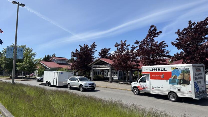
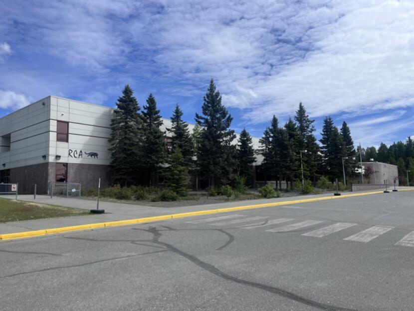
The district closed River City Academy in Soldotna, Tustumena Elementary School in Kasilof and Sterling Elementary School, sending students to other schools in Soldotna and Kenai. On the eastern side, the district closed Seward Middle School where classes will be consolidated into the elementary and high schools.
“The response was overwhelmingly that parents do not want these schools to close down. Communities did not want the schools to close down,” said Kari Dendurent, assistant superintendent of the Kenai Peninsula School District.
One of those parents is Kylie Wilcox, a mother of five living in Soldotna. Two of her children attended River City Academy, which was a standards-based school serving grades seven through 12. She said they liked the supportive environment and had hoped to continue through high school there.
“They were starting to make friends at River City, and so they were really sad, like ‘I’ve got to start over again.’” she said. “And they were angry. They talked a lot about, you know, ‘why can’t they just give money to schools? Don’t they think that we’re worth it?’ My oldest was upset enough that they were willing to testify in the district meeting as well. I was really, really proud of them for doing that.”
Dendurent, the assistant superintendent, said the district worked through a transition plan to help students and families plan where to attend schools next year. She said some teachers from River City Academy transferred to Skyview and will be in homerooms with former students. She said it’s a difficult process with cuts across the district, including reading programs, library aides, English language learning programs, swimming pools and others.
“It’s very, very difficult, and it impacts everybody, and the other part that also makes it difficult is we are in contract negotiations right now with our certified and our classified employees as well,” she said.
Dendurent said the district has seen more students and families opt for homeschool programs, resulting in less state funding for the district. “It’s a borough issue, it’s a state issue, and it’s a national issue with declining enrollment,” she said.
She said rising health care costs is also a major factor for the district budget, as well as fuel and utilities costs. Even with the school closures, Dendurent said the district’s financial picture is still uncertain. “Predictable, sustainable funding is what I think all of us are looking for,” she said.
Wilcox said she has empathy for district officials and they handled the process fairly well, but wishes there was more support from the Kenai Peninsula Borough and from state leaders. She said her family is still evaluating options, but will likely homeschool her two middle and high school age students, with her 10th grader also pursuing classes at the Kenai Peninsula College.
“Honestly it feels sometimes like there are people in our state government that would rather see public schools fail, and rather see more homeschool and private school options happen for kids. And I feel like that’s not going to serve all of Alaska’s kids,” she said.
“Like, homeschool is a great option for a lot of people. I am a homeschool graduate,” she added. “But I know that there are families where that’s just simply not an option, and they deserve the support of the state for their child’s education, that’s one of our rights.”
Anchorage closes three elementary schools, with deep cuts across the district
In the state’s urban center, the Anchorage School District made severe cuts this year to address a $90 million deficit and opted to close three elementary schools. It is the largest school district that serves nearly 42,000 students.
The closures were at Fire Lake, Lake Otis and Campbell STEM elementary schools. A parent group filed a lawsuit challenging the district’s decision to close Campbell STEM, which is still under dispute. It’s the only one of the three schools without plans to move a charter school into the building.
Andy Ratliff, the district’s financial officer, said closing the three schools accounted for just a fraction of the deficit, and cuts were made across the district — including almost 500 staff positions, or about 10% of the district’s staff.
“We reduced millions of dollars in administrative costs. We’ve increased our class sizes by four. We reduced a lot of our IT positions, maintenance, everything,” he said. “Mental health, our teaching and learning department was cut by like 45 or 55%. Yeah, I mean it’s just kind of all across the board, even into our special education realm.”
Ratliff said the district has spent down its savings, and the small increase in state funding last year didn’t meet the district’s rising costs. He said health insurance rose in the double digits and now is about 20% of the total budget. “It’s really just this inconsistent funding that’s really just kind of dictated by the state that has put us in this position,” he said.
Ratliff noted the state’s energy relief funds are contingent on oil revenues and likely won’t reach districts until September. He said the uncertainty of funding this late in the year is challenging for staffing and determining what cuts if any can be restored.
“They did approve money, but we don’t have it yet,” he said. “So it’s hard for districts to do any sort of restoring of the cuts that they’ve made at this point.”
State legislature approves $144M in one-time next year, but funding still uncertain
District officials said the Legislature’s boost of $700 per student in the state’s funding formula last year was welcome, but did not significantly affect districts’ overall financial challenges.

The 12 school closures this year comes after five schools were closed last year in Kodiak, the Kenai Peninsula Borough and Fairbanks.
Many district officials, education advocates and lawmakers have emphasized that state funding has not kept pace for years with school districts’ needs and costs for providing public education.
But Bishop, education commissioner for the Dunleavy administration, rejected the notion that school funding has been flat.
“Over time in our state, because of the fluctuations of how we get resources to provide to schools, I think that’s exactly why money is either in the formula or out of the formula, but over time you will see that generally there’s been an increase in funds every year,” she said.
She acknowledged the rising costs of school districts, and said at the same time the governor and Legislature have competing priorities for the state budget. “Everybody in the state has to look at the picture as a whole,” she said.
“Hopefully when we can create new revenue, continue to really thrive in schools and innovate programs to match needs that families are seeking, that we’ll be able to move into the future,” she said.
This year, lawmakers seemed to have less appetite for taking on another education funding battle with Dunleavy, particularly among competing priorities of election reform and reviving the state’s pension system. Both initiatives were vetoed by Dunleavy and a legislative veto override effort failed for both. Citing increased oil revenues due to the Iran war, the Legislature passed $144 million in additional one-time funding and nearly $150 million for K-12 school maintenance and repairs.
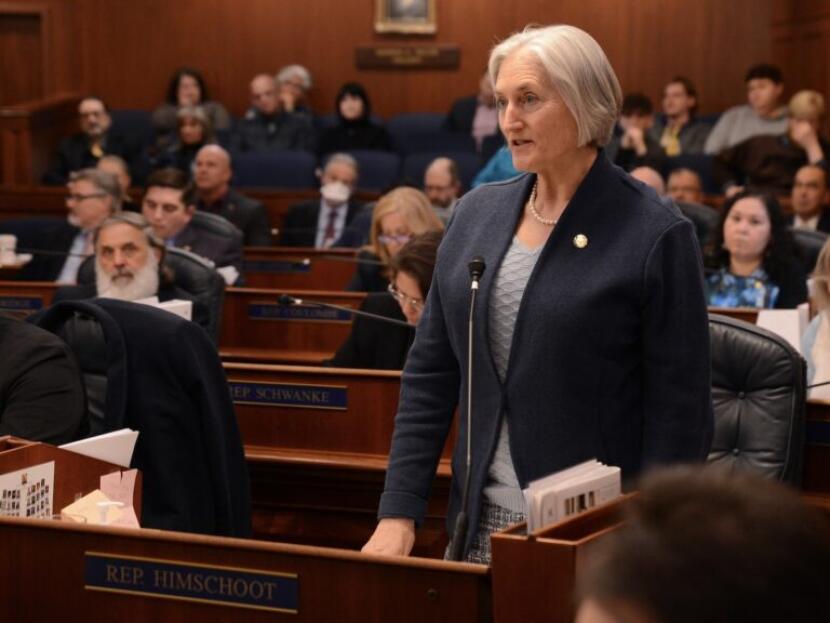
Rep. Rebecca Himschoot, I-Sitka, is a former teacher and vocal proponent of increasing education funding. She co-chairs the bipartisan task force on education funding launched last year.
“Closing a school feels like a death, and it is,” Himschoot said.
Himschoot pointed to budget problems, loss of enrollment and the shift to homeschool, but said the state, in her view, is not funding education as it should.
Himschoot said the task force is investigating short and long term funding solutions. The state approved an adequacy study this year to determine how much funding is needed to support schools, to be completed in the next few years. Another bill to allow districts to budget based on a three year average of student counts, failed in the Legislature this year, but Himschoot said the policy is likely to be revived next year to allow districts to set budgets earlier in the year. “It would take some of the uncertainty out and I think that’s going to have an impact on outcomes,” she said.
She said the task force is continuing its work looking at the problems and funding mechanisms, gathering input and evaluating solutions to address issues in the funding formula, major maintenance and rising costs like health care. Recommendations are due next January.
“The pain is felt by the students. That’s a straight line from state funding to what students get or don’t get,” she said. “It keeps me awake at night.”


