Critics skeptical as chemical companies agree to $1.19 billion PFAS settlement

By Will Atwater
On Friday, three large chemical manufacturers agreed to contribute $1.19 billion to a fund to settle lawsuits brought by water utilities across the country that allege that the companies contaminated drinking water supplies with per- and polyfluorinated chemicals, or PFAS.
This announcement comes as lawsuits — filed by state governments, environmental advocacy groups, water utilities and others — accusing Chemours, DuPont and Corteva of poisoning the environment and causing illness among people with long-term exposure to PFAS are piling up.
Seven years after the Wilmington Star-News first published the announcement about the presence of GenX compounds in Cape Fear River deposited there by DuPont spinoff Chemours, the settlement agreement was met with skepticism by many in the environmental community.
“I am extremely concerned about this, as lawyers are going to make a ton of money off the backs of contaminated communities — and giant chemical corporations are getting out easy,” said Dana Sargent, executive director of Cape Fear River Watch, a Wilmington-based environmental advocacy group.
Cape Fear River Watch sued Chemours in 2018 for discharging the chemical GenX into the Cape Fear River. The action led to a consent order among Cape Fear River Watch, Chemours and the North Carolina Department of Environmental Quality.
The order required Chemours, among other things, to develop and execute a PFAS remediation plan for contaminated air, soil and water for the affected lower Cape Fear River Basin communities.

This area includes New Hanover, Brunswick, Columbus and Pender counties. Like many critics, Sargent believes the pledged funds represent a small fraction of what’s required to address the nationwide problem.
“This settlement comes nowhere near the amount needed to cover the devastation they have caused. It is clear they’re coming out on top; their stocks have gone up as their shareholders see this as their liability issues being behind them,” Sargent said. “I am grateful that, to my knowledge, lower Cape Fear utilities are not participating in this settlement.”
Since the 1940s, PFAS — referred to as “forever chemicals” for their persistence in the environment and the human body — have been used in the manufacturing of oil and water-resistant products, as well as products that resist heat and reduce friction.
More than 12,000 PFAS compounds are almost ubiquitous in nonstick cookware, cosmetics, cleaning products, dental floss, water-resistant clothing and textiles, and in some firefighting foams and firefighting turnout gear.
While there is no definitive evidence about PFAS posing health risks to humans, there is mounting research that suggests links between extended exposure to forever chemicals and weaker antibody responses against infections in adults and children, elevated cholesterol levels, decreased infant and fetal growth, and kidney and testicular cancer in adults.
Who’s eligible?
Settlement funds are only available to municipal water systems with detectable levels of PFAS and systems required to monitor for PFAS per “EPA monitoring rules or other applicable laws,” according to the news release.
Water systems not eligible include those managed by state and federal governments and small systems that currently have no PFAS detected and are not required to be monitored. Also, water utilities in the Cape Fear River Basin are ineligible unless they request to opt in, the release says.
In response to the recently announced settlement, the Cape Fear Public Utility Authority, which would be allowed to opt in based on the guidelines outlined in the agreement, posted a response on its website that states, in part:
“Unfortunately, CFPUA has not been provided with the terms of the agreement and we do not know what compensation CFPUA should expect if it were to participate. Our utility’s financial losses and future financial commitments to address our upstream neighbor’s pollution are substantial, and any settlement must substantially address these damages.
“Litigation will continue until the polluter provides solutions that meet our community needs. CFPUA must consider the best interests of the Authority and the community it serves.”
In 2019, CFPUA, which provides drinking water to more than 200,000 customers in the Wilmington area, started construction on a $43 million granular activated carbon filtration system at its Sweeney Water Treatment Plant to remove GenX and other PFAS compounds from the drinking water supply.
CFPUA anticipates spending “$3.7 million for Fiscal Year 2023 [and] $5 million in subsequent years,” according to the utility’s 2022 annual report.
The millions of dollars spent by CFPUA and the ongoing financial burden required to maintain the system are examples of why critics argue that the settlement amount falls short of what’s needed.
“Chemours, DuPont and Corteva’s recent $1.19 billion agreement will not cover the installation of reverse osmosis filters to all 101 water providers in North Carolina, let alone the over 150,000 public water systems in the U.S.,” said Beth Kline-Markesino, founder of North Carolina Stop GenX in Our Water, a grassroots advocacy organization based in Wilmington.
A closer look at the agreement
The following are key points outlined in the agreement, according to the release:
- Chemours will contribute 50 percent (about $592 million), DuPont about $400 million and Corteva about $193 million. The court ordered the money to be deposited in a fund and made available within 10 business days of being approved by the court.
- If the agreement is finalized in 2023, a final ruling will be delivered by the U.S. District Court for the District of South Carolina. Then, those wishing to join the settlement will have a certain amount of time to do so. If not enough water systems join the settlement, the chemical companies can decide to opt out of the agreement.
- If an agreement can’t be reached with plaintiffs, the chemical companies have vowed to defend themselves in court against pending litigation.
Though many environmental advocates argue that the best way to address the issue of PFAS contamination is for manufacturers to stop producing the chemicals, there was a sliver of optimism coming from the North Carolina Attorney General’s office after first hearing about the settlement agreement. Attorney General Josh Stein has filed several lawsuits against Chemours.
“Our office is pleased to see Chemours/DuPont/Corteva beginning to take some responsibility for their actions,” said Laura Brewer, Stein’s communications director.
“We look forward to reviewing the details of the proposed settlement. Based on initial reports, this proposed settlement does not address all of the issues in A.G. Stein’s lawsuit,” she said. “A.G. Stein’s case against these companies continues, and he will continue his work to ensure that the water North Carolinians drink is clean and safe.”
The post Critics skeptical as chemical companies agree to $1.19 billion PFAS settlement appeared first on North Carolina Health News.
As the nation’s second-largest reservoir recedes, a once-drowned ecosystem emerges
If you want to see the Colorado River change in real time, head to Lake Powell.
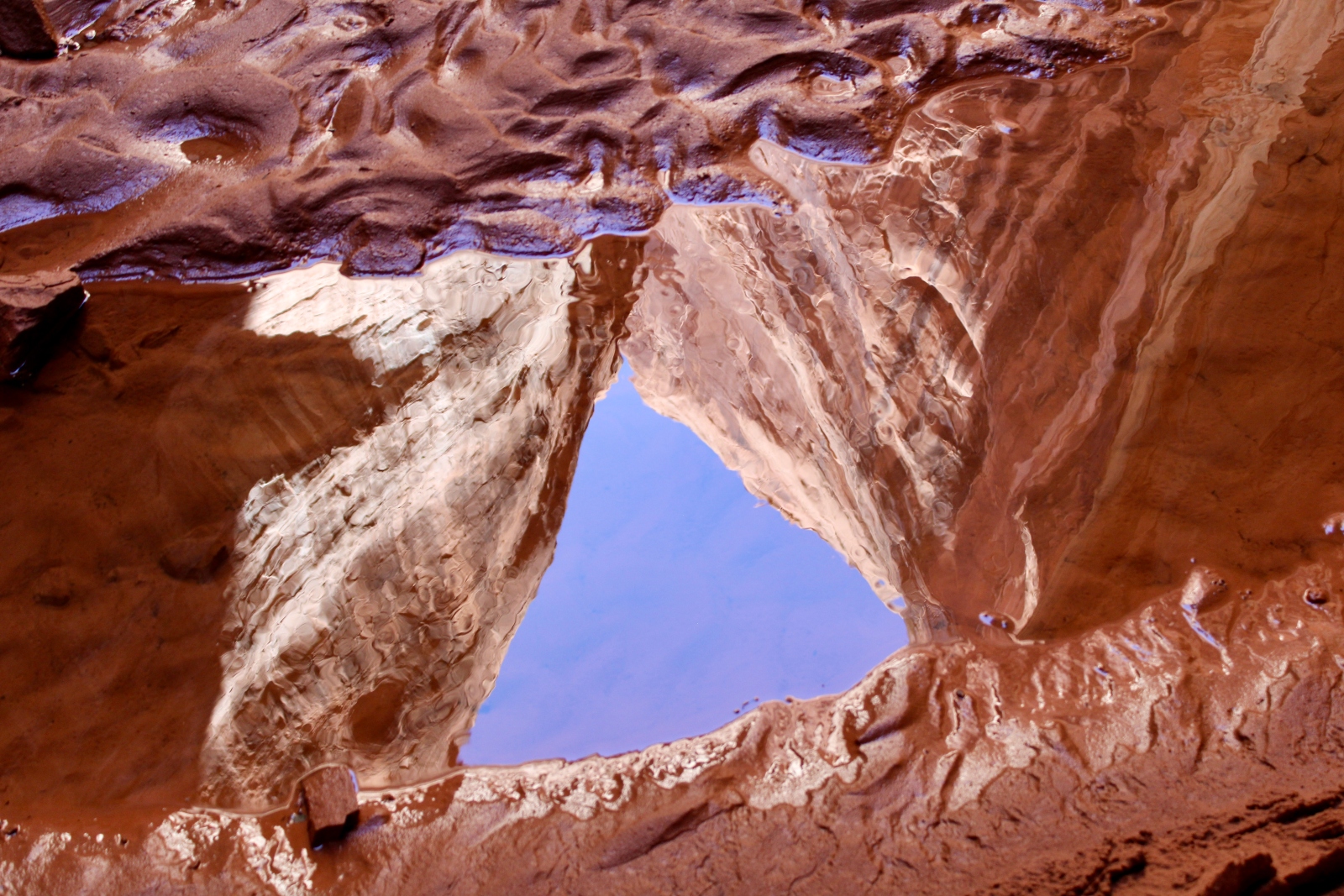
At the nation’s second-largest reservoir, water levels recently dipped to the lowest they’ve been since 1968. As the water recedes, a breathtaking landscape of deep red-rock canyons that cradle lush ecosystems and otherworldly arches, caverns and waterfalls is emerging.
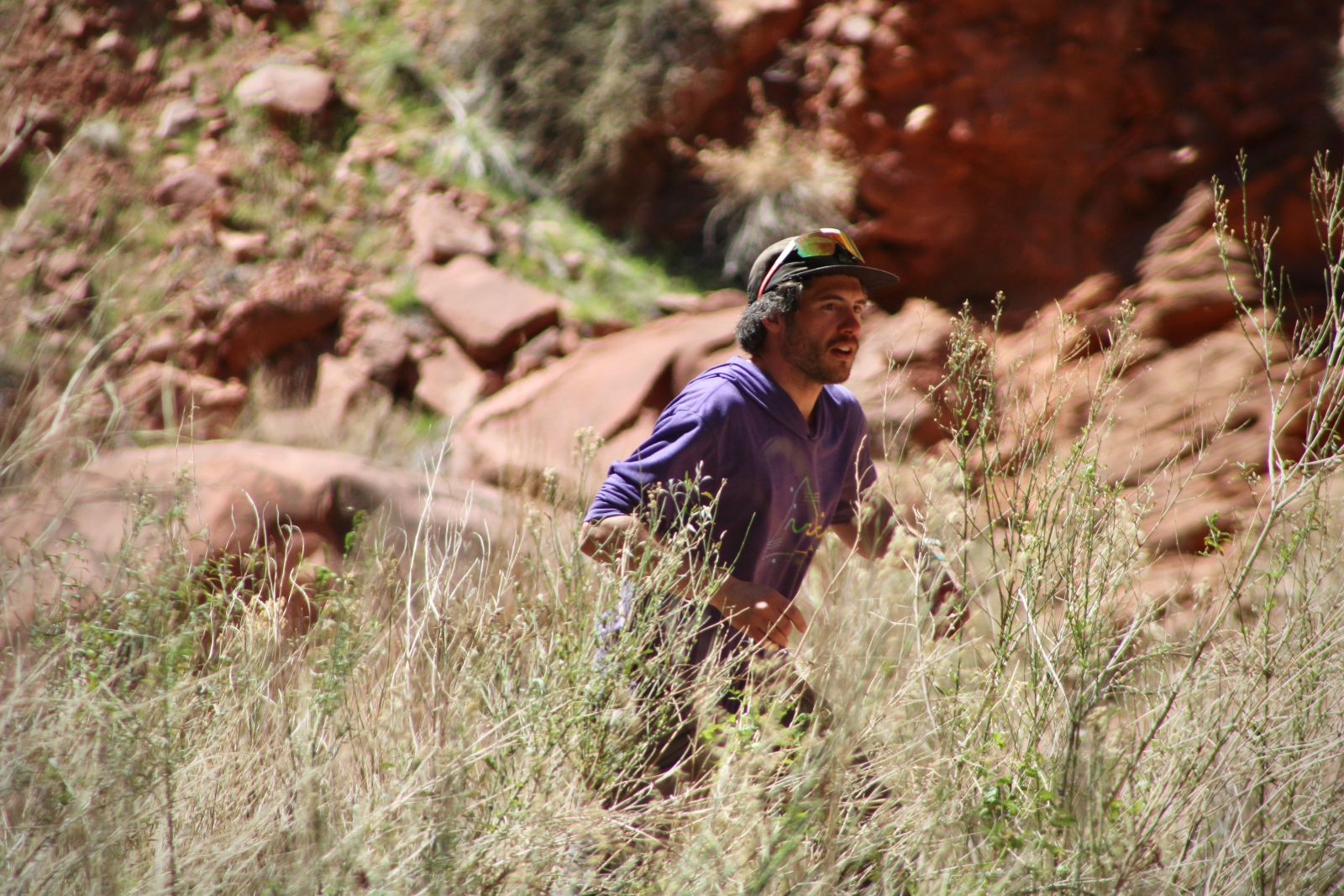
On a warm afternoon after the reservoir had dipped to a record low, Jack Stauss walked along a muddy creek bed at the bottom of one of those canyons. He works as the outreach coordinator for Glen Canyon Institute, a conservation nonprofit that campaigns for the draining of the reservoir and highlights the natural beauty of Glen Canyon, which was flooded in the 1960s to create Lake Powell.
“I call this the moon zone,” Stauss said, as his shin-high rubber boots splashed through cold pools and eddies. “There are ecosystems that thrive in these side canyons, even when they’ve been de-watered for just, like, four years. You start to see stuff come back on a really unprecedented scale.”

Alex Hager / KUNC
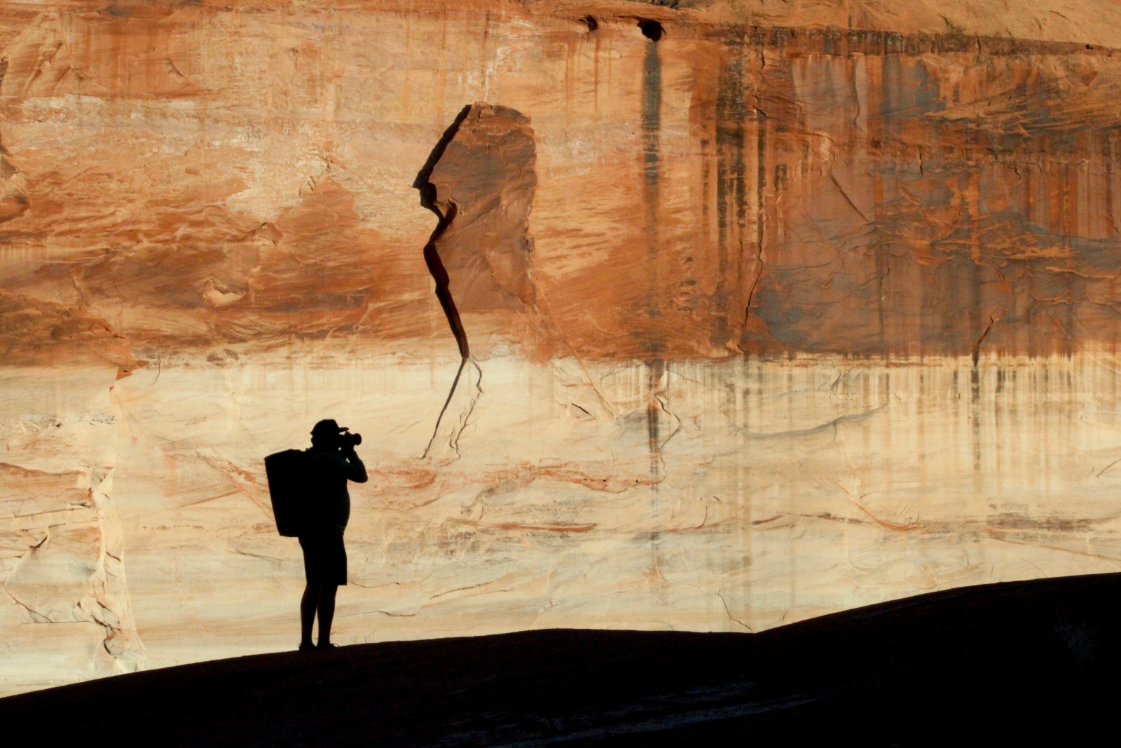
Lake Powell is already receiving a major springtime boost. Until July, snow from an epic winter in the Rocky Mountains will melt and flow into the reservoir, and portions of those side canyons will flood anew. But for a brief moment in the late winter and early spring of 2023, Powell was creeping lower by the day. The falling water levels have created a harrowing visual reminder. Climate change has put the West’s key water supply on the ropes. At the same time, the drop reveals a spectacular landscape that environmentalists have heralded as a “lost national park.”
Stauss – an environmentalist who refers to Lake Powell as “the reservoir” – invited a small group of adventurous water wonks to chronicle its historically low water levels. He ambles along through the ankle-deep water, pointing up toward the infamous “bathtub rings,” chalky white mineral deposits on the canyon walls that serve as visual markers of the reservoir’s heyday.
“It’s staggering,” Stauss said. “The scale is hard to wrap your head around. The fact that the whole time we were just hiking, we would have been underwater, is shocking.”
The high water line, set in the early 1980s, is more than 180 feet above our heads. Even last summer’s high water mark is about eye level.
Reminders of Glen Canyon’s return to some form of pre-reservoir normal aren’t always as static as the bathtub rings on canyon walls. All around our feet, the shallow water teems with life. The crystal-clear creeks are full of spindly bugs that float on the water’s surface. Occasionally, toads jump from the stream’s sandy banks. Lizards bask in patches of sun. Bird calls echo off the smooth walls and melt into a distorted chorus.
Teal Lehto, who makes short videos about the Colorado River on TikTok under the name “WesternWaterGirl,” was also on the expedition. She pushed past a dense thicket of willows as we hiked through the canyon.
“It’s really, really interesting seeing the way that the ecosystem is recovering,” Lehto said. “And then there’s a little bit of heartbreak knowing that this area is probably going to be submerged again in a couple of months.”
After spending decades under mostly-still water, these canyons are laden with heaps of sediment that settled onto on the lake’s floor. Towering, crumbly banks of sand and dirt line the bottom of each side canyon, often high enough that some of the group’s ski enthusiasts try to carve down, sliding across the loose deposits in their sandals.
As those sandy banks start to erode, they also reveal traces of human activity. Old beer cans, golf balls, and other tattered bits of unidentifiable trash poke through the sediment, leaving lasting reminders of Powell’s double-life: a bustling haven for recreation, and a key piece of water storage infrastructure.
Alex Hager / KUNC
‘Nature bats last’
The group’s boat – a rented pontoon boat with plenty of space for the camera gear, camping setups and loaded coolers we’ve piled towards the back – wasn’t particularly agile. Stauss carefully piloted the craft through a “ghost forest,” where the blackened, skeletal tips of cottonwood trees are just seeing the light of day after decades underwater.
“Every time you come down here, it’s sort of a different game of steering the boat through stuff,” he said. “It’s kind of exciting, actually, like a little puzzle.”
After a slow cruise around the eerie labyrinth of treetops, Stauss leaned the accelerator back into neutral. The boat idled in front of the messy, muddy delta of the Escalante River. The river carries snowmelt about 90 miles through Southeast Utah before it runs into Lake Powell, in an area which was once the free-flowing Colorado River.
Another member of the expedition, Len Necefer, was in this same spot last year. Necefer, a member of the Navajo Nation, founded the consulting and media group NativesOutdoors and holds a PhD in engineering and public policy.
“It’s constantly changing,” he said. “In a few weeks you’ll be able to motor around and go up to Willow Canyon and all that. But right now it’s in this sort of crazy zone of transition.”
The group ponders a trek out onto the delta itself but decides against venturing into the mud, where footing looks uncertain. As the boat cruised into a U-turn, Necefer posited that “nature bats last.”
“Bottom of the ninth, end of a baseball game, nature is at bat and basically has the final say on what happens,” he said.
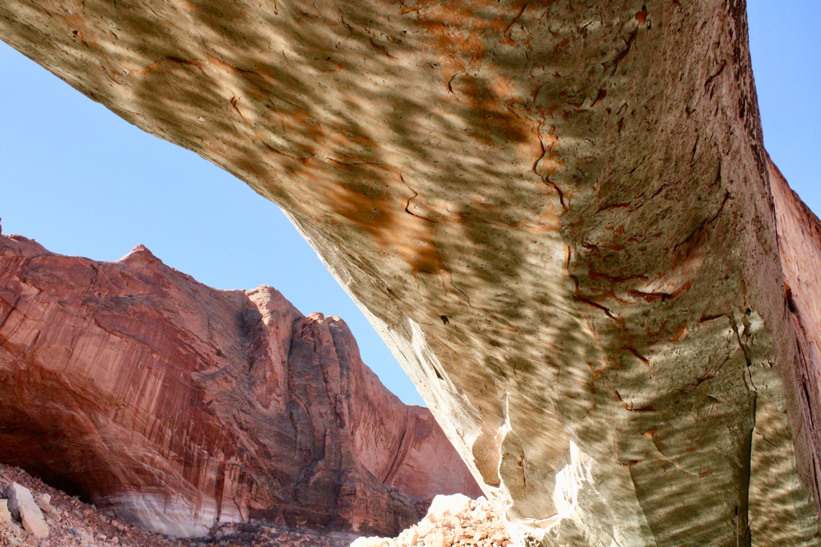
Nature is taking its last licks in nearly every corner of the sprawling reservoir. Elsewhere, a natural stone arch, once completely submerged, is now so high above the water that you can drive a boat underneath.
Alex Hager / KUNC
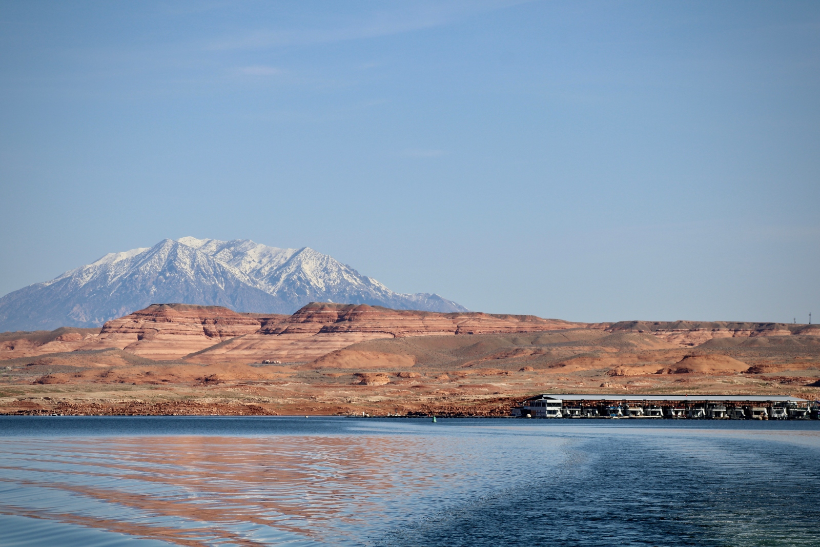
At the reservoir’s marinas, receding water has thrown a curveball to Lake Powell’s powerhouse recreation industry. In 2019, Glen Canyon National Recreation Area attracted 4.4 million visitors, more than Yellowstone National Park. The National Park Service says tourism brought $502.7 million to local economies.
But the recreation area – a world-renowned hotspot for houseboaters, wakeboarders, and jet skiers – has taken a hit.
At marinas along Lake Powell, the distance between the parking lot and the shore of the reservoir has gotten dramatically longer over the past two decades.
At Bullfrog Marina, where Stauss rented the pontoon boat, what was once a gentle ramp right next to the parking lot is now a strip of concrete hundreds of feet long. Docks and buoys once moored in water dozens of feet deep now lie crooked and dusty on the desert ground.
In the past few years, the National Park Service has had to make the Bullfrog Marina ramp even longer, chasing the water as it recedes. Further upstream, the Hite Marina, once a busy put-in for boats, is stranded so far away from the water that it is now shuttered.
‘Speechless’ at the Cathedral
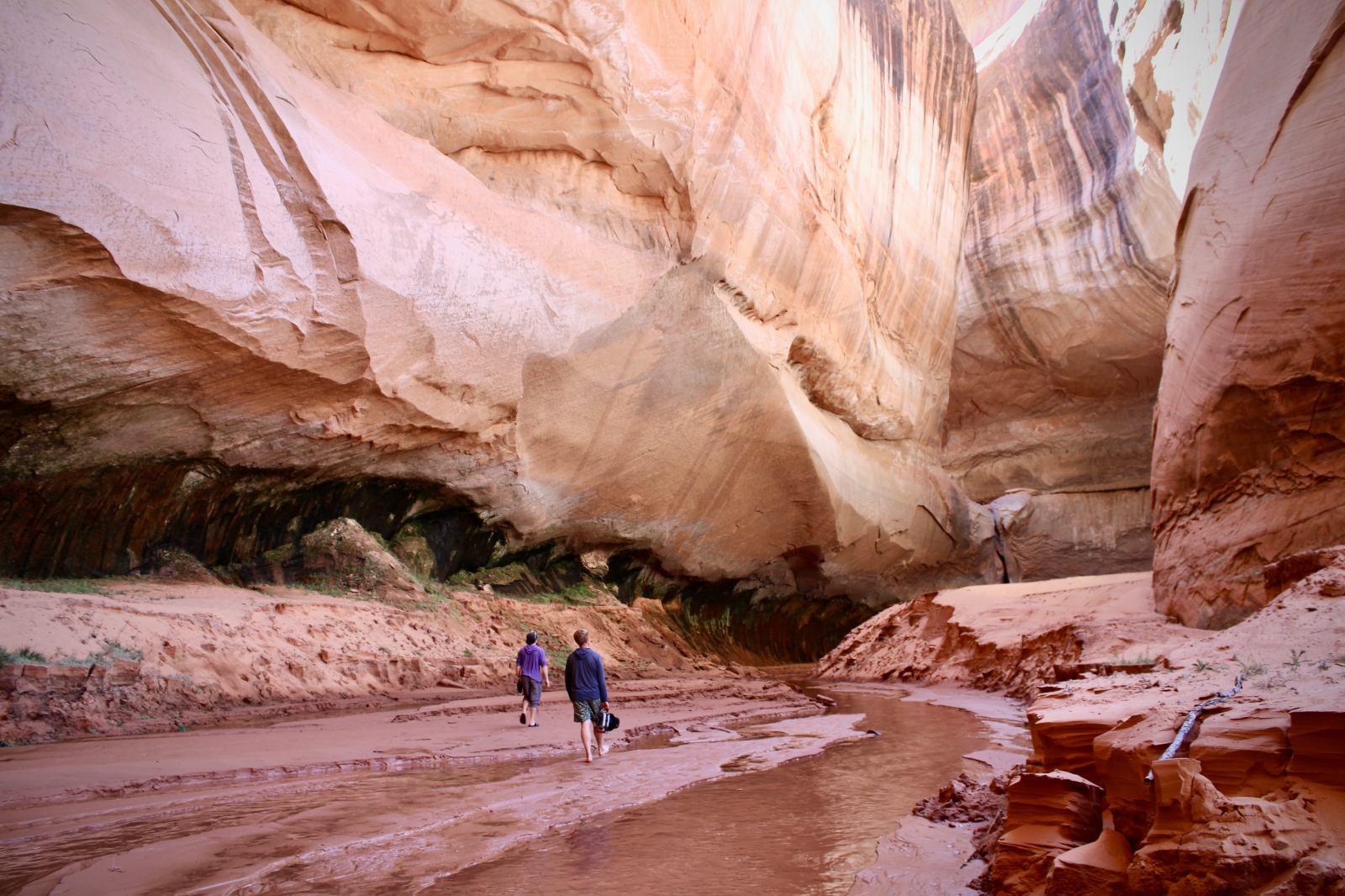
Each hike into a new side canyon was the same. Stauss pushed the bow of the pontoon boat into the muddy shore, and the group hopped out clad with backpacks full of cameras. At each new mooring, the path was only visible a few dozen yards up the canyon before a dramatic curve obscured the route ahead.
On one hike, an extra-squishy patch of mud turned out to be quicksand. The trekkers tap danced across it, careful not to sink too deep, but egged each other on to test its limits. Filmmaker Ben Masters, a member of the expedition, wriggled around until he was waist deep and needed a hand to get unstuck.
“Indiana Jones taught me to stop resisting,” Lehto said as Masters pulled himself out of the muck.
After about a half hour of strolling, the crew got what it came for – a rare glimpse of Cathedral in the Desert.
Awe-inspiring as they are, the side canyons can blur together after a few hours of plodding through relatively indistinct curves in the rock.
This one is different.
The hikers round a corner and come upon a red-rock cavern. The group, chatty on the way in, falls silent for a moment.
Alex Hager / KUNC
“I’m kind of speechless, which is really funny for me, because I always have something to say,” said Lehto, the TikTok creator. “But it is gorgeous. It’s amazing to me to imagine that this was all underwater, and it will be underwater again soon.”
The canyon tapered into a kind of dome, where only narrow slivers of sunlight peek through. In one corner, at the foot of a giant sand mound, a thin waterfall trickled from above. The rivulet snaked through a crack in the rock before it dribbled into a frigid, still pool and echoed through the cavern.
“I kind of wish there was a choir here because I think it would be really beautiful,” Lehto said. “Anybody know how to sing?”
Nobody in the group chimes in. Most are silent, staring up toward the top of the waterfall and contemplating the best way to position their cameras.
After a few minutes of silent marveling, Stauss provides some context.
Cathedral in the Desert made a brief above-water appearance in 2005, only to be submerged again until 2019. Since then, fluctuating water levels have flooded in and out of the pocket, limiting the waterfall’s height.
“People used to boat up 100 feet above the waterfall,” he said. “It’s something we’ve been waiting for for a long time. It’s another one of these markers of restoration to see Cathedral come back and to know that it’s not just a fraction of what it once was, but it’s going to be full size.”
After the fall, a rise
Standing under the Cathedral’s ceiling of smooth desert stone, Stauss pondered the future of a region where Lake Powell, and the rest of the Colorado River’s sprawling network of storage infrastructure, are due for an overhaul.
“I don’t think we should just think that the drawdown of these reservoirs is over,” he said. “I think we should use the moment to rethink completely how we store, use and conserve water across the West—and I think Glen Canyon should be at the heart of that conversation.”
Alex Hager / KUNC
In some circles, Glen Canyon is a major thread in conversations about water management. Environmentalists argue that Powell should be drained and Glen Canyon should be allowed to return completely. Recreators disagree, and water managers have shown reluctance to break so sharply from the status quo.
But the Colorado River’s rapid drying has pushed the idea of draining Lake Powell from the fringe and given a semblance of legitimacy to water management ideas once considered far-fetched. The river, which supplies tens of millions across the Southwest, has faced dry conditions since around 2000. The seven U.S. states which share its water have been caught in a standoff about how to cut back on demand.
This year, deep mountain snow promises a serious boost, the likes of which have only been seen a handful of times in the past two decades. Runoff is expected to raise the reservoir’s surface by about 50 to 90 feet by this July.
But even the most cautious runoff estimates would leave the reservoir less than 40 percent full. Its levels will again begin to drop over the fall and winter.
One year of strong snow won’t be nearly enough to pull the reservoir out of trouble. Climate scientists say the Colorado River would need five or six winters like this one to rescue its major reservoirs from the brink of crisis.
The past few springs delivered relatively low runoff, leading to summers fraught with mandatory water cutbacks and emergency releases from smaller reservoirs – efforts primarily focused on keeping water in Lake Powell.

Alex Hager / KUNC
Water managers are under pressure to keep water flowing through hydroelectric turbines within Glen Canyon Dam, which holds back Powell. After decades as a rock-solid emblem of the nation’s Cold War era expansion into the West, dropping water levels are threatening one of the dam’s primary functions. If water dips too low, the federal government could be forced to shut off hydropower generators that supply electricity to 5 million people across seven states.
This wet winter will ease some of that pressure, although water managers have publicly emphasized the need to avoid “squandering” the benefits of an unusually snowy year. The favorable conditions could relieve the need for emergency changes to Colorado River management, allowing the seven states which share its water to wait until 2026 for broader changes. The current operating guidelines for the river are set to expire that year, and water managers are expected to come up with more permanent cutbacks to water demand before that happens.
Amid tense negotiations and pre-2026 posturing, environmentalists like Stauss and his colleagues at Glen Canyon Institute are arguing for a future which cuts out a need for Lake Powell entirely – decommissioning Glen Canyon Dam and storing Powell’s water in other reservoirs.
Alex Hager / KUNC
In the meantime, Stauss relished the brief glimpse at what that might look like.
“It’s a scary future for water in the West,” he said. “But as far as Glen Canyon goes, it’s a pretty amazing silver lining.”
This story is part of ongoing coverage of the Colorado River, produced by KUNC, and supported by the Walton Family Foundation.
This story was originally published by Grist with the headline As the nation’s second-largest reservoir recedes, a once-drowned ecosystem emerges on Jun 3, 2023.
‘Prove it or lose it.’ How tribes are forced to fight to secure senior water rights
Can retiring farmland make California’s Central Valley more equitable?
Last year, Fairmead received a grant to help plan for farmland retirement in order to recharge groundwater under California’s Sustainable Groundwater Management Act, or SGMA. But the community’s vision for the future is bigger than that: The locals also want to see improved air quality, a community center and reliable domestic wells.
The West is not just facing an energy transition, it is also at the beginning of a major transition in land and water use. In California’s Central Valley, groundwater regulations will require retiring between 500,000 and 1 million acres by 2040. (Retirement, or “fallowing,” refers to taking lands out of agricultural production.) The planning and decision-making now underway across more than 260 regional Groundwater Sustainability Agencies will determine how SGMA plays out across different groundwater basins: whether landowners will be compensated for retired lands, what the lands will become and who will manage them, and how counties will replace the revenues they currently collect from agricultural lands and use to help provide services to residents in need.
“The side effects of agriculture have a huge impact on the environment and on everyone.”
But while groundwater sustainability is SGMA’s focus, it’s not the only thing on Central Valley residents’ minds: They also need jobs, as well as clean air and water. Many Central Valley towns have diverse demographics; Fairmead, for example, is over 70% Latino — mostly immigrant and predominately Spanish-speaking — but there are also Black, Asian, Indigenous, mixed-race and white individuals. The median household income is less than half of the state’s average, and the residents are disproportionately exposed to environmental hazards.
Workers package cantaloupe on a farm in Firebaugh, California, nearby Fairmead. Agricultural jobs lost from fallowing farmland would need to be replaced to support Central Valley residents.
David Paul Morris/Bloomberg via Getty Images
“The side effects of agriculture have a huge impact on the environment and on everyone,” said Ángel Fernández-Bou, a climate scientist at the nonprofit science advocacy organization Union of Concerned Scientists, which is researching the Central Valley’s land-use transition. He and others spoke to High County News about how SGMA can help create a healthier and more sustainable post-agriculture Central Valley:
Improved air and water quality: Locals are in dire need of better air quality. “When they spray, they spray all kinds of pesticides,” said Nelson, who is also president of the organization Fairmead Community and Friends. “The Central Valley has a lot of problems with people with asthma and COPD because they grow so much stuff out here. The environment is bad to breathe, plus it’s super-hot.”
Around 200 million pounds of pesticides are used in California each year, and the geographical pattern of their application is one of environmental inequality: According to the Pesticide Action Network, majority-Latino counties see 906% more pesticide use than counties with fewer than 24% Latino residents. Fernández-Bou calculated that creating “buffer zones” by retiring the farmland in a one-mile radius around the Central Valley’s “disadvantaged communities” — a term used by the state of California for municipalities with median household incomes lower than 80% of the state’s — would decrease pesticide use by 12 million pounds, and also combat the health effects of pesticide drift.
Agricultural inputs also affect the water quality. When the nitrate from fertilizers leaches into aquifers, it can cause chronic health effects and conditions, such as blue baby syndrome. A long-term study by the Environmental Working Group found that 69 Central Valley water systems serving at least 1.5 million residents — the majority of them Latino — exceeded federal standards for nitrate. The impact is likely even higher, given the numerous domestic wells. Creating buffer zones would reduce nitrate leaching into aquifers by over 200 million pounds, per year, Fernández-Bou calculated.
The impact of land fallowing on dust is less clear. The Public Policy Institute of California has raised concerns about increased dust blowing off fallowed lands and affecting farmworkers and nearby communities. But Fernández-Bou took a more optimistic view, saying that dust is most often a problem when farmers till fallowed fields; left alone, he said, cover crops or weeds will grow roots that hold the soil in place.
A tractor kicks up dust as it plows a dry field on in Chowchilla, California, near Fairmead. Fallowing more crop land could increase dust, but climate scientist Ángel Fernández-Bou said that dust is most often a problem when farmers till fallowed fields; left alone, he said, cover crops or weeds will grow roots that hold the soil in place.
Justin Sullivan/Getty Images
Workforce transition: For many Central Valley residents, the biggest question concerns jobs, wondering how they’ll make a living once farmland is retired. Transitioning away from agriculture is “a hard pill to swallow,” said Eddie Ocampo, director of the organization Self-Help Enterprises. “Everyone is for economic diversity, but there’s going to be a gap, and those who are the most vulnerable are going to be the most affected.”
Under Fernández-Bou’s buffer-zone model, an estimated 25,682 agricultural jobs would be lost. Communities are only beginning to think about what will replace them. One option is renewable energy: California’s SB100 requires the state to be 100% renewable by 2045 — a timeline similar to SGMA’s land fallowing — and the Central Valley is being eyed for significant solar production. “We’re going to see long-term sustained demand for solar construction and maintenance jobs,” said Andrew Ayres of the Public Policy Institute of California. Community colleges in the Central Valley are working to develop training programs for these jobs. Another initiative plans to re-train farmworkers to install water recycling systems.
“Everyone is for economic diversity, but there’s going to be a gap, and those who are the most vulnerable are going to be the most affected.”
Access to drinking water: Like Fairmead, many of the Central Valley’s low-income rural communities lack urban water infrastructure and must rely on shallow domestic and municipals wells to meet their drinking water needs. Because SGMA prioritizes access to drinking water, many people believe it could improve the health of those wells. “Generally speaking, SGMA implementation is going to be good for rural groundwater wells,” said Ayres. Recharging groundwater, he said, “can buoy those community wells.”
Dialogue: The planning process itself, said Ocampo, has been beneficial for the Central Valley. Developing successful land-repurposing plans, he said, requires the participation of diverse interests — agribusiness, environmental justice organizations, land trusts and under-represented communities. “A lot of stakeholders realize that the more diversity of opinion there is, the more multi-beneficial and inclusive the outcome will be,” said Ocampo.
Planning for groundwater sustainability gives historically agricultural communities the chance to envision myriad new economies and land uses that will shape the future of the Central Valley. Habitat restoration, parks, regenerative agriculture, community centers and cooling centers are all on the table.
“I would say the possibilities are endless,” said Fernández-Bou. “But please don’t bring bad stuff to the valley.”
Caroline Tracey is the climate justice fellow at High Country News. Email her at caroline.tracey@hcn.org or submit a letter to the editor. See our letters to the editor policy.
From Food Fountain to Fire Extinguisher: The Tiny Pond That Never Stops Giving
Ohio environmentalists and oil companies battle state over dumping of fracking wastewater
Advocates for both sides say public drinking water may be tainted by underground leaks of “produced water” from fracking.
The post Ohio environmentalists and oil companies battle state over dumping of fracking wastewater first appeared on Athens County Independent.
Battle of the berms: Farmers build maze of levees to protect land as ‘Big Melt’ heads for Tulare Lake

Growers and water managers in the Tulare Lake area have been moving mountains of dirt to beef up levees and build entirely new ones as they brace for snowmelt this summer.
A string of storms in March battered the region, blowing out levees and overwhelming infrastructure as flood water plowed through homes, dairies and crops. The mad scramble to move dirt is in part to repair that damage but also to fend off future damage in the face of an historic snowpack that’s already swelling valley rivers.
“It’s turning into ‘Whoever has the biggest berm wins,’” said Craig Andrew, manager for Sandridge Partners, one of the largest landowners in Kings County.
Sandridge built a large berm around its raisin facility about a mile southeast of the tiny community of Stratford on Highway 41, he said. Other farmers are taking dirt from Sandridge to build berms around their farms and dairies.
Berms are going up all around the Stratford area as locals fret about the South Fork of the Kings River potentially going above its current flow of 2,500 cubic feet per second. In fact, water is already standing against the levees that protect Stratford.
Growers are spending, “millions of dollars,” building berms to protect themselves, confirmed Mark Grewal, a water manager in Kings County.
“These levees are gigantic,” said Grewal. “They’re million dollar plus levees.”
It’s mostly private companies and landowners doing the levee building, he said.
Vahid Salehi has been building up levees to try and hold off increasing flows from the Kings River. Salehi is the president of Pistacia Global, which manages about 8,500 acres of almonds and pistachios throughout Kings, Tulare and Fresno counties.
The problem areas have mostly been on properties next to the North Fork Kings River, said Salehi. There, multiple sections of crops have been inundated with water. Salehi and his workers have been excavating and moving dirt so they can bring in pumps to redirect the water.
While it hasn’t cost the company millions, it’s still expensive, said Salehi. He estimates costs from roughly the last month of labor and equipment at about $50,000.
“There’s a lot of issues and maybe budget-wise infrastructure problems,” said Salehi. “There’s just all sorts of problems.”
Pistacia Global’s Kings River properties are within the jurisdiction of the Kings River Conservation District, which oversees river infrastructure and flood operations, among other things.
For the most part, Salehi is able to do what he wants when it comes to moving dirt. But there have been some instances where KRCD has stopped construction, he said.
Salehi was moving dirt on the river trying to build up some of the lower parts of the banks when KRCD told him to stop. The construction would put pressure on other parts of the river, KRCD staff told him.
“We have a good relationship with them, we try to be friends with everybody. So we haven’t tried to challenge it so much,” said Salehi. “The river has its own rules and they try to enforce those rules.”
KRCD staff have also been moving dirt building up levees. The district manages 140 miles of levees on the Kings River that start upstream of Highway 43 and run through the main river channel, the North Fork and the South Fork down to the town of Stratford.
Landowners are allowed to do what they want on their own property, said Charlotte Gallock, director of water resources and chief engineer for KRCD. But the district has jurisdiction on anything within 15 feet of the river levee, she said. Any work in those areas needs to be coordinated with the district and permitted by the Central Valley Flood Protection Board, she said.
There are three locations where levees have been sloughing dirt and have had to be rebuilt, said Gallock. Two were on the main river channel near Lemoore and the third was on the South Fork, she said.
The biggest area of concern is the South Fork, said Gallock. The district has already raised some sections of levees, in one area by about three feet and another by a foot. There will probably be more levee raising to follow.
“We’re moving forward with those projects in those areas of concern and we anticipate those will be done pretty swiftly,” said Gallock.
Kings County and the Office of Emergency Services have helped to get levee building materials down to the district, she said.
KRCD has seven workers patrolling the levee system during the day and eight patrolling at night. It’s a 24 hour surveillance system, said Gallock.
“They’ll look to see if there’s water somewhere where it shouldn’t be,” said Gallock.
The berm building frenzy has sometimes run afoul of Kings County rules.
“Some berms have been placed in the public right of way, we are either removing the berms if they create a safety issue or if acceptable, we work with the property owner to secure an encroachment permit,” wrote a Kings County spokesperson in an email.
Meanwhile, the Tulare Lake, once the largest freshwater lake west of the Mississippi until it was drained more than 150 years ago for agriculture, continues to refill. Flood water is creeping close to Stratford and Corcoran where it’s being held back by the Corcoran levee.
The state is paying $17 million to raise that levee.
But managers at Westlake Farms five miles south of Stratford are taking matters into their own hands. The company hasn’t taken any water yet but workers are building a levee around its headquarters, said Ceil Howe III, COO of Westlake Farms.
The company owns about 2,000 acres of pistachios, olives and field crops.
The levee building is, “just a precautionary practice,” said Howe III.
“We just have to take care of ourselves,” said Howe III. “It’s just tough times for everybody. It’s just unfortunate. Mother Nature wins and it’s just a tough deal.”
The post Battle of the berms: Farmers build maze of levees to protect land as ‘Big Melt’ heads for Tulare Lake appeared first on Fresnoland.
Some Nebraska farmers are protecting drinking water while boosting profit. Here’s how.
Facing the floodwaters in California’s San Joaquin Valley
Listen to this story on The California Report
Allensworth, a farmworker town of about 500 people in California’s San Joaquin Valley, sits at the edge of an area called the Tulare Lake Basin, a patchwork of scrub brush and irrigated farmland that’s part of the most productive agricultural region in the nation. Last March, California’s barrage of atmospheric rivers overwhelmed the area, flooding pistachio orchards and swamping communities, and Allensworth found itself all but surrounded by a shallow sea. Residents were told to evacuate. They were also told that this flood was just the beginning.
California is fighting a slow-motion disaster, one that could become its largest flood in recent history. As the near-record snowpack in the Sierra mountains melts, the water making its way through the foothills is pooling in the basin, reviving a lake that had long disappeared. This process is expected to accelerate over the coming weeks and months, and it could take up to two years to subside. And while the return of Tulare Lake could devastate everyone in the region, historically disenfranchised communities like Allensworth are uniquely vulnerable.
“It’s a horrific situation,” said Denise Kadara, an Allensworth community leader and the vice chair of the Central Valley Regional Water Quality Control Board. “We’re here like sitting ducks, waiting for the water to come and flood us out.”
Part of Allensworth’s problem stems from the politics of water: For over a hundred years, water in the Tulare Lake Basin has been controlled and hoarded by a handful of powerful landowners, usually at the expense of everyone else. The Basin’s water management system still favors those powerful landowners, leaving the town with little recourse when floodwaters approach.
‘I don’t need a whole bunch of people to break the law’
That was evident one windy night in March, when Allensworth residents Takoa Kadara and his father, Kayode, called an emergency town meeting. The goal was simple: to keep the water massing in the basin from pouring into people’s homes.
At the time, water was flowing toward town through culverts that run under railroad tracks to the east. The culverts are on private property, and the tracks that run on top of them are owned by BNSF Railway, one of the top freight transportation companies in the nation. The last time community members tried to block the culverts with rocks, gravel and plywood, a BNSF employee called the police, then removed the makeshift dam they had built.
Now the group wanted to protect the community, but knew they might be at risk of breaking the law. Residents only saw two options: act illegally, or not at all, and they couldn’t come to an agreement.
“If you guys disagree with this solution, then let’s go home,” Kayode Kadara said.
“No, it’s not, ‘let’s go home!” his son, Takoa Kadara, said, “let’s come up with another solution.”
“I’ll just say it like it is,” said one resident, who declined to give his name. “If I’m gonna break the law, I don’t need a whole bunch of people to break the law [with me]. Ten minutes? We’re gone.”
Allensworth residents have tried to block the culverts legally—many, many times. But BNSF wouldn’t give them permission to do it, and so far, the town hasn’t been able to find a government agency with the power to override the corporation’s decision, or persuade it to reconsider. Their local stormwater district doesn’t have jurisdiction over the railroad’s property, and representatives from several state agencies, including Caltrans, CalFire and the Department of Water Resources, said they couldn’t do anything either, even though community members said those agencies agreed that the water spilling through the culverts is a problem.
BNSF did not respond to requests for comment, but in an interview with the Los Angeles Times, a company spokesperson claimed that blocking the culverts could damage their tracks.
When Allensworth was put under a mandatory evacuation order back in March, the Kadaras and most of their neighbors refused to leave. Who would defend their town if they did?
“The water flowing is natural,” said Denise Kadara. But added it’s also determined by men who say “‘This is where they want the water to go.’”
The history behind today’s water politics
To understand the power dynamics in the Tulare Lake Basin—and how Allensworth ended up on the losing side of it—we have to go back to when the town was founded and Tulare Lake was still alive. In 1908, Lt. Col. Allen Allensworth was a formerly enslaved person who had become the highest ranking Black military officer of his time. As Jim Crow tightened its grip throughout the South, he moved to California to create what he hoped would become the “Tuskegee of the West,” a thriving Black community and college town. Founded by a dream team of Black doctors, professors and farmers, the community of Allensworth became the first town in California to be founded, financed and governed by Black Americans.
Allensworth picked a spot near Tulare Lake, which used to be the largest lake west of the Mississippi. Accounts from the late 1800s describe it as shallow, thick with tule reeds, and ringed by marshland. Herds of elk waded through the shallows, and millions of migratory birds flocked to its shores every year.
But by the time Lt. Col. Allensworth got there, the lake was rapidly disappearing—it had been for years.
“Geologists call that end of the San Joaquin Valley one of the most engineered landscapes in human history,” said Mark Arax, a journalist and expert in the Central Valley’s history and water politics. “[The] human hand has altered that land in a way that few places have been altered.”
Allensworth’s residents weren’t the only people who’d settled along Tulare Lake. A group of white landowners had settled there, too—some of them descending from slave-owning families.
“Many of them were Southerners who’d come from the Confederate states,” said Arax. “They arrived here and they started grabbing the snow melt out of those rivers, and then diverting that onto their farmland.”
In the 1920s, two particularly bold landowner families, the Boswells and the Salyers, made a move on the lakebed itself. The soil at the bottom was dark and unusually rich; it’d be the perfect place for a farm, if the lake wasn’t in the way. So they drained it and diverted the water for irrigation. According to Arax, those diversions ended up drying up the lake completely.
Meanwhile, Allensworth couldn’t get enough water to sustain itself, no matter how hard the community tried. White farmers diverted a river they relied on. A white-owned company refused to dig the community’s wells, but it was more than happy to dig wells for a white town nearby. By the 1920s, a lot of Allensworth’s original settlers had moved away. And by the 1940s, the white landowners in the Tulare Lake Basin had become some of the most powerful farmers in the country, and had successfully seized control of the water for themselves.
Those long-established power dynamics are still at work in the region. Today, Allensworth is a farmworker town where the tap water isn’t safe to drink. Many of its neighbors are large corporations and wealthy farmers, and they control many local agencies—like water and reclamation districts—which make decisions about who gets water in dry years and what to do when the floods come.
“You have these quasi-government agencies, but they’re controlled by the biggest landowners,” says Arax. “It’s a no man’s land in a lot of ways, and that’s the way it’s operated. It resorts to its own devices all the time.”
The Tulare Lake Basin also has a long history of levee sabotage. Historically, when the basin has flooded, some farmers cut levees and blocked canals to protect their land, but it also threatened the town with flooding. This is still happening today. Denise Kadara remembers getting the news from their local stormwater manager in March that a levy on the west side of town had been intentionally breached, prompting calls to evacuate.
As communities like Allensworth brace for the snowmelt this spring—and the floods they know are coming—this history of water theft, sabotage, and discrimination is always in the backs of their minds.
Although residents at that March meeting decided against blocking the railroad culverts, they haven’t stayed quiet. Allensworth’s community leaders have been calling every government official they can think of, trying to find someone who can help them. And in the past few weeks, Takoa and his family say some politicians and government agencies have started to respond.
CalFire’s emergency response team blocked the levee that was allegedly sabotaged, as well as other breaches, and saved the town from flooding. California Gov. Gavin Newsom visited the community in April and promised to send more resources. Allensworth residents are used to the system in this basin working against them, but they hope that’s finally changing. How state agencies act may be the only thing standing between Allensworth and catastrophic flooding.
“We need all the help we can get, from every agency, and every person that wants to help and believes in communities like ours,” Denise Kadara said.
This article was produced in collaboration with KQED’s The California Report. It may not be reproduced without express permission from FERN. If you are interested in republishing or reposting this article, please contact info@thefern.org.
You made it this far so we know you appreciate our work. FERN is a nonprofit and relies on the generosity of our readers so that we can continue producing incisive reporting like this story. Please consider making a donation to support our work. Thank you.