Why are we paying for crop failures in the desert?

In mid-July in Phoenix, a man demonstrated to a local news station how to cook steak on the dashboard of his car. The city sweltered through a nearly monthlong streak of 110-degree temperatures this summer, while heat records are tumbling across the Southwest. 

But despite the signs that this is the new normal, farmers in the region are planting the same thirsty crops on the same parched land in the desert, and watching them wither year after year. And why not? The American taxpayer is covering their losses.

Research released in June by the Environmental Working Group shows that, since 2001, heat linked to climate change has driven $1.33 billion in insurance payouts to farmers across the Southwest for crops that failed amid high temperatures. As the planet warms through the century, payments resulting from the impacts of climate change across the nation are likely to increase by as much as $3.7 billion.

Studies have repeatedly shown that federally subsidized crop insurance discourages farmers from updating their practices, tools, or strategies in ways that would help them adapt to climate change—but the federal government still subsidizes a whopping 62 percent of farmers’ insurance premiums. Until someone in Washington figures out a better way to spend our money, farmers in the Southwest are going to keep planting thirsty crops in the desert. They have little incentive not to.

Heat linked to climate change has driven $1.33 billion in insurance payouts to farmers across the Southwest for crops that failed amid high temperatures.

The Federal Crop Insurance Program (FCIP), the world’s largest crop insurance system, was established in the wake of the Dust Bowl to protect farmers from debilitating acts of God—decades before a growing body of scientific work firmly established the link between our fossil fuel use and rising temperatures. Although the government’s safety net for farmers includes an array of tools, this single program’s annual $10-billion price tag, which covers everything from drought in Arizona to flooding in Mississippi, accounts for a third of all public money spent on agriculture. Four-fifths of that are used to subsidize farmers’ costs.

Buoyed by ardent lobbying from large agricultural interests, the FCIP guarantees near-normal revenues in the face of losses that would cripple other businesses. It props up poorly managed operations while enabling risky decisions—like growing thirsty crops in a desert where millions of people vie for dwindling supplies of water.

In states like Arizona that depend on the stressed Colorado River, how and what farmers choose to grow has taken on new importance. Agriculture uses three-quarters of the region’s water to raise crops like cotton, which sucks up an average of 41 inches of irrigation annually, compared to wheat, which needs just 25 inches. Despite the arid conditions, there are plenty of reasons why farmers in the Southwest grow cotton, including the market, availability of financing, past experience, and the tools at hand. Subsidized insurance is a big one.

Although the program covers more than 100 different crops across the U.S., the vast majority of payouts go to corn, soybeans, wheat, and cotton, which are planted nationally on the most acres. Cotton is unique in the FCIP program in that it accounts for only 5 percent of the total acres enrolled in FCIP policies, but it has received a full 10 percent of claim payments over the past three decades—thanks in part to its intense water needs and the droughts that have roiled portions of the country in recent years. In central Arizona, where farmers experience the most acute impacts of Colorado River water shortages, a bale of cotton that sells for 65 cents actually costs 83 cents to raise. Still, cotton growers in Pinal County, south of Phoenix, continue planting with help from around $10 million in annual crop insurance payments—more than in any other county in the state.

Agricultural production is worth protecting; food and fiber are too important to subject to the increasingly cruel vagaries of the weather and global trade. But as it stands, the FCIP is maladapted to the challenges of  our modern world, where places like Arizona are routinely smashing through heat records and water in the West is becoming increasingly scarce. While home insurers like State Farm are pulling out of California and Florida due to the mounting costs of climate disasters, the FCIP is doing the opposite: insulating farmers from the true cost of doing business.

The average return for home and auto policies is about $0.60 per dollar spent on premiums. Farmers receive an average of $2.22 for every dollar they put into crop insurance. As a result, between 2000 and 2016, farming businesses—mostly large ones—collectively pocketed $65 million more in claim payments than they paid in premiums. They were paid to plant crops that never came to market. 

What is clear is that farmers’ participation in subsidized crop insurance programs is primarily driven by its availability.

Despite these failures, some of Washington’s most influential players say that the FCIP is working just fine. Collin Peterson, a 15-term Democratic Congressman from Minnesota who is now a lobbyist for the agriculture industry, said last year that the program is “the most successful thing we’ve done in agriculture.” Without federally subsidized crop insurance, he argues, farmers would be unable to compete with global markets or Mother Nature. But farmers saw prices and incomes strengthen during the years leading to 1980, before Congress expanded the program to subsidize premiums. Other supporters contend that consumers would suffer from skyrocketing prices. Yet economists have found no meaningful link between food and fiber prices and crop insurance.

What is clear is that farmers’ participation in subsidized crop insurance programs is primarily driven by its availability. When faced with paying the full cost of premiums themselves, farmers find other, cheaper means of managing risk, like conservation practices that save money in the long run, according to a recent analysis by The American Enterprise Institute.

The age of climate change demands better ways of managing risk. We need agriculture—even in Arizona. There’s good sun in the desert, and it makes sense to take advantage of that asset by planting well-suited crops. Some farmers are trying overlooked native food crops, including beans or experimental rubber plants, but these so far lack the market opportunity that the FCIP helps to maintain for cotton.

I’ve met farmers in Arizona who would gladly accept an alternative to cotton if it were economically viable. But there are other factors in play. Although the FCIP is government funded, its policies are sold and serviced by 14 private insurance companies that have gotten rich by keeping things exactly as they are.

Most of the program’s money not spent subsidizing premiums is used to reimburse these companies’ administrative costs. Ten of these are large, publicly traded corporations whose CEOs collectively take home almost $112 million a year, according to the EWG. And they all earn a 14.5 percent rate of return on their investments, compared to the 10 percent common to other insurance industries. This is thanks to the lobbying efforts of groups like the nonprofit American Farm Bureau Federation, which owns American Farm Bureau Insurance Services, Inc.—one of those 10 providers. 

Lawmakers are currently negotiating a new farm bill—a once-every-five-years opportunity to set FCIP policy. Subsidies still make sense for many farmers, especially small ones, but a few updates to the program would go a long way. First, funds should be reserved for the growers most in need, not millionaire operations. Next, to adapt to climate change, forecasts for determining premiums should be based on the latest climate models, rather than historic trends. Painting a more accurate picture of the risk would inform more sustainable cropping decisions.

Most importantly, FCIP funds should be used to pay farmers to permanently retire acres that consistently fail to produce. This would allow farmers to focus their efforts and resources where they do the most good. The program should also limit its coverage of crops ill-suited to their regions, and instead invest in existing conservation programs and research into markets for desert-adapted products. A sober fix would be to reapportion some FCIP funds to existing programs that help farmers upgrade their irrigation systems, or that provide conservation and agricultural assistance—including those that help reduce on-farm greenhouse gas emissions.This is all politically difficult, but it’s not impossible—and the advancing water crisis in the West means that time is of the essence. In May, legislators celebrated the latest inadequate agreement for sharing what’s left of the Colorado River. Like the winter’s generous snowpack and spring’s encouraging rains, the deal will buy a little more time to find a sustainable solution to the region’s chronic water shortage. Meanwhile, technocrats float implausible fixes, like piping in water from the Mississippi River basin or desalting the Sea of Cortez. Congress has an opportunity to end some of this absurdity—to change the incentives to reflect the reality of a changing climate, and allow desert farmers to continue providing food and fiber while doing their share to help avoid a calamitous future.

This article was produced in collaboration with The New Republic. It may not be reproduced without express permission from FERN. If you are interested in republishing or reposting this article, please contact info@thefern.org.
You made it this far so we know you appreciate our work. FERN is a nonprofit and relies on the generosity of our readers so that we can continue producing incisive reporting like this story. Please consider making a donation to support our work. Thank you.

Juneau’s worst glacial outburst flood destroys homes and displaces residents

Why Washington’s Tunnel 5 Fire is destined to be repeated

Without a major policy shift, more private homes will burn and more public money will be spent trying to protect them

Why Washington’s Tunnel 5 Fire is destined to be repeated

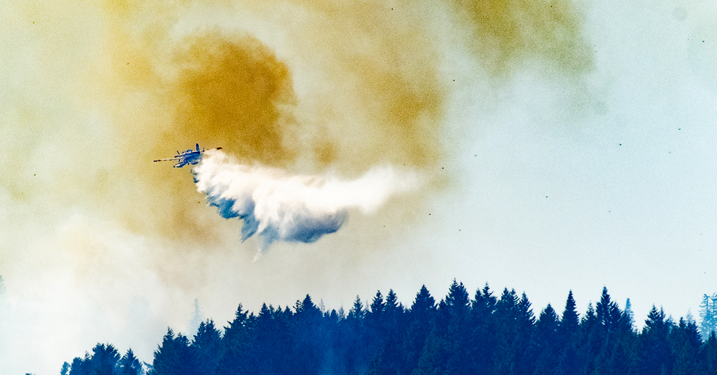
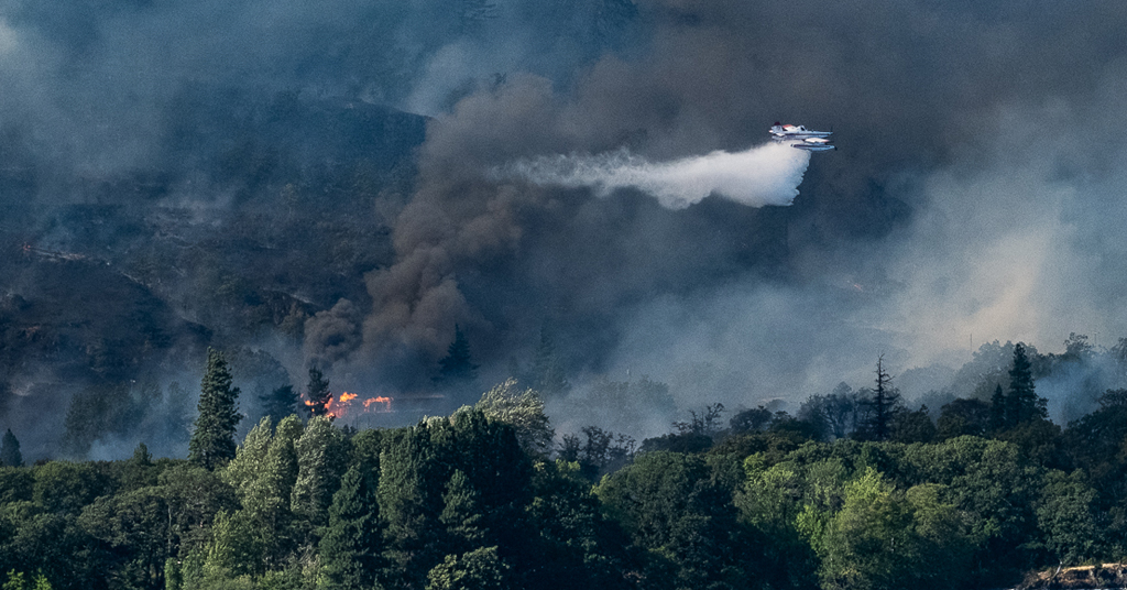
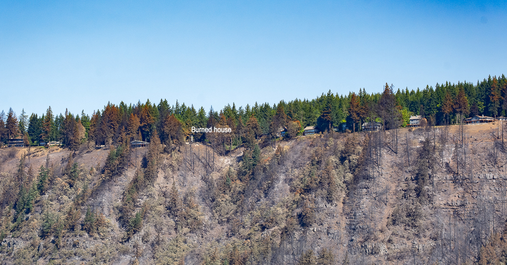
Not all can be saved: A Fire Boss amphibious air tanker dumps 200 gallons of water over the Tunnel 5 Fire. The house in flames (left) and directly beneath the water drop were completely destroyed. Photo: Jurgen Hess

By Jurgen Hess. August 3, 2023. On July 2, the Tunnel 5 Fire began in Underwood, Washington, about two miles west of the town of White Salmon in the Columbia River Gorge National Scenic Area.

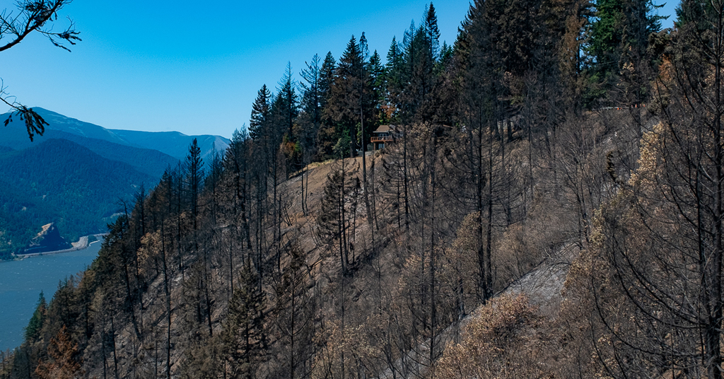
Before being 80% contained by mid-July, the fire scorched 529 acres and destroyed 10 structures, mostly homes. At least 40 fire engines, 256 firefighters and other personnel, five helicopters, six dozers and 16 water tenders were employed to fight the blaze.

The cost is still being calculated, but a single retardant drop by jet airplane on the Tunnel 5 Fire cost as much as $12,400.

The expense for fighting the 2017 Eagle Creek Fire on the Oregon side of the Columbia River Gorge eventually reached $40 million.

For two weeks, the Tunnel 5 Fire provided a shocking and unsettling sight as flames and smoke billowed above a stretch of the Columbia River dotted with large, cliff-top homes.

But it was hardly unprecedented.

In 2007, the Broughton Fire burned 200 acres and seven structures (including five houses) in the precise location.

That fire was caused by the BNSF Railway Company’s grinding of nearby railroad tracks. “Track grinding” or “rail grinding” repairs deformities and corrosion of rail tracks due to heavy use. The process creates sparks.

The cause of the Tunnel 5 Fire remains under investigation.

Close call: The Tunnel 5 Fire blew up steep slopes carried by fuels of trees, shrubs and grass. This house was fortunate to be spared from the fire. Photo: Jurgen Hess

Two wildfires in the exact location in just 16 years—is this simply a coincidence, a supreme stroke of bad luck?

Unfortunately no.

The Broughton and Tunnel 5 Fires burned, proved so difficult to fight and were wildly expensive to contain for similar reasons.

Might another catastrophic blaze burn in the same area in the near future?

Unfortunately it’s likely.

The reasons have to do with the geography of the area around Underwood and particular regulations that govern private property in the National Scenic Area.

But they also point to broader issues involving the encroachment of residential homes in heavily forested areas, and the way the U.S. Forest Service currently prioritizes private real estate (i.e., houses) over public resources (i.e., trees and surrounding habitat) when fighting fires.

Is such a policy wise? Is it in the public’s interest?

With national insurance companies beginning to refuse to issue policies for homes in some parts of the country due to “growing catastrophic exposure,” is it time to reconsider the construction of houses in fire-prone areas and the way we fight nearby fires when they inevitably come?

Recipe for disaster

Located along Washington State Route 14 at the confluence of the White Salmon and Columbia Rivers, Underwood is an unincorporated community within the Columbia River Gorge National Scenic Area. Its position atop a set of bluffs commands fantastic views of the Columbia River Gorge and, across the river into Oregon, Mount Hood.

But the bluffs atop which the community sits are so steep they form a nearly vertical wall.

In summer, these slopes are covered with highly flammable dry grass, brush and trees. One source of ignition and a decent wind are all that’s needed to send fires roaring up the hillside. (In the first days of the Tunnel 5 Fire, winds gusted between 35 and 40 mph.)

Heaven meet Hell: Slopes below Cook Underwood Road burned right up to the hilltop houses. Photo: Jurgen Hess

At the bottom of the bluffs, SR-14 and adjacent railroad tracks—both proven and potent sources of ignition—parallel the river.

At the top of the bluffs, Cook Underwood Road is lined with over 50 houses, each surrounded by forest, trees and brush.

The recipe for disaster is obvious.

“We can’t stop the fires, [we] shouldn’t build there,” Robin Dobson, a retired U.S. Forest Service ecologist who worked in the Columbia River Gorge National Scenic Area for 24 years, told Columbia Insight after the Tunnel 5 Fire. “We need to use our common sense.”

“Nobody thinks [fire] can happen to them, but the reality is that it does,” said Dan Harkenrider, USFS National Scenic Area manager from 2001 to 2011.

How Firewise are we?

In 2002, recognizing the growing problem of wildfires in rural residential areas (especially California), the National Fire Protection Agency created an educational program called Firewise Communities USA. The idea was to teach homeowners best practices for how to live “fire wise” in Wildland Urban Interface (WUI) areas as a way to mitigate potential wildfire losses.

Firewise measures include removing shrubbery and trees close to home ignition points by creating a “lean, clean and green landscape” zone; using fire-resistant building materials; screening house vents; and keeping gutters free of burnable material.

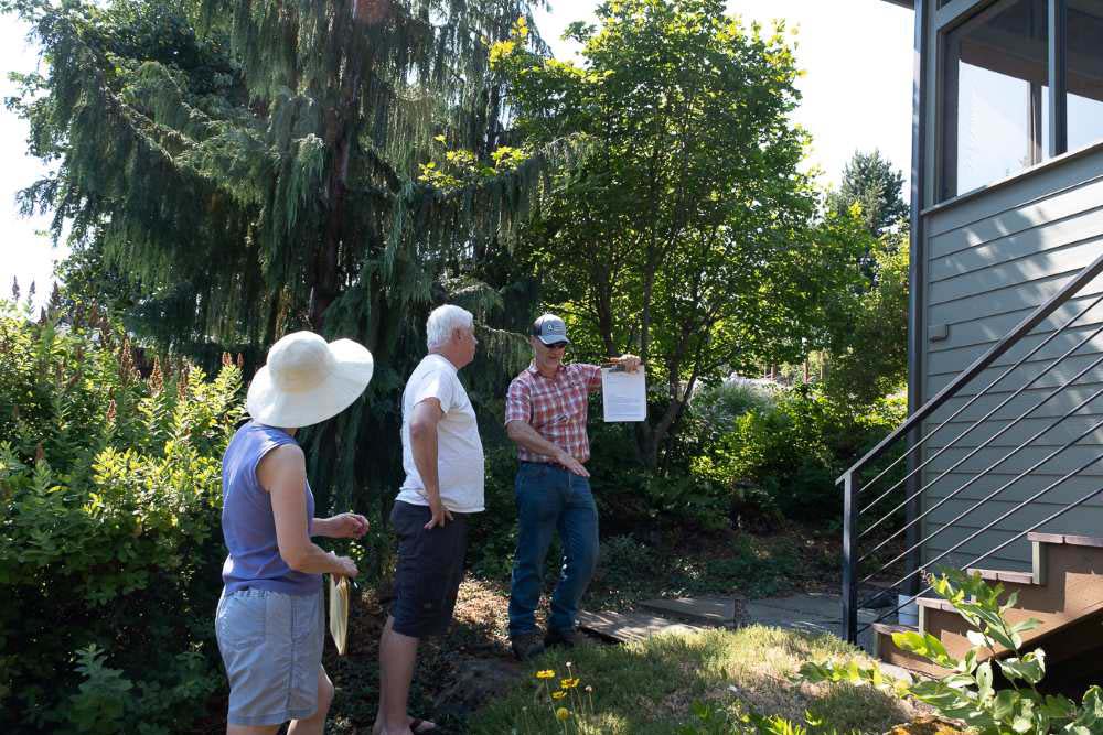
Dan Richardson, Underwood Conservation District, Climate and Community Resilience lead, administers the Firewise program in Underwood by doing a wildfire home hazard assessment.

Firewise home review in Columbia River Gorge

Passing grade: Dan Richardson (right) conducts a Firewise review at the Columbia River Gorge home of Luci Walker and Kevin Widener. Photo: Jurgen Hess

On a recent visit to the home of Luci Walker and Kevin Widener (north of Cook Underwood Road, not in the immediate area of burned houses), Richardson walked around the perimeter of the home looking for vegetation too close the house.

After explaining that most house fires are started by glowing embers, he noted that all vents in the house were well screened and that the house siding was made of unburnable cement board. The gutters were largely empty of burnable debris. There was no bark dust, which is very flammable.

A small juniper plant was recommended for removal.

A question arose of what to do about a long line of large Douglas fir trees on the east property line. Those trees could carry a crown fire.

Richardson concluded that picking up limbs and debris, cutting branches to a height of 10 feet and thinning out smaller trees would help reduce fire risk.

Overall, the homeowners got a report that the house met Firewise standards, with a few recommendations for improvement.

Conflicting guidelines

The Columbia River Gorge National Scenic Area Management Plan includes provisions for implementing Firewise practices.

“The reviewing agency shall provide information on Firewise standards to landowners at the time of application (for a building permit),” states the plan. “Landowners shall be encouraged to incorporate Firewise standards in their proposal.”

Fire-risk directions are also included in the Gorge Commission’s recently adopted Climate Change Action Plan.

But Lisa Naas Cook, a planner with the Gorge Commission, says meeting National Scenic Area standards of scenic preservation and reducing fire risk is a tricky dance.

That’s because homeowners in the Gorge are bound by National Scenic Area Management Plan regulations that require houses be screened with trees or other vegetation to meet scenic-protection measures.

Air war: Black spots in the sky during the Tunnel 5 Fire are hot embers driven by upslope winds. During wildland fires, embers are the primary ignition source for house fires. Photo: Jurgen Hess

In a way it feels like a trap, with Firewise and National Scenic Area guidelines appearing to be at odds.

“Absolutely there is a conflict between fire safety (and scenic standards),” said ecologist Dobson.

Cook said the Commission plans to take a closer look at the issue during its next Management Plan review.

According to the Gorge Commission’s website, the Commission can amend its plan “if it finds that conditions in the National Scenic Area have significantly changed.”

At this time, however, there is no proposal on record to amend the plan.

During the public input phase of the Climate Change Action Plan development, several members of the public argued for more stringent standards to reduce fire risk.

Janet Wainwright, a former Gorge commissioner, wrote: “Mandate (not suggest) all new construction adhere to Firewise standards. Make this one of the requirements of application approval.”

But such measures can do only so much to prevent wildfires from burning homes built within forests and other wilderness areas.

“Homeowners who live in forested settings must take responsibility and prepare their property to survive wildfire rather than relying on firefighters to save their homes,” said Jack Cohen, a USFS research scientist. “Because during intense fire conditions firefighters will likely be overwhelmed.”

Private property vs. public treasure

When fighting fires, USFS policy dictates that saving human lives is the top priority, followed by saving property, such as houses and businesses.

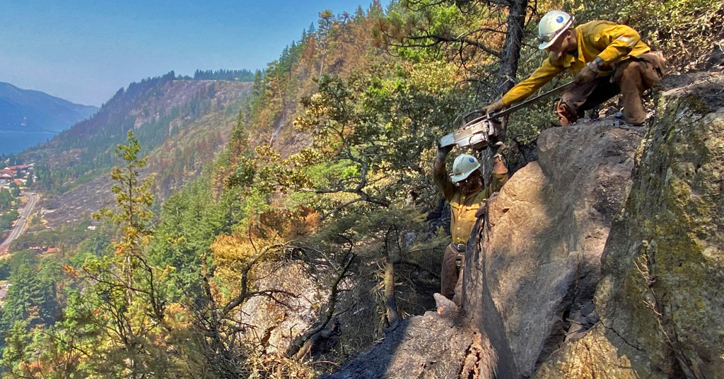
This became a problem when the Tunnel 5 Fire struck. Firefighters weren’t sent onto the steep slopes below the Underwood houses due to safety risks.

“It’s just too hazardous for firefighters to work on the steep ground,” Bobby Shindelar of Northwest Incident Management Team 12 told Columbia Gorge News.

Instead, at a great financial cost, aircraft dropped water and retardant on the steep slopes.

Extreme slopes: It’s not just flames and smoke that imperil firefighters. Treacherous inclines, like those faced by these Tunnel 5 firefighters, introduce another level of danger. Photo: Wash. DNR

Firewise is good practice, but after an event like the Tunnel 5 Fire it’s reasonable to wonder how much homeowners can realistically do to prevent the loss of property constructed in such an obviously precarious place.

Shifting attitudes of insurance companies may also become a factor in the way we view fighting fires.

On May 26, State Farm Insurance announced it would no longer accept applications for home and business insurance in California due to “historic increases in construction costs outpacing inflation, rapidly growing catastrophe exposure and a challenging reinsurance market.”

Some of those increased construction costs and catastrophic exposures are related to high fire risk and requirements to make new homes fire-safe.

In conversations with Columbia Insight, County Commissioner Lennon, Scenic Area Manager Harkenrider and several Tunnel 5 firefighters said they believed insurance policies would be a “check” and on future construction in fire-hazard zones.

But David Waymie, director of the Skamania County Public Works and Planning Department, which administers building permits in the area of the Tunnel 5 Fire, said his department is unlikely to require fire-protection measures for homes being rebuilt in the wake of the fire.

But, he said, “there is a risk in living in the forest. While the view is tremendous, there is a fire danger.”

Homeowners in Skamania County have two years to start the process of replacing a burned house.

Same old, same old?

Another fire in Underwood is likely because conditions that led to the previous two fires will remain stable.

SR-14 isn’t going anywhere. Neither are the railroad tracks nor the steep, vegetated cliffs directly below the community.

For maybe 10 years or so after a fire, fuels and risks are lower. But with hotter and dryer weather fire risk is increasing, especially on these slopes,” said Lorretta Duke, South Zone fire management officer of the Gifford Pinchot National Forest, a portion of which is located in Skamania County.

Duke also points to rail-grinding operations. “Consider timing of grinding to not do that during high fire danger times,” she said.

“There needs to be conversations with Burlington Northern as to their track-grinding procedures,” Skamania County Commissioner Tom Lennon told Columbia Insight when asked about preventing future fires in the area.

Others are more blunt in their assessment of construction and rebuilding of houses destroyed or damaged in areas of high fire risk.

“It seems crazy to build a new house in this fire-risk zone,” said Harkenrider. “Where is the line where people shouldn’t be allowed to build?”

The post Why Washington’s Tunnel 5 Fire is destined to be repeated first appeared on Columbia Insight.

The post Why Washington’s Tunnel 5 Fire is destined to be repeated appeared first on Columbia Insight.


Why Washington’s Tunnel 5 Fire is destined to be repeated was first posted on August 3, 2023 at 9:19 am.
©2022 Based in Hood River, Oregon, Columbia Insight’s mission is to publish original, balanced journalism about environmental issues affecting the Pacific Northwest. Columbia Insight is a fully independent, registered nonprofit organization. To support environmental journalism “donate here” to Columbia Insight.

A cold snap boosted state revenue by $175M

A cold snap boosted state revenue by 5M

Improved pricing for coal and oil, and a rollercoaster of highs and lows in the natural gas market, contributed to a stronger-than-expected revenue picture for the state budget, according to a July “pacing report” by the Consensus Revenue Estimating Group. 

As of April, revenue to the state’s primary budget accounts — the General Fund and the Budget Reserve Account — was on track to exceed a January forecast by $176.1 million, or 11%, according to the report

“It’s almost entirely due to the natural gas price environment” in December and January, CREG co-chair Don Richards said.

The CREG, made up of representatives from several state offices and the University of Wyoming “is responsible for formulating projections for the main sources of income to the major accounts in the State.”

Extremely frigid temperatures across the nation forced homes and businesses to crank the heat during those two months, which sent the price of natural gas soaring. The average spot price for natural gas at the Opal Hub in western Wyoming surpassed $26 per thousand cubic feet for more than a month, Richards said. Since, the average spot price at Opal has settled to more normal levels — $3.98 per thousand cubic feet this week.

While coal and oil held steady, a spike in natural gas prices fueled a better-than-anticipated revenue picture for the state. (Consensus Estimating Revenue Group)

“Natural gas isn’t just a story,” Richards said. “It’s the whole story, at least when it comes to the actual revenue in excess of CREG’s forecast. 

“To put an even finer point on that,” Richards continued, “the excess revenue [$176.1 million] was generated in December 2022 and January 2023 from higher-than-anticipated prices, primarily on natural gas production on the western side of the state.”

However, pricing for natural gas, oil and coal is expected to soften, resulting in calls for a cautious approach to spending in the upcoming legislative budget session. 

While the report “may appear favorable on the surface,” Gov. Mark Gordon said in a prepared statement, “this examination of recent revenues also shows gathering storm clouds on the horizon that could signal a change in Wyoming’s future revenues.”

In addition to softening fossil fuel markets, Wyoming’s mineral extraction industries face an onslaught of “anti-fossil fuel policies” from the Biden administration, Gordon said. Plus, he added, the state must come up with $330 million to maintain existing government services initiated under the American Rescue Plan Act, a stimulus package passed by Congress during the pandemic.

“We should appreciate that Wyoming has been conservative with the windfalls that have come our way in recent years,” Gordon said. “We must continue to be vigilant in our ongoing spending.”

Gordon will present his proposed budget to the Wyoming Legislature in November.

Energy industry performance

Although the volume of coal extraction is in line with last year, a 4.3% bump in pricing so far this year has helped contribute to an overall rosier revenue picture, according to the CREG report. 

A rig drills on a ranch in the southern Powder River Basin in December 2019. (Dustin Bleizeffer/ WyoFile)

The same was true for oil. Production increased 6.5% over fiscal year 2022 and averaged $80.79 per barrel — a 1.4% year-over-year average price increase. However, forecasters expect oil prices to weaken in coming months due to larger-than-average stockpiles and uncertainties in the global market.

While cold weather and extremely volatile natural gas prices inflated monthly utility bills for ratepayers, they were lucrative for producers and for state revenue, which funds a variety of public services, including K-12 education. 

Overall natural gas volumes fell slightly compared to last year. However, the market-disrupting cold spells last winter resulted in temporary price spikes that ultimately boosted the average natural gas price by 58.1%.

“The actual revenue in excess of our [January] forecast is due to something that occurred seven months ago,” Richards said. “We’re no longer in that environment. We might be [this winter]. Who knows?”

Higher than average utility prices — for natural gas and electrical generation — also bumped sales and use taxes from the utility sector by 32.7%. Wind power construction and upgrade projects also boosted sales and use taxes, according to the report.

The post A cold snap boosted state revenue by $175M appeared first on WyoFile.

Increasing fire weather places emphasis on defensible space

Increasing fire weather places emphasis on defensible spaceFire requires three things to thrive: fuel, oxygen, and a spark. And right now, there is plenty of fuel drying out across the region.

How will the ‘Flood of 2023’ rank in history — and does it foretell the future?

Image from the Leslie Jones Collection, Boston Public Library
The late photographer Leslie Jones captured this glass negative of flooding in Bellows Falls in November 1927. Image from the Leslie Jones Collection, Boston Public Library.

The good news: Last week’s statewide storm was no match for Vermont’s “Great Flood of 1927,” a 36-hour downpour that economists estimate would have damaged up to $4 billion in property today.

And the bad: Although officials are still tallying the impact of the most recent deluge, the collective cost could rival 2011’s Tropical Storm Irene — and be a sign of things to come, according to a just-released national study.

“Make no mistake, the devastation and flooding we’re experiencing across Vermont is historic and catastrophic,” Gov. Phil Scott said last week of water that resulted in one confirmed fatality as well as road and business closures from Albany, Barton and Craftsbury in the Northeast Kingdom to Wardsboro, Weathersfield and Weston in southern Vermont.

Many Vermonters may judge the present destruction against that of past natural disasters. The Flood of 1927 remains the worst, having killed 84 people, while Irene claimed seven lives, state records show. But experts fear the toll of future storms could be worse.

A newly published study by national researchers at the nonpartisan, nonprofit First Street Foundation has found the number of Vermont properties at flood risk is three times as many as what the Federal Emergency Management Agency considers the figure to be for 1-in-100-year events.

In the state capital of Montpelier and surrounding Washington County, for example, formerly once-a-century floods are now considered to be 1-in-62-year events, the foundation is set to report on its website Risk Factor. The study also raises the region’s total of high-risk properties from 1,400 as categorized federally to more than 4,700.

“In environmental engineering, there is a concept called stationarity, which assumes that today is going to be like yesterday, and tomorrow is going to be like yesterday,” Dr. Ed Kearns, the foundation’s chief data officer, said in a statement. “This concept used to work, but with a changing environment it’s a poor assumption and no longer does.”

E. T. Houston Studio produced this postcard of Montpelier flooding at the corner of State and Main streets on Nov. 4, 1927. Image from the Norwich University Archives

1927: ‘The greatest catastrophe’

Then again, yesterday shattered precedent, too. The year 1927 is remembered for such advances as the first talking motion picture, first Model A automobile and first solo nonstop flight across the Atlantic — all while Vermont maintained fewer than 100 miles of asphalt roads, with the rest being dirt or gravel under local control.

“The rational Vermonter has been of the opinion that hard roads would ruin the state,” a Chicago Tribune reporter wrote in 1928 of the reluctance to pave the way for outsiders to roll in.

That spelled mud when up to 15 inches of rain fell for 36 hours Nov. 2-4, 1927, the late historians Deborah Pickman Clifford and Nicholas Clifford detail in their 2007 book “The Troubled Roar of the Waters’: Vermont in Flood and Recovery, 1927-1931.”

The storm, deemed “the greatest catastrophe in Vermont’s history” by then-Gov. John Weeks, destroyed 1,258 bridges and countless more miles of road and rails, state records show. That slowed or stopped delivery of food and other household essentials and forced farmers to churn whatever milk they couldn’t ship or store into butter, as only 30 percent had electricity before the storm, let alone refrigeration.

Three Massachusetts travelers, trying to drive to Burlington, stopped in Montpelier to ask directions, period newspapers recounted. The man they met told them it would take two weeks.

“Do you live here?” one of the tourists was quoted in the press.

“I guess I do — I am the governor,” Weeks reportedly replied, spurring the travelers to abandon their car and walk 40 miles from the capital to the state’s largest city. 

They weren’t alone. Historians recall how an Army captain had to ride a horse from Colchester’s Fort Ethan Allen over Smugglers Notch to offer the military’s help to Montpelier, while a Central Vermont Railway brakeman walked, waded and swam 50 miles to Essex Junction to report train troubles in Bethel.

Few complained. When then-U.S. Commerce Secretary Herbert Hoover surveyed Vermont on behalf of then-President Calvin Coolidge, Hoover’s car had to stop in Waterbury because of muddy roads.

“We have nothing left,” one local was said to have told Hoover, “but plenty of courage.”

Long before the creation of the Federal Emergency Management Agency, a special session of the 1927 Legislature approved what was then an $8.5 million bond issue to not only repair but also improve roads.

“There was no point in simply restoring roads that would once again be vulnerable to catastrophe, that even before the flood had already been inadequate, and whose maintenance costs would be greater than if they were rebuilt in a more durable form,” the Cliffords wrote in their book.

Vermont would spend what was then $12 million on highways (including a then-unprecedented $2.6 million federal grant) the first two of four years of rebuilding, state records show. The governor, using the disaster to overturn a tradition of one-term officeholders, ran for reelection in 1928 and persuaded the Legislature to approve another 125 miles of “hard road.” 

The state’s current highway system was born.

The Weather Channel’s Jim Cantore, a Vermont native, broadcasts live from Brattleboro on Aug. 30, 2011, after Tropical Storm Irene ravaged the Whetstone Studio for the Arts. File photo by Kevin O’Connor/VTDigger

2011: ‘Irene was just the appetizer …’

Vermont faced its second biggest test on Aug. 28, 2011, when Tropical Storm Irene crumbled more than 500 miles of highway, closing such north-south arteries as Route 100 — the state’s longest — and east-west corridors including Route 9 linking Bennington and Brattleboro, and Route 4 connecting Rutland and White River Junction.

Irene’s statistics, though not as steep as those in 1927, nonetheless were staggering. The 2011 storm dumped up to 11 inches of rain, destroyed nearly $750 million in property (a figure equal to almost two-thirds of that year’s state general fund budget) and damaged 200 bridges, 450 utility poles, 600 historic buildings, 1,000 culverts, 2,400 road segments, 3,500 homes and 20,000 acres of farmland.

In Danby, Irene washed away the old home of the late Nobel Prize-winning writer Pearl Buck just hours after the town christened its new artifact-filled historical society. Rockingham watched the water carry off its nearly 150-year-old Bartonsville Covered Bridge — an act captured and replayed on YouTube a half-million times.

Most expensively, Irene gutted the 1,500-employee Waterbury State Office Complex — ironically, the home of Vermont Emergency Management. Crews spent $130 million to restore the campus (with all occupied space now a half-foot above the 500-year flood mark) in the state government’s biggest-ever construction project.

Just as the 1927 flood spurred the state to modernize its infrastructure, Irene sparked more government changes. Many cities and towns bought out property owners in flood zones to avert future problems, while the state built stronger roads and bridges, updated its laws so planning addresses resilience and river corridor protection, and launched a Flood Ready Vermont website to educate the public about its programs. 

“When the flooding comes, no one can stop that, but there’s work we can do to be ready for the next thing,” Neale Lunderville, the state’s former Irene recovery officer who’s now head of Vermont Gas Systems, said on the storm’s 10th anniversary in 2021. “Irene was just the appetizer for the main course that’s yet to come if we don’t buckle down and start making changes.”

a goose swims in a flooded street.
A goose swims along a flooded Main Street in Montpelier on Tuesday, July 11, 2023. Photo by Glenn Russell/VTDigger

2023: ‘Historical data no longer capture the threats’

The most recent storm dropped as much as an average two months of rain, with a state high of 9.2 inches in Calais, according to the National Weather Service. But infrastructure improvements after Irene lessened damage to transportation and utility lines.

The Vermont Agency of Transportation, which required four months to repair more than 500 miles of highway ravaged in 2011, already has reopened 90% of the 100 state roads closed by last week’s storm, the agency has reported.

Green Mountain Power, which provides electricity to three-quarters of the state, reported 140,650 total outages during Irene, compared to 52,500 during this month’s storm.

Even so, the most recent flooding has sparked coast-to-coast headlines. Reporters have quoted scientists who blame saturated ground, mountains that channel water into river valleys — and climate change.

“As temperatures rise, the air can hold more moisture, which can mean more severe rainfall, bringing worse flooding,” The New York Times summed up the situation.

But many current models don’t account for such shifts. The National Weather Service bases its predictions for extreme rainfall more on past observations. Likewise, the new research from the First Street Foundation estimates the number of properties at flood risk is significantly larger than what FEMA says.

This month’s Vermont storm has turned the latter study’s release into national news.

“Historic flooding,” The Washington Post wrote in connecting the research to current events, “was not a product of any tropical system — laying bare how flooding predictions based on historical data no longer capture the threats posed by extreme rainfall as the planet warms and the air carries more moisture.”

The latest storm also has highlighted the need for continued investment in long-term planning.

“I have seen an increase in records being broken, records that have stood for decades or even a century,” U.S. Rep. Becca Balint, D-Vt., told reporters last week. “We really need to start to better understand what it’s going to look like 10 or 20 years from now, so we can use our mitigation dollars to help reduce those impacts and help these systems be more resilient.”

Disclosure: Neale Lunderville is a board member of the Vermont Journalism Trust, the parent organization of VTDigger.

Read the story on VTDigger here: How will the ‘Flood of 2023’ rank in history — and does it foretell the future?.

Can Biden’s climate-smart agriculture program live up to the hype?

A new kind of food may soon be arriving on grocery store shelves: climate smart. Under the Partnerships for Climate-Smart Commodities, a nascent U.S. Department of Agriculture (USDA) program, this amalgam of farming methods aims to keep the American agricultural juggernaut steaming ahead while slashing the sector’s immense greenhouse gas footprint.

This spring, the Biden administration began allocating $3.1 billion to hundreds of agriculture organizations, corporations, universities, and nonprofits for climate-smart projects. These entities will pass most of the money on to tens of thousands of farmers, ranchers, and forest owners, including growers who manage thousands of acres and underserved and disadvantaged farmers who often have much smaller operations. The first agreements have now been signed; the money is starting to flow.

The USDA estimates that the 141 funded projects will, collectively over the project’s five-year lifetime, eliminate or sequester the equivalent of 60 million metric tons of carbon dioxide emissions, on par with removing more than 2.4 million gas-powered cars from the road over the same period. They will achieve this by paying growers to adopt practices thought to either reduce greenhouse gas emissions or capture carbon dioxide from the air. These practices include reducing or eliminating tilling of soil, planting “cover crops” that grow during the off-season and are not harvested, improving how farmers use fertilizer and manure, and planting trees.

Drip irrigation, like the system seen here at a vineyard near Porterville California, is more efficient than sprinklers and flood irrigation. It also reduces runoff and evaporation. Photo by Robyn Beck/AFP via Getty Images.

More importantly, the agency aims to catalyze new, premium markets for products such as climate-smart corn, soybeans, and beef, which it hopes will spur farmers to continue these practices far into the future. “People want to know that when they’re spending their dollar at the grocery store that they’re not hurting the environment; they want to be helpful,” Agriculture Secretary Tom Vilsack said last December when announcing projects that received funding. The emerging market for climate-friendly products, he added, represents “a transformational opportunity for U.S. agriculture.”

The idea has enthusiastic supporters. The market that Vilsack envisions “is potentially massive — much bigger than any federal program could be,” says Ben Thomas, senior policy director for agriculture at the Environmental Defense Fund. “And it’ll last as long as the conditions that create the market still exist.”

But the high-profile effort has also come under fire. Some researchers fear that the agency lacks a workable plan for measuring and verifying the impacts of the practices federal dollars will be paying for. Others say science has yet to prove that climate-smart practices truly reduce greenhouse gas emissions. “We don’t have that understanding yet for most climate-smart management practices,” says Kim Novick, an environmental scientist at Indiana University.

“It’s a greenwashing scheme. It’s going to allow nothing to get done.”­

Sylvia Secchi, University of Iowa

The program’s harshest critics assail it as a giveaway to rich corporations that will do little to rein in climate change — and might even exacerbate it. “This program is just pork for big polluters,” says University of Iowa economist Sylvia Secchi. “It’s a greenwashing scheme. It’s going to allow nothing to get done.”­

For decades, efforts to cut fossil fuel emissions have focused on power plants, factories, and automobiles, not farmland. “Agriculture has just not been at the table in a meaningful way,” says Thomas.

But it should be. For all of industrial farming’s success at feeding people and livestock and producing biofuel, the sector is also a major polluter, accounting for roughly 10 percent of U.S. greenhouse gas emissions and roughly a quarter of emissions globally. The main greenhouse gases emitted by U.S. agriculture today are nitrous oxide, which comes mainly from soil microbes that digest nitrogen fertilizer, and methane, burped by the nation’s roughly 92 million cows. Both warm the atmosphere far more, per molecule, than carbon dioxide.

Farmland itself was also once a major source of atmospheric carbon dioxide as farmers cleared carbon-rich forests and plowed up prairie soils, releasing carbon from trees and the ground. Now, climate-smart agriculture aims to recapture some of that carbon.

“A voluntary, collaborative approach is the only approach that works here. Regulation isn’t very good at asking people to adopt new practices.”

Robert Bonnie, USDA

Unlike with organic farming, climate-smart farming has no list of allowed or prohibited practices. “There is no single definition of climate smart,” says Omanjana Goswami, an interdisciplinary scientist at the Union of Concerned Scientists. Instead, it comprises a mélange of practices that, studies show, can either reduce farms’ greenhouse gases emissions or increase the amount of carbon stored in their soils.

Funded projects are receiving up to $95 million over five years to help farmers take up these practices and to create monitoring and marketing programs that, it’s hoped, will keep farmers on the climate-smart track after the program ends. That all-carrot, no-stick strategy is intentional and necessary to reduce agriculture’s climate impact, says Robert Bonnie, under secretary for farm production and conservation at USDA and one of the program’s chief architects and champions.

“A voluntary, collaborative approach is the only approach that works here,” says Bonnie. “Regulation isn’t very good at asking people to adopt new practices.”

The department says the program will deliver benefits to underserved and disadvantaged farmers, a group that includes farmers of color, women, veterans, and small and beginning farmers who have, in the past, struggled to access USDA funding streams and have sometimes been intentionally excluded from them. Many of the projects whose signed agreements have been made public, for example, will direct at least 20 percent of funds to underserved farmers.

Champions of the program also note that expected benefits go beyond increasing carbon sequestration and reducing greenhouse gases from farm fields. By encouraging farmers to reduce tillage, plant cover crops, and take other measures, “we’re improving water quality; we’re reducing erosion,” says Adam Kiel, executive vice president of AgOutcomes, which is managing a $95 million climate-smart partnership led by the Iowa Soybean Association.

But as the climate-smart commodities program gets underway, many experts are warning that even its most-touted practices often fall far short. For example, some cover crop studies have found that the practice did not sequester significant amounts of carbon in soils, while other studies that did find gains also had gaps or methodological problems that diminished confidence in the results. And an analysis published in May in Nature Sustainability found that yield losses resulting from cover crops in the United States could erase as much as 70 percent of their climate benefits if farmers cut down trees elsewhere or plow up grasslands to compensate for those losses.

Better manure management is among the climate-smart practices the USDA is funding in the partnerships. Here, manure is put into a digester to be turned into biofuel at Vanguard Renewables in Haverhill, Massachusetts, on Jan. 28, 2019. Photo by Suzanne Kreiter/The Boston Globe via Getty Images.

“I wouldn’t say we should pause everything, because there are some real benefits to cover cropping,” says David Lobell, a food security researcher at Stanford University and a coauthor of the Nature paper. “But I think we should be much more vigilant about maintaining productivity” as more farmers start using cover crops.

Other projects aim to reduce the greenhouse gas footprint of beef and dairy herds by more carefully managing how these animals graze pastures, so their manure can feed perennial grasses and other plants whose roots pull carbon deep into the soil. But grass-fed cows can also emit significantly more methane over their lifetimes than those that spend more of their lives in feedlots. Some projects plan to feed cows experimental additives that could reduce those methane emissions.

Measuring and modeling nitrous oxide emissions accurately is also notoriously difficult. And practices thought to reduce such emissions — like applying some fertilizer in the spring, just before planting, rather than applying all fertilizer in the fall — sometimes backfire. In fact, few long-term assessments of any climate-smart practices have been conducted on working farms, says Novick, making it hard to tailor practices to particular soil types, climates, and situations.

“It doesn’t appear that funding decisions from this program were necessarily made in a way that maximizes climate mitigation,” says Novick, who led a team that last fall authored a report on how science can inform nature-based climate solutions. “Ideally we would have first invested in the data tools necessary to understand when and where a practice is likely to succeed as a climate solution.”

There’s also the question of how to measure the program’s benefits. Funded groups are required to take measurements that will allow the USDA to assess the impacts of the practices farmers are implementing. But the agency is also relying heavily on a computer model that was designed to estimate greenhouse gases for planning large-scale projects and that cannot accurately quantify emissions and carbon capture from individual farms, notes Jon Sanderman, a soil scientist at the Woodwell Climate Research Center.

Bill Hohenstein, director of the USDA’s Office of Energy and Environmental Policy, acknowledges that the science behind climate-smart agriculture remains a work in progress. But he says it’s mature enough to take action. “We could wait a decade and probably understand these benefits better,” Hohenstein says. “But our view is that we would end up with generally the same recommendations.”

In addition to the technical challenges of measuring carbon and greenhouse gas changes, the Climate-Smart program will have to get farmers to stick with new practices after payments have ended. Officials say that payments to cover the startup costs for enrolled farmers are essential. “If this stuff was free, folks would already be doing it,” Bonnie says. But once they’ve bought equipment like seed drills for no-till planting and climbed the learning curve, he and Hohenstein say, reduced input costs, yield increases resulting from healthier soils, and premiums for climate-smart products will start to pay for themselves.

Many experts view such projections as overly optimistic. Hanna Poffenbarger, a soil scientist at the University of Kentucky, says it may take a decade for cover crop benefits, such as reduced need for fertilizer and increased soil organic matter, to translate into profits. That aligns with the experience of early adopters like Trey Hill, a farmer in Maryland who says that even after planting cover crops for more than 20 years, he’s still seeing yield losses in some of his corn fields and an unclear impact on his bottom line. “When you talk about improving soils,” he says, “we’re talking about a 10-year commitment before you would really even see anything significant.”

Details on the projects themselves have been slow to emerge. Though the projects receiving the bulk of the funding were announced last September, the USDA has so far shared fewer than a quarter of the signed agreements on its website. For the remaining projects, the department has published scant information. For example, a $61-million project led by the agribusiness giant Tyson to create and market “climate-smart beef” comes with only a two-sentence description that does not explain what practices will make beef climate smart. In response to an interview request, a Tyson representative linked to a blog post lacking substantive information on how the company’s claims will be verified.

The vagueness troubles observers like Goswami, of the Union of Concerned Scientists, who says that without clear standards, companies will define “climate smart” in different ways, potentially confusing customers. “If Tyson comes in and says farms and ranches who we’re buying cows from have implemented X amount of cover cropping, does that make their beef climate smart?” she asks.

Even people who received funding fear that the program could overwhelm or confuse farmers who are suddenly inundated with competing climate-smart offers. “In Iowa alone, there are 17 different climate-smart projects” that will be recruiting farmers, Kiel notes. At the same time, another branch of the USDA, the Natural Resources Conservation Service, has been tasked with disbursing nearly $20 billion injected by the Inflation Reduction Act into farm programs, including ones that pay farmers to grow cover crops or set aside land for conservation. Private-sector carbon markets are also courting farmers. And many of these initiatives require that farmers not take money from competing programs, to avoid double counting of climate benefits. “There’s going to be farmer confusion,” Kiel says. “It’s unfortunate, but at least there’s going to be lots of choices.”

Secchi, meanwhile, questions why some of the wealthiest corporations and individuals in industrial agriculture are receiving additional federal money. She would have instead liked to see the government insist that growers already receiving government subsidies through other programs do more to reduce their climate impact. “Why can’t we ask farmers who are getting crop insurance subsidies to plant cover crops at zero extra cost for the taxpayer?” Secchi asks. She’d also like to see more of the funds directed toward minority, Indigenous, and other disadvantaged farmers.

Bonnie, the USDA undersecretary, responds that catalyzing large-scale change requires working with companies big enough to reach thousands of growers farming millions of acres. Building a program that will create new markets rather than new regulations and policies, he adds, insulates climate-smart agriculture from future Congresses and administrations that may be less climate friendly.

One thing is certain: As the government looks to steer the ocean liner that is American farming in a direction that’s climate friendlier yet still highly profitable, a lot of eyes — both hopeful and skeptical — will be watching closely.

This article was produced in collaboration with Yale Environment 360. It may not be reproduced without express permission from FERN. If you are interested in republishing or reposting this article, please contact info@thefern.org.
You made it this far so we know you appreciate our work. FERN is a nonprofit and relies on the generosity of our readers so that we can continue producing incisive reporting like this story. Please consider making a donation to support our work. Thank you.

Oak trees at risk in Columbia Gorge

How the Inflation Reduction Act is helping to jumpstart New Hampshire’s long-stalled climate plan

Who is ‘Held’ of Held v. State of Montana?

This article is part of a series on the youth-led constitutional climate change lawsuit Held v. Montana, which goes to trial in Helena on June 12. The rest of the series can be read at mtclimatecase.flatheadbeacon.com. This project is produced by the Flathead Beacon newsroom, in collaboration with Montana Free Press, and is supported by the MIT Environmental Solutions Journalism Fellowship.


Rikki Held’s last name has been referenced in legal briefs, news articles and water cooler conversations for two years now, since the court case Held v. State of Montana was filed in Montana’s First Judicial District Court. Held was one of 16 youth plaintiffs who filed the 2020 lawsuit against several Montana government agencies, and its governor, alleging that the implementation of two energy-related policies is an infringement of the youths’ constitutional right to a clean and healthful environment. Since she was the only plaintiff of age when it was filed, it’s her name that will be forever attached to the decision made in the landmark case.

This story also appeared in Flathead Beacon

Held was brought to the legal table by a meandering path that runs through the heart of her family’s ranch. Held grew up on a 7,000-acre cattle ranch and saw the destruction of the land and her family’s livelihood caused by the changing climate — an experience she feels can be understood by the rural state’s ranching and farming communities.

“I think that ranchers see it in a different way, ranchers are on the ground every day,” Held said. “Maybe they aren’t having as many conversations about climate change necessarily, but they are seeing these changes with wildfires and are worried about the daily impacts of hay prices going up because of drought and losing cattle from water variability or fires.”

Between growing up on a ranch and a chance encounter with the world of scientific inquiry at a young age, Held charted a unique path to the courtroom. And while Held didn’t set out to become a climate activist, she felt compelled to act on behalf of her younger peers. Those who are too young to vote on the actions of the government look at the world through a different lens than their older counterparts, she says.

“As youth, we are exposed to a lot of knowledge about climate change. We can’t keep passing it on to the next generation when we’re being told about all the impacts that are already happening,” Held said. “In some ways, our generation feels a lot of pressure, kind of a burden, to make something happen because it’s our lives that are at risk.”

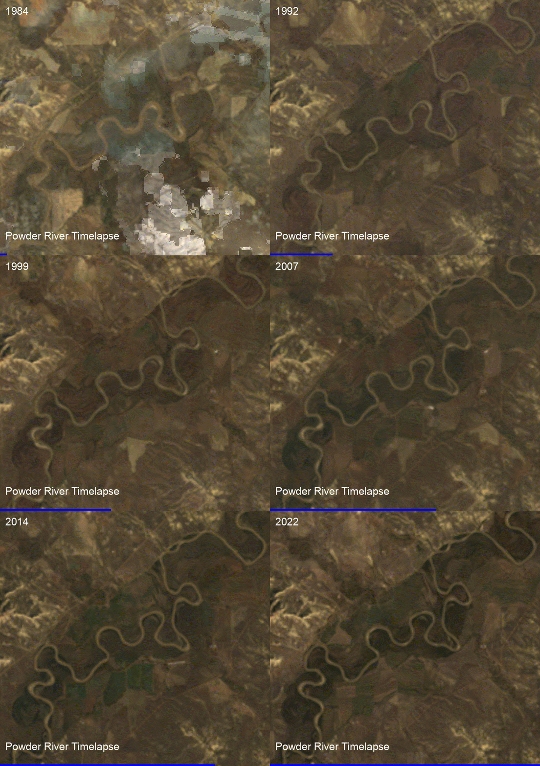
Before it was a legal reference, Rikki Held’s name was first published in the acknowledgments of a 2015 peer-reviewed paper in the scientific journal GeoResJ titled “Preserving geomorphic data records of flood disturbances.” Though Held was in middle school at the time, she is credited with helping U.S. Geological Survey (USGS) researchers survey cross sections of Montana’s Powder River, one of the longest undammed waterways in the West, which happens to pass through her family’s 7,000-acre ranch.

The Powder River begins in the Bighorn Mountains of Wyoming and flows north through Montana before joining the Yellowstone River between Miles City and Glendive. With no man-made modifications along the route other than some diversions to irrigate farmlands, Powder River provides a lengthy, natural, outdoor laboratory — a scientist’s dream. A study on the river that began in the 1970s has quantified the natural erosion, transport and deposition of sediments throughout the riverbed, and mapped changes to the river’s channel with specific focus on years of high flood or periods following nearby wildfires. Researchers have established 24 survey sites along a 57-mile stretch of the Powder River, several of which are accessed through the Held family ranch.

A satellite timelapse of the meandering Powder River near Held’s family ranch. Credit: Flathead Beacon

Several scientific papers have come out of the study over the years. One documented the aftereffects of a major flood event in 1978 where as much as 65 feet eroded from sections of the river bank. Regular follow-up studies characterized sediment composition, erosion patterns and plant distribution along the river.

“Even when I was little I would go out with [the researchers] during surveys, just following them around and learning from them,” Held said, adding that she “got kind of caught up” in the science, which later led to internships and ultimately the mention in the 2015 paper. “I think that really got me interested in science, I was able to connect it back to my ranch, my home.”

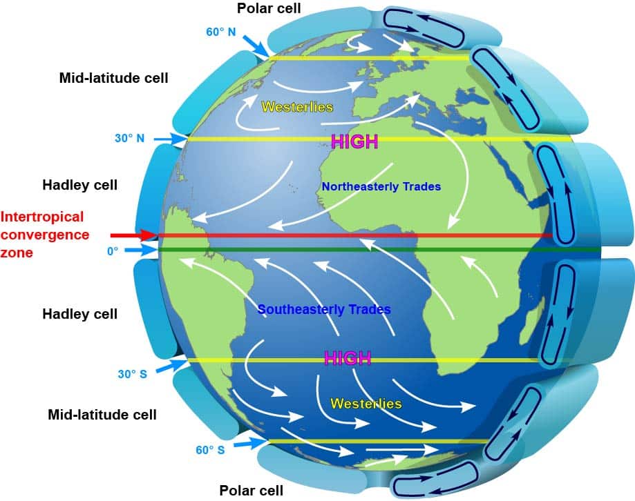
Throughout high school, Held gravitated toward the hard sciences. “I remember a wind pattern diagram with Hadley cells, and I just thought that was fascinating how things could be explained,” she said. “I got really interested in environmental science that way and learned about climate change in high school. I just knew that this is a really serious issue that we need to focus on.”

A diagram showing global air circulation, including Hadley cells near the equator. Kaidor, licensed under CC BY-SA 3.0.

Held, now 22, graduated this spring from Colorado College with a degree in environmental science and is figuring out how to use her aptitude for environmental research to carve out a career path. Speaking about a recent NASA-funded study she contributed to, Held grew visibly excited as she described her work on “combining ecology and geomorphology to map out invasive Russian olive species.” She said she’s considering future studies in climatology or hydrology, something “about Earth processes where I can bring it back to the people and use science to help them.”

While Held was learning to survey stream widths and how Hadley cells circulate tropical air around the globe, she was also witnessing the effects of extreme weather events on her family’s livelihood. The complaint states that in 2007, following several years of drought in southeastern Montana, the Powder River dried up, eliminating the water source for the ranch’s crops and livestock. A decade later, an early spring thaw flooded the river basin, nearly reaching Held’s house and eroding several feet of riverbank. Increased risks of major flooding events, such as the 2022 floods that damaged an entrance road to Yellowstone National Park, have been linked to global warming. One study published using the Powder River data also cites climate change as a contributing cause for the river’s changing migration rate over time.

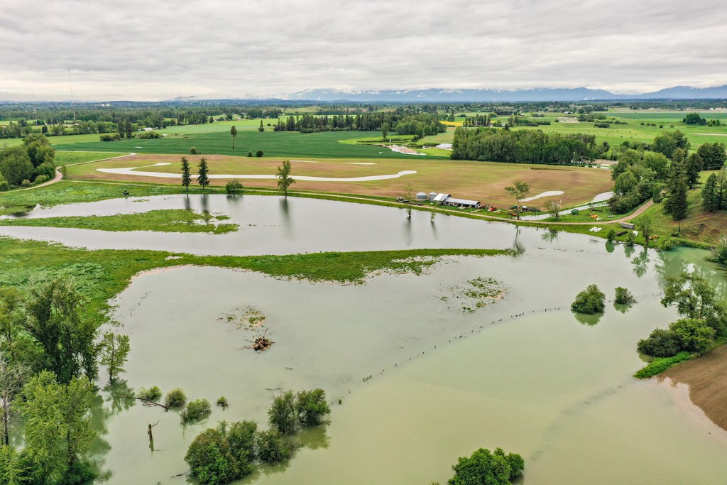
Saturated farmland off of Steel Bridge Road in Kalispell after flooding along the Flathead River on June 15, 2022. Credit: Hunter D’Antuono | Flathead Beacon

The Held family has lost cattle to flooding events, an economic hardship for any ranch. On the elementally opposite side of the extreme weather spectrum, the Helds also lost a great number of animals in 2012 to starvation following a wildfire that burned through acres of grazing land. The fire took out miles of powerlines in the area, leaving the ranch without electricity for weeks. During another spate of nearby fires in 2021, Held recalls ash falling from the sky, dusting the ground for days, and local schools being set up as shelters for families that had to evacuate their homes. The wildfire smoke, along with a record-breaking string of triple-digit days that summer, didn’t keep Held inside — there was ranch work that couldn’t wait.

“When you’re in the moment, you have to just keep going with daily life, you have to do everything you can to keep up with the business or keep your livestock as safe as you can and figure out issues like how to get them water,” Held said. “It’s hard to think about it more broadly in terms of climate change … but from studying this, I know that we need to make some big systematic changes in what we’re doing to not continue down the route we’re taking.”

The increased effects on her family’s ranching lifestyle, along with her growing interest in studying environmental science in college, led Held to reach out to Our Children’s Trust when she heard about the potential lawsuit.

“When I was first learning about climate change in high school, I saw it as something on the other side of the world, like polar bears and ice melting or the coastlines with sea level rise,” Held said. “Living in the U.S., in a landlocked place, I didn’t really think about how it affected me, even though I’d seen these changes while I was growing up.”

“Being part of this case, it’s been nice to put my own story into the broader climate change narrative and make the connections through science and observation of how my home plays into it,” she said. “Montana is a big emitter of fossil fuels and is contributing to climate change. I know it’s a broader global issue, but you can’t not take responsibility.”

Held doesn’t know whether she’d consider taking over the family ranch, saying she’s “unsure what the future will be there.” It’s a sentiment about the viability of the industry she thinks is shared by many farmers and ranchers in the state — indeed it’s her lived experience on the family ranch that she thinks will allow the lawsuit to resonate with a greater portion of Montanans who may not as readily engage in discussions of climate change

Across the state, though, Held believes that Montana is still a place where residents value their neighbors and the land and resources they’re entrusted, making it a unique place for this lawsuit to play out.

“Those values could play into this conversation and make a change,” she said. “It’s important that this case is happening here.”

The post Who is ‘Held’ of Held v. State of Montana? appeared first on Montana Free Press.