Last year, Brandi Jo Desautel installed a SpaceX-powered Starlink dish in front of her trailer outside Inchelium, Washington, on the Colville Reservation. At $700 for the equipment and $120 a month for service, it wasn’t cheap. But for her, it was the only option.
Some folks in town have basic internet through their cable provider, but the network doesn’t reach the 32-year-old’s address. A paraprofessional for Inchelium High School, Desautel is out of range of wireless towers, and cellphone coverage is spotty.
Satellite internet allows her to take online classes at night from Spokane Community College, where she is working on a special education degree. It also helps her twin daughters, grade six, do their schoolwork from home.
“Between my school and theirs, we don’t have a choice,” Desautel said.
Even though classes are back in person after the Covid-19 pandemic, access to reliable home internet remains critical both for a well-rounded education and for participation in modern life. Yet some 236,000 Washington households still don’t have broadband-level speeds or internet access at all – many of them in rural areas like where the Desautels live where it is not as profitable for internet providers, according to Federal Communications Commission data.
Over the past few years, Congress has invested hundreds of millions of dollars to expand broadband infrastructure in Washington. Another $1.2 billion will begin rolling out as soon as next year. All of this federal funding will do a lot to bridge the digital divide, but it probably won’t be enough to meet the state’s ambitious goal of universal high-speed internet for every address by 2028.
Accessible by ferry across the Columbia River on the east side of the Colville Reservation, Desautel’s hometown of Inchelium has some of the worst internet coverage in Eastern Washington.
The Starlink Satellite dish at Brandi Jo Desautel’s home is in the front yard as her dog, Rocky, barks at visitors in Inchelium, Washington. (Photo by Kathy Plonka / The Spokesman-Review)
That should change soon, as the Confederated Tribes of the Colville Reservation are expanding their network with the help of a $48.4 million federal grant to bring fiber and wireless internet to 2,867 unserved Native American households and several hundred businesses and institutions in Inchelium and nearby Keller. The grant is part of the Tribal Broadband Connectivity Program, a $3 billion fund from the 2021 Bipartisan Infrastructure Law.
The Spokane Tribe was awarded $16 million for a similar project.
“In the modern world, internet access is critical,” Colville Business Council Chairman Jarred-Michael Erickson said. “It is especially vital for our youth and their education.”
Although she is not an enrolled member, Desautel is a direct descendant of the Colville Tribes. She lives near extended family several miles down a dirt road in an area northwest of town called Seylor Valley, or simply “The Valley” to locals.
Her satellite service cuts out sometimes. Other times, she loses internet because of power outages.
“The hardest part is convincing teachers to let me turn in late work,” Desautel said.
Starlink is becoming more popular among Desautel’s neighbors, but many cannot afford it. It could be a few more years before residents like Desautel get connected.
Growing Up in a Digital ‘Desert’
Nearly every public school building in Washington has broadband ethernet through the state’s K20 Education Network overseen by the Office of Financial Management. The network includes K-12 school districts, public libraries and colleges.
The challenge is to bring that same level of access to students’ homes.
During the pandemic, many school districts used Covid-19 relief money to provide hotspots for students, but much of that funding has run out.
School districts with less internet access tend to adjust homework requirements accordingly.
John Farley, superintendent of Republic School District in Ferry County, said his district accommodates students by not demanding work that would require internet at home.
“We want to make sure they are getting everything they need at school,” he said.
Farley noted the growing importance of technology in education and teaching online literacy and safety. The internet becomes more important as students apply for college or jobs, he said.
Rob Clark, superintendent of Washtucna School District in Adams County, said most of his students live in town, where they have internet access. Washtucna was awarded a Washington state Public Works Board grant in 2021 to build fiber to the homes in town.
“I can’t say it is a real big issue here,” Clark said. “It is a problem, but it is a minor problem.”
Washtucna is a tiny district with about 70 students where everyone can take home a Chromebook. The district is capable of going fully remote again in case of bad weather or another outbreak, Clark said.
Internet levels vary from district to district. Most incorporated towns in Eastern Washington have basic broadband options, and ongoing grant projects will make those options better. The larger challenge will be to reach those in unincorporated areas, especially those who don’t live near major highways.
Margaret Kidwell, supervisor of Spokane Community College’s center in Republic, said some students don’t have internet at all, and a few don’t even have electricity.
With mountainous terrain, many places in Ferry County don’t have cell service, so hotspots don’t work. Kidwell said she knows one person who uses a solar panel just to power their hotspot.
“We live a lot differently up here,” Kidwell said.
Students without internet will do their homework at the college office or the local library. Running start students – high schoolers who take classes for both high school and college credit – do their homework at the high school.
Teri Ford-Dwyer, a business instructor at Spokane Community College in Newport, Washington, teaches students across the state’s three northeastern counties.
She teaches “flex” classes, which are more flexible than hybrid classes by giving students a choice to attend each class in person, live on Zoom or to watch the recorded lectures later. This option is helpful for working parents, like Desautel, and those who live far away with spotty internet.
Bandwidth is a constant struggle for her live video classes. Many students turn off her video feed and just listen. Most students keep their cameras off. If they can’t even use audio, they will type in the chat. Students will often lose connection in the middle of class, then rejoin.
Students miss out when they don’t have fast enough internet to fully participate, Ford-Dwyer said.
They don’t get the same level of interaction with their fellow students during discussions. Peer relationships are an important part of the college experience because students learn from each other.
With the help of the internet and branch centers, SCC is able to reach rural students in a way it couldn’t before. Universal broadband would make it even easier.
“The course offerings are there, but the infrastructure hasn’t caught up,” Ford-Dwyer said.
Michael Gaffney, assistant director of Washington State University Extension, said internet access is not only important for college students, but for adult education and workforce development.
WSU Extension offers a 30-hour remote work certificate. As a prerequisite, some students have had to figure out how to get a high-speed internet connection, Gaffney said.
During the pandemic, WSU introduced 24-hour Wi-Fi at more than 30 extension offices. With the state broadband office, WSU Extension maintains a map of hundreds of free drive-up Wi-Fi locations across Washington.
For some, this remains the only way to access the internet.
Allen Pratt, executive director of the National Rural Education Association, said reliable internet is essential for K-12 students, too.
Although they might get by, growing up without the internet could leave these children behind their urban and suburban counterparts. Faster internet means more capabilities and educational opportunities.
And if a student has to ride a bus for an hour or more and they come home to slow internet, it will take them longer to get their work done.
“This is an equity issue,” Pratt said. “If we don’t have communities with the same access, it’s not equitable. We’ve got to do something as a country to make that equal for all.”
While many school districts lend devices and hot spots, one Whitman County school district has taken an extraordinary step of providing broadband infrastructure directly to its students.
Pullman Public Schools’ technology director, Garren Shannon, spearheaded a $1 million grant from the state broadband office to build four wireless internet radio towers in Pullman, Albion and Tekoa.
The stark divide during the pandemic between students who had quality internet and those who didn’t inspired him to do something about it. The district will distribute 60 specialized Chromebooks in the coming months for students to connect to the closed network.
West Plains companies New J and Peak Industries designed the retractable telescoping towers, which range from 65 to 120 feet tall and can be relocated if needed.
Some questioned why Pullman, home of Washington State University, needs such a program.
“If you drive 2 miles out of town, it is a desert, digitally speaking,” Shannon said.
Albion, just northwest of Pullman, is a part of the school district with cheaper housing and many low-income residents. Town clerk Starr Cathey said students sit outside the library in the winter using the Wi-Fi to do their homework, since the small branch is only open a few hours a week.
Stories like that make Shannon want to expand the pilot program to more districts. That’s why the program also includes Tekoa, a small town with its own school district in the northeast corner of the county with a similar profile to others across the Palouse, whose rolling hills make long-range wireless difficult.
“If we can make it work there, we can make it work anywhere,” Shannon said.
What $1 Billion Can Do
Scott Hutsell, a hands-on Lincoln County commissioner, used a forklift on a recent Monday morning to unload 20,000-foot spools of fiber-optic cable from a delivery truck into a semi-cylindrical warehouse. The spools, along with dozens of pallets of related hardware, are temporarily stored at the fairgrounds in Davenport until contractors pick them up and string the fiber, mostly along telephone poles, across the county.
It’s part of a series of projects from more than $20 million of federal and state grants to connect the county’s eight incorporated communities with fiber. The projects, overseen by the county’s recently created broadband office, also will build redundancy into the network by creating more connections between towns.
Some internet providers are expanding their networks, but the free market falls short in low-density places like Lincoln County.
“No one else was going to come here,” Hutsell said. “They would have been here already if they could make money.”
The model is a little different from other counties, which mostly operate their broadband projects through a port or public utility district. Instead, Lincoln County owns and oversees the project directly. The goal is to run it as a self-sustaining business where internet service providers will be allowed to use the network for a fee, then the county will reinvest the profit to maintain and expand the network.
The Federal Communications Commission defines broadband speed as at least 25 megabits per second for downloading and 3 megabits per second for uploading. This is abbreviated as 25/3 Mbps.
Some say that is too slow.
A household’s bandwidth needs depend on the type of use and the number of people using different devices at the same time. Email and web browsing require minimal bandwidth, video streaming requires a little more, and video conferencing and gaming require a lot.
Washington’s stated goal is for all businesses and residences to have 25/3 Mbps by 2024 and 150/150 Mbps by 2028.
To date, the federal government has invested $705 million for broadband projects in Washington, while the state has invested $68 million. Another $1.23 billion will soon be coming from the Broadband Equity, Access, and Deployment (BEAD) Program, which was funded by the 2021 Bipartisan Infrastructure Law.
That will almost certainly fall short of the state’s goal.
The Washington State Broadband Office estimates it will cost at least another $2.02 billion to serve every remaining location with fiber. Even with BEAD’s 25% match requirement, there is still a gap of nearly $500 million.
Fiber is the preferable broadband technology because it is most reliable and has the most bandwidth. But fiber is harder to deploy over large, low-density areas.
Broken down per household, the average cost across the state for a fiber connection is estimated at $8,825. That average is much higher in rural counties, where it can exceed $20,000.
Hutsell said the state’s goal is ambitious, if not overly optimistic, at least for Lincoln County.
“Getting fiber to every home is going to be tough – not that it isn’t a long-term goal,” Hutsell said. “A certain amount of that is going to have to be fixed wireless.”
The broadband office has drafted a Five-Year Action Plan and Digital Equity Plan to help inform how the BEAD money will be allocated. The office is accepting public comments on these plans through October 15 and 31, respectively.
While the countryside takes much of the focus, urban areas aren’t completely connected either. Urban counties with some of the highest rates of subscription, including King and Spokane, also have the highest number of households without broadband, the Five-Year Action Plan points out. These households are often in lower-income or marginalized neighborhoods.
Spokane County last year formed a regional broadband public development authority called Broadlinc to improve access in rural and urban parts of the county.
There are other barriers for people adopting broadband besides infrastructure. It also needs to be affordable, users need devices, and users need to want to and know how to use the internet.
The federal Affordable Connectivity Program subsidizes $30 a month for low-income families and $75 for households on tribal lands. The program’s future is uncertain, as its funding is set to run out sometime next year, unless Congress renews it.
Some 307,000 Washington households are enrolled in the program, according to the Universal Service Administrative Co. ACP Enrollment and Claims Tracker.
Advocates say broadband should be a universal utility, comparing it to New Deal-era investments in the electric grid, telephone lines and the public road system. Some go so far as to call it a human right.
Michael Gaffney said broadband for everyone is a worthy a goal, even if it isn’t 100% achievable.
“As technology advances, we’ve got to recognize broadband is not a luxury, it is a necessity,” Gaffney said. “It’s like water or electricity.”
Reporting conducted for this article was completed with funding from a Center for Rural Strategies and Grist grant program.
In Photos: This small Midwestern town still crowns its Coal Queen
Every year in August, the small town of Marissa, Illinois, celebrates the fossil fuel that gave it prosperity: coal. The area around the town, which sits about 40 miles southeast of St. Louis, used to be known for its number of coal mines, and Marissa was considered its capital.
The celebration, known colloquially as Marissa Coal Fest, is a weekend of carnival-like festivities. This year’s, held from August 11 to 13, included a meet-the-miner event, food stands, and a parade featuring the candidates for the coal court who were vying for the titles of Coal Princess, Coal Prince, and the Queen of Coal.
A sign announces Marissa’s Coal Fest, which took place August 11-13, 2023.
Virginia Harold
Despite there only being a few actual coal mines left in the area, coal is sacred here. An underground coal mine and power plant still employs a number of people in town and is a source of pride. Prairie State Energy Campus was built during the last wave of coal-fired power plants in the early 2010s, and still employs hundreds of people.
Though Beverly Terveer was not born in Marissa, and lives in nearby St. Libory, she finds the Marissa community welcoming and friendly. She said that folks around town are the type of people to help each other out after a disaster hits. “It’s a very warm, tight-knit community, but it also has had a big decline because of the coal industry,” said Terveer.
Despite the fact that Terveer’s house is fitted with a solar panel, a passion project of her late husband’s, she is skeptical of using farmland for renewable energy.
“I think we still need to keep the electric power grids going with coal,” she said. She attends the coal festival every year and loves to see the town come together.
Marissa coal parade
Virginia Harold
Scenes from the 2023 Marissa Coal Festival parade. Virginia Harold
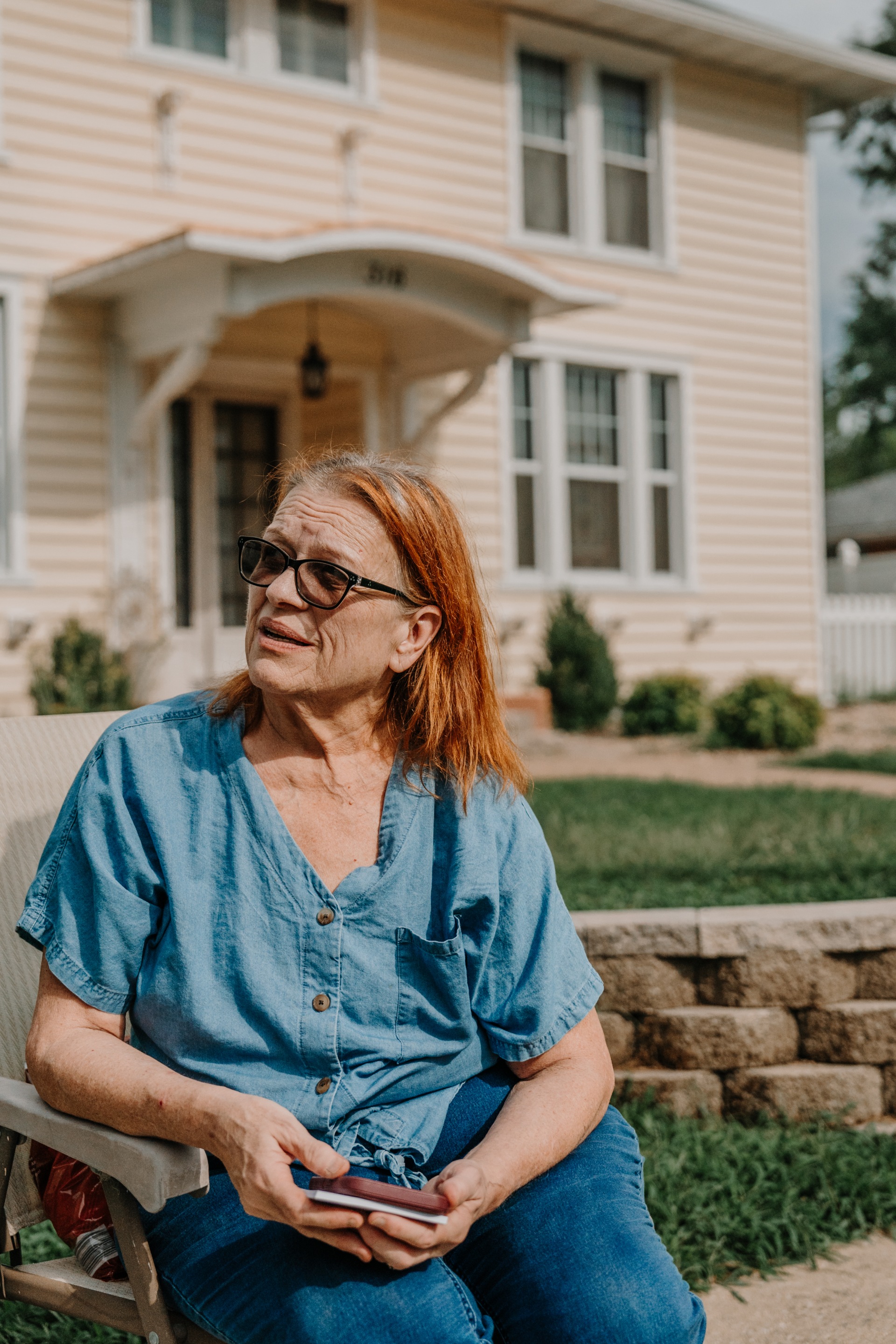
Beverly Terveer, a Marissa resident and homeowner. She has a solar panel atop her house but still supports the coal-fired power plant just outside of town.
Virginia Harold
Beverly Terveer was one of the many locals watching the Coal Festival parade. Virginia Harold
The Rolling Nobles at the Marissa Coal Fest parade
Virginia Harold
Most people in town are fiercely protective of coal, and Marissa’s history with commercial coal mining stretches back to the 1850s. Generations of Marissa residents were employed by coal companies — often mom-and-pop operations, unlike the large corporations that dominate the fossil fuel energy sector today.
For resident Paul Weilmuenster, who was watching the parade from the front porch of his home on Main Street, becoming a coal miner was a no-brainer.
He started young, at 20, following the career path of his father, who was also a miner. He relished carrying on the tradition. Now, though, he sees how the decline of the industry has meant less investment in the town, a place he’s lived his whole life.
“Who wants to build a new home, a $300,000 to $400,000 home in Marissa?” said Weilmuenster.
Still, he’s hoping Prairie State can stay open as long as possible to keep employing local people.
“So that could be another [400 to 500] people in Marissa losing their jobs — and then what are they going to do?”
A man from the Banana Bike Brigade rides a bicycle with a paper-mache lion head attached to the front during the parade.
Virginia Harold
A man from the Banana Bike Brigade rides a bicycle with an attached paper-mache lion’s head during the parade. Virginia Harold
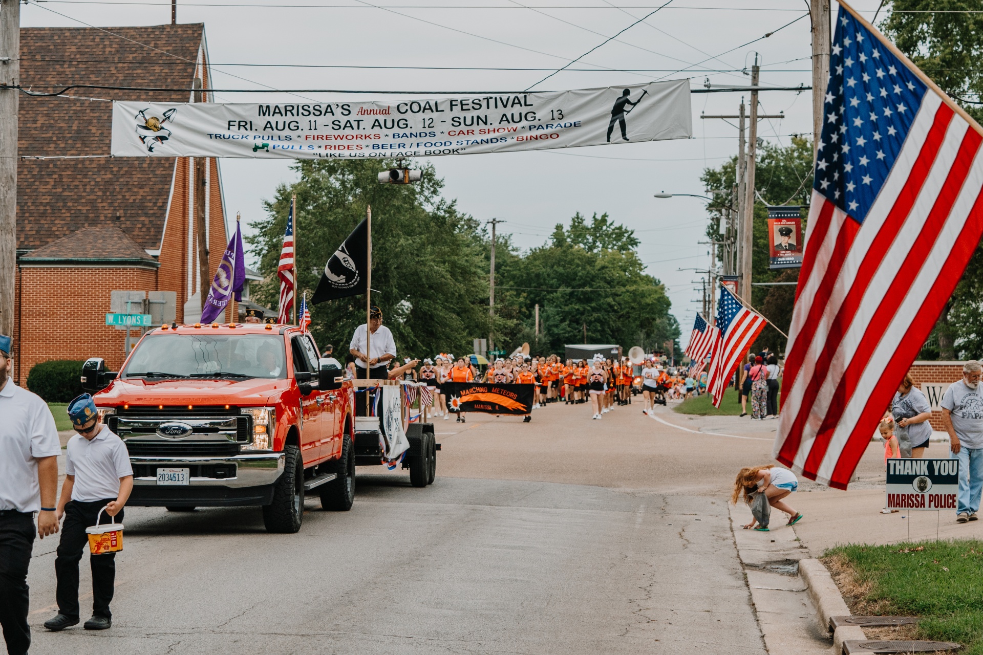
At the Marissa Coal Festival parade, a truck with a group of veterans is followed by the Marissa Marching Meteors band and cheerleaders.
Virginia Harold
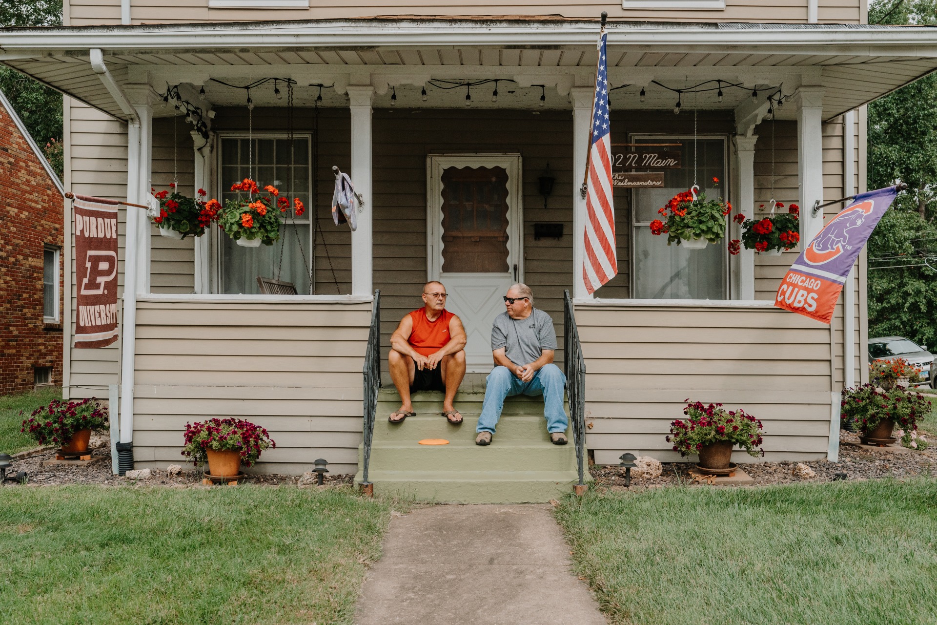
Paul Weilmuenster, a former coal miner, watches the parade from his porch with Roy Dean Dickey, a Marissa Village board trustee. Virginia Harold
Paul “Paw Paw” Weilmunster, a former coal miner, on his porch next to Roy Dean Dickey, a Marissa Village board trustee
Virginia Harold
Although the power plant has served as a huge economic driver for the town, not every Marissa resident has a positive experience with coal. Maria Cathcart is the daughter of a coal miner, but she said that climate change means coal needs to be phased out to prevent further warming from fossil fuel emissions.
“I see how we’re cutting back on coal, so it is cutting back on, kind of, a tradition, but it needs to be done,” Cathcart said. “We’re tearing apart our world. And we need to stop, because it’s going to get to a point where it’s going to be irreversible.”
The personal impact of coal on miners’ families was real for her. She remembers her father fondly, but also knows that the career he committed his life to contributed to his death from black lung.
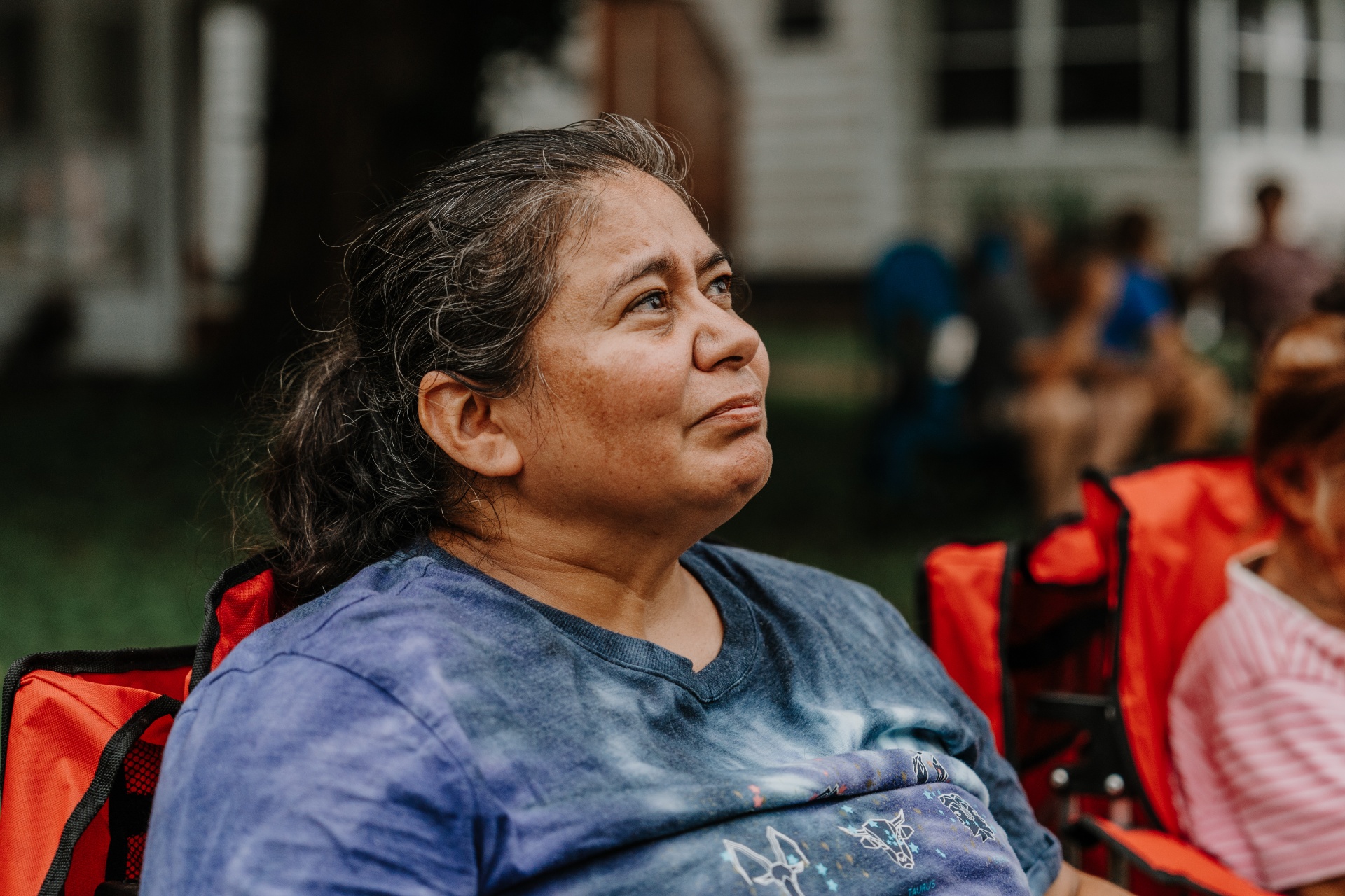
Maria Cathcart, 49, a lifelong Marissa resident and daughter of a coal miner. He died in her arms of black lung. Virginia Harold
“He actually died in my arms, so it really hurt me,” she said. “I was right there when he died.”
Still, she comes every year to the coal festival with her mother, Carmen. Not doing so is out of the question, even though Cathcart’s relationship to coal and the town itself remains complicated. Life in Marissa revolves around the event, and Cathcart cheered in the crowd when the parade started, alongside everyone else.
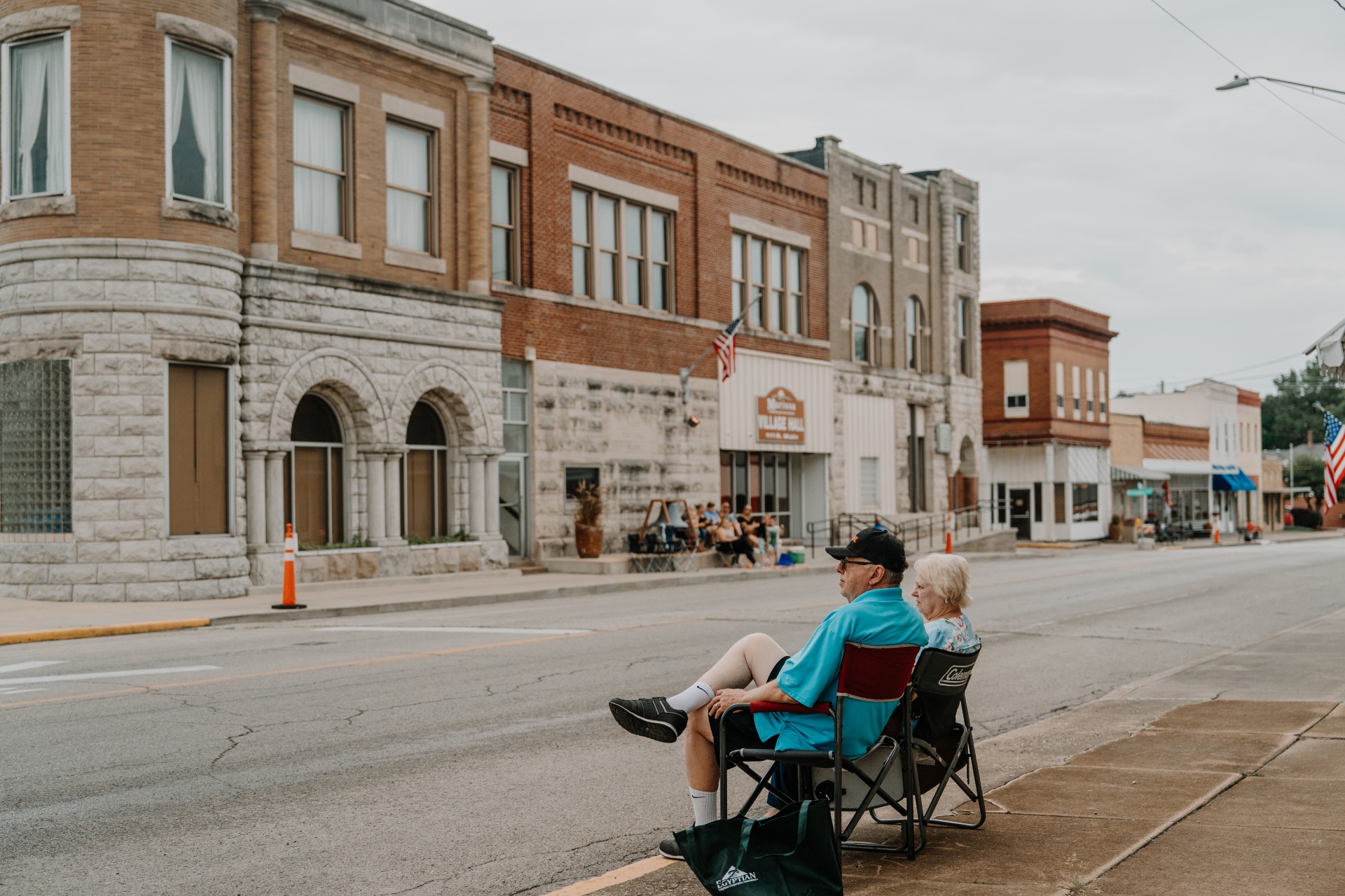
Residents line the streets to watch the parade.
Virginia Harold
Locals set up chairs to watch the parade. Virginia Harold
Residents set up to watch the parade.
Virginia Harold
Virginia Harold
Coal Queen candidate MacKenzie Jetton rides in the Coal Fest parade.
Virginia Harold
Coal Queen candidates participate in the parade. Later, they will compete for the title. Virginia Harold
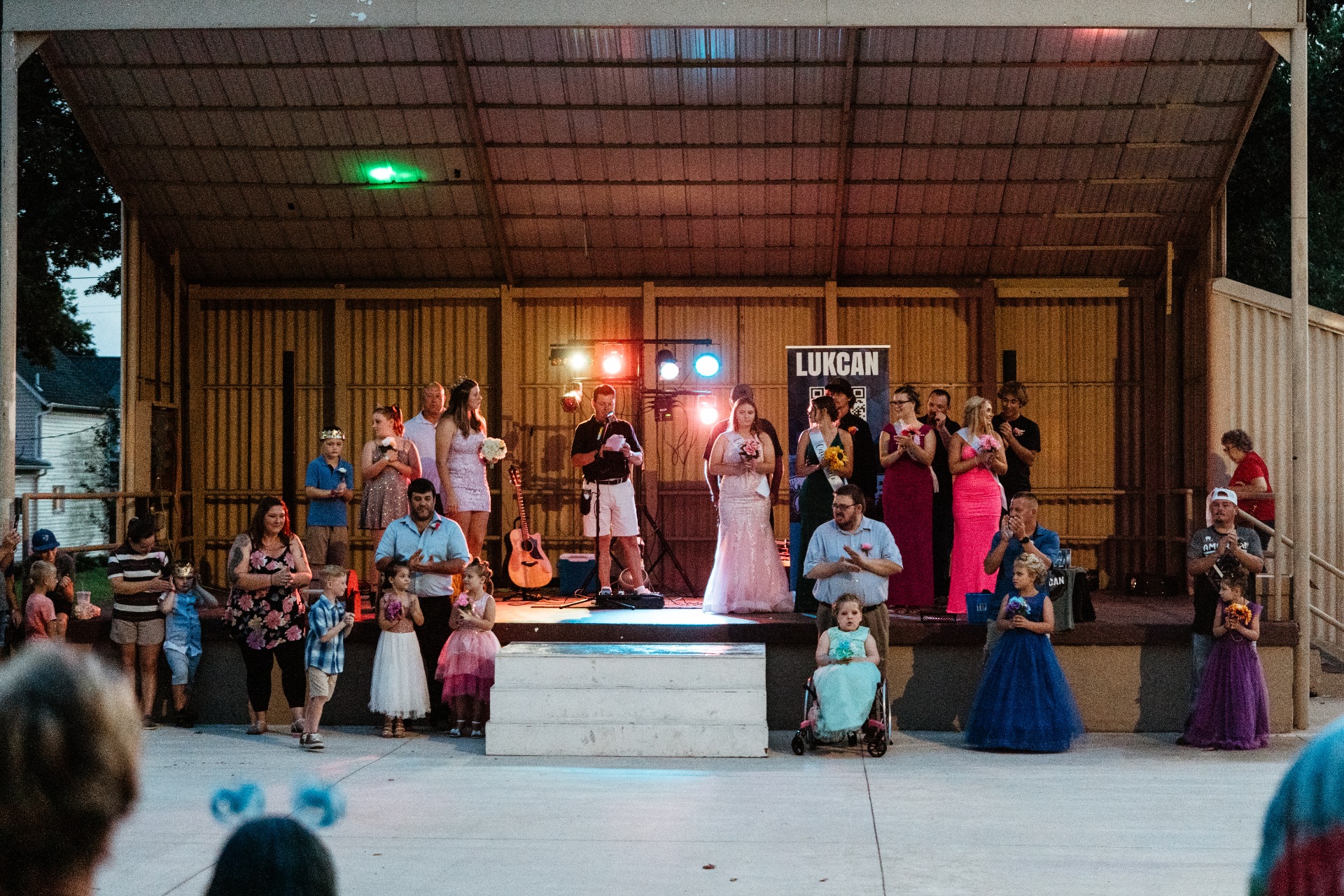
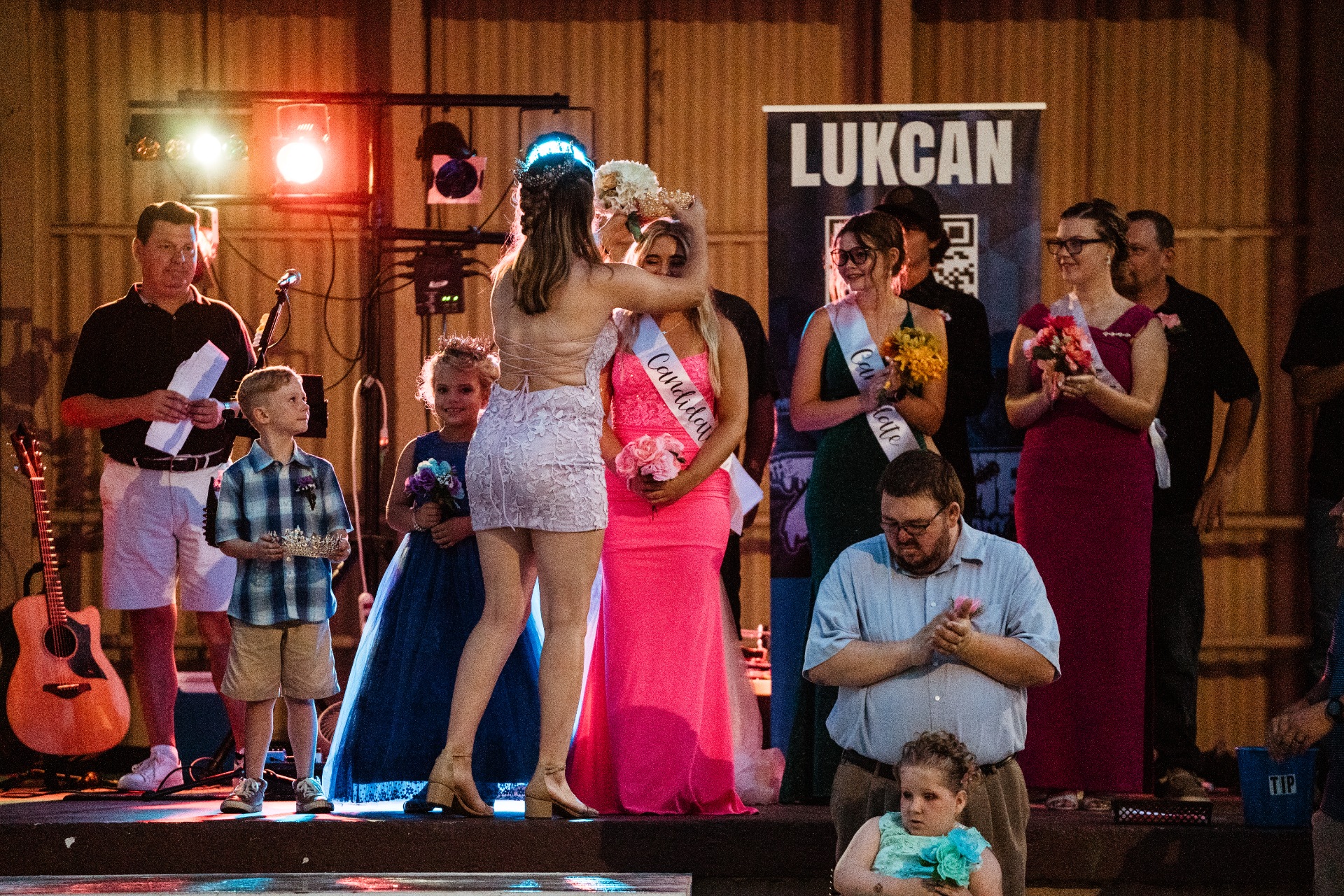
The Coal Festival includes food, rides, and games as part of the weekend-long celebration. And, as the carnival roars in the background and the sun begins to set, the festivities culminate in the annual crowning of a Coal Prince, Coal Princess, and Coal Queen.
Virginia Harold
The annual Marissa Coal Festival includes rides, games, and food as a part of the weekend-long celebration.
Virginia Harold
Scenes from the carnival grounds. Virginia Harold
Virginia Harold
Virginia Harold
Virginia Harold
Virginia Harold
MacKenzie Jetton, a local high school graduate, was named 2023 Coal Queen. Virginia Harold
How does climate change threaten your neighborhood? A new map has the details.
If you’ve been wondering what climate change means for your neighborhood, you’re in luck. The most detailed interactive map yet of the United States’ vulnerability to dangers such as fire, flooding, and pollution was released on Monday by the Environmental Defense Fund and Texas A&M University.
The fine-grained analysis spans more than 70,000 census tracts, which roughly resemble neighborhoods, mapping out environmental risks alongside factors that make it harder for people to deal with hazards. Clicking on a report for a census tract yields details on heat, wildfire smoke, and drought, in addition to what drives vulnerability to extreme weather, such as income levels and access to health care and transportation.
The “Climate Vulnerability Index” tool is intended to help communities secure funding from the bipartisan infrastructure law and the Inflation Reduction Act, the landmark climate law President Joe Biden signed last summer. An executive order from Biden’s early months in office promised that “disadvantaged communities” would receive at least 40 percent of the federal investments in climate and clean energy programs. As a result of the infrastructure law signed in 2021, more than $1 billion has gone toward replacing lead pipes and more than $2 billion has been spent on updating the electric grid to be more reliable.
“The Biden Administration has made a historic level of funding available to build toward climate justice and equity, but the right investments need to flow to the right places for the biggest impact,” Grace Tee Lewis, a health scientist at the Environmental Defense Fund, said in a statement.
According to the data, all 10 of the country’s most vulnerable counties are in the South, many along the Gulf Coast, where there are high rates of poverty and health problems. Half are in Louisiana, which faces dangers from flooding, hurricanes, and industrial pollution. St. John the Baptist Parish, just up the Mississippi River from New Orleans, ranks as the most vulnerable county, a result of costly floods, poor child and maternal health, a list of toxic air pollutants, and the highest rate of disaster-related deaths in Louisiana.
“We know that our community is not prepared at all for emergencies, the federal government is not prepared, the local parish is not prepared,” Jo Banner, a community activist in St. John the Baptist, told Capital B News.
Even in cities where climate risk is comparatively low, like Seattle, the data shows a sharp divide. North Seattle is relatively insulated from environmental dangers, whereas South Seattle — home to a more racially diverse population, the result of a history of housing covenants that excluded people on the basis of race or ethnicity — suffers from air pollution, flood risk, and poorer infrastructure.
A map shows a divide between the North and South Seattle, with darker tones indicating areas that are more vulnerable to environmental hazards.
The U.S. Climate Vulnerability Index; Mapbox / OpenStreetMap
Similar maps of local climate impacts have been released before, including by the Environmental Protection Agency and the White House Council on Environmental Quality, but the new tool is considered the most comprehensive assessment to date. While it includes Alaska and Hawai‘i, it doesn’t cover U.S. territories like Puerto Rico or Guam. The map is available here, and tutorials on how to use the tool, for general interest or for community advocates, are here.
Dianne Feinstein dies, leaving a complicated legacy on climate issues
Senator Dianne Feinstein, who died on Thursday evening at the age of 90, leaves behind a long and complex legacy on climate and environmental issues. Feinstein represented California as a Democrat in the U.S. Senate for more than 30 years, becoming the longest-serving woman in Senate history, and during that time she brokered a number of significant deals to protect and restore the natural landscapes of the West. In recent years, as politics shifted, she found herself on the receiving end of criticism over her approach to tackling the climate crisis.
After taking office in 1992 following a decade as the mayor of San Francisco, Feinstein established herself as a champion for conservation. She worked to pass legislation that would protect millions of acres of California wilderness from development and extractive industry, using her deft skills as a negotiator to bridge disputes between competing interests. She succeeded in that conservation effort where her predecessors had failed, spearheading a 1994 bill that created the Death Valley and Joshua Tree national parks, which encompass millions of acres. She later passed bills to protect Lake Tahoe, the California redwoods, and the Mojave Desert.
Even so, as a compromise-oriented legislator from California, she often had to weigh the competing interests of farmers, ranchers, and environmentalists, and at times she angered all of them. This tendency toward centrism was evident in her legislative work on water in the state’s Central Valley. She brokered a monumental restoration agreement on the valley’s overstressed San Joaquin River in 2009, but then helped override species protections for fish on that same river in 2016.
“That is wrong, it is shocking,” her colleague Senator Barbara Boxer said at the time, according to E&E News.
Even so, as the pace of the climate crisis advanced, Feinstein attracted criticism from the left for not supporting more ambitious policies to tackle climate change, and her reputation as a broker of compromise came back to haunt her. In early 2019, a group of activists with the Sunrise Movement confronted Feinstein in the Capitol building, urging her to support progressive calls for Green New Deal legislation.
Feinstein rebuffed the protestors.
“I’ve been doing this for 30 years. I know what I’ve been doing,” she said in a viral video. “You come in here and say it has to be my way or the highway.” Her office later released a statement on the incident that mistakenly referred to the protestors as part of the “Sunshine Movement.”
In the following years, following reports that Feinstein was experiencing a loss of her mental faculties, some politicians called for her to step down from the Senate. She resisted those calls and instead said she would retire at the end of her current term, which would have lasted through next year’s election.
The senator’s death will create even more turmoil in Washington, D.C., as lawmakers tangle over a looming government shutdown. The Senate has moved closer to passing a resolution to fund the federal government over the course of the week, but it’s unlikely to pass the House of Representatives thanks to a revolt from hardline Republicans.
Feinstein cast her final vote on Thursday morning on a procedural item relating to the Federal Aviation Administration, but she didn’t vote on an environmental bill later that afternoon. In the vote she missed, Republican lawmakers tried to override President Biden’s veto of a bill that would have rolled back endangered species protections for the prairie chicken. The final vote total was 47 Republicans to 46 Democrats, not enough to override the veto.
Correction: An earlier version of this article misstated the outcome of a vote on endangered species protections.
High bacteria levels prompt seasonal closure of South Lilliwaup Beach for shellfish harvest
The Washington State Department of Health (DOH) has closed South Lilliwaup Beach for recreational shellfish harvesting and commercial shellfish harvest on adjacent tidelands. According to DOH, …
Virginia is bailing on a carbon cap-and-invest program. Activists say that might be illegal.
After a blazingly hot stretch of summer in early July 2022, the skies broke open over Buchanan County, Virginia. Floodwaters damaged almost 100 homes and destroyed miles of road in the rural, overwhelmingly low-income mountain towns that dot the region. In the wake of the devastation, local officials spent $387,000 compiling a flood preparedness plan. The multistep blueprint analyzed inundation risks and recommended potential risk-reduction projects.
To develop the proposal, the county tapped the Community Flood Preparedness Fund, a state program that makes hundreds of millions of dollars available for disaster risk analysis and mitigation. They were among the first to do so after money for such things became available in 2021 through proceeds from a carbon-offset program called the Regional Greenhouse Gas Initiative, or RGGI. But those plans, and the fund, are now in doubt because Virginia Governor Glenn Youngkin wants to withdraw from the initiative despite the fact it has provided $657 million for flood preparedness and energy-efficiency programs and reduced the state’s carbon emissions by almost 17 percent.
Critics of such a move say that, beyond curtailing the significant emissions reductions RGGI has already incurred, pulling out will reduce the funding available to help communities prepare for increasingly common extreme weather. It is, they say, a huge mistake and, what’s more, illegal. A group of four Southern environmental nonprofits, led by the Southern Environmental Law Center, filed suit on August 21 to stop it.
“Repealing this regulation is just outside of their authority,” said Nate Belforado, a senior attorney with the center. “If they disagree with it, they have to take it to the General Assembly, and they’ve tried to do that and it hasn’t been successful.”
RGGI, often pronounced “Reggie,” is a collaborative cap-and-invest effort that links 12 states stretching from Maine to Virginia. Power plants in those states must acquire one carbon-emission allowance for every ton of CO2 emitted, with the permissible level of emissions declining over time. Ninety percent of the allowances are sold through quarterly auctions, generating money states can invest as they choose. The program reportedly has slashed power plant emissions in participating states by half and raised nearly $6 billion.
Virginia joined the program two years ago, following the legislature’s 53-45 vote to require participation. Of the $657 million Old Dominion has raised, 45 percent has gone toward the Community Flood Preparedness Fund to help communities with resilience planning and municipal projects. (At least a quarter of the fund’s annual allocations go to low-income communities.) The remainder has financed home weatherization for low-income residents, reducing their utility bills through simple, but often expensive, home improvements.
But Youngkin says the rate increases utilities instituted to cover the costs of participation in the initiative create a financial burden for low-income Virginians. “RGGI remains a regressive tax which does not do anything to incentivize the reduction of emissions in Virginia,” his office told 13th News NOW. (The governor’s office did not respond to a request for comment.) “Virginians will see a lower energy bill in due time because we are withdrawing from RGGI through a regulatory process.”
The appointed Air Pollution Control Board, of which four of seven members were personally named by Youngkin, voted in June to withdraw from the program by repealing the Community Flood Preparedness Act that made Virginia a part of it in 2020. If the decision stands, the move would take effect December 30. Environmental groups said the proper procedure would have been to introduce a legislative bill and have lawmakers decide. One poll found that 66 percent of Virginians support staying in RGGI; to go against them, Youngkin’s critics argue, is a fundamentally anti-democratic move. A comment period for the withdrawal remains open until Wednesday.
Beyond that criticism, Benforado calls Youngkin’s move frustrating given the progress made under the initiative. “Virginia’s monopoly utilities are required to zero out their carbon by 2050,” he said. “RGGI is the tool that will help us get there.”
Municipalities all over Virginia have used the flood-resiliency funds to shore up infrastructure, draft evacuation plans, and restore blighted wetlands. “Local governments are on the front lines of the climate crisis,” said Mary-Carson Stiff, the executive director of the nonprofit Wetlands Water Watch, which worked with Buchanan County on its flood-resiliency plan. “And they are on their own, to come up with resources to come up with plans and to fund strategies to protect against losses.”
In a 2020 report, the organization noted that most of the state’s rural communities do not have any flooding or other climate resilience plans to speak of. Proponents of RGGI say that before Virginia joined, there was almost no money for disaster preparation and planning, which can be time- and labor-intensive, and requires hiring specialists and conducting environmental studies.
Stiff says Virginia’s use of funds raised through the initiative has been fairly forward-thinking. “We’re unique in the other participating RGGI states where our auction proceeds are being spent on grant programs that are actually reducing greenhouse gas emissions,” she said.
Youngkin’s claim that Virginia ratepayers underwrite the cap-and-invest effort echoes an argument Dominion Energy, the state’s biggest utility, has made. It has said in public comments that the costs it had incurred under RGGI made it necessary to raise rates. It has proposed a rider of $2.29 on top of recent increases caused by fluctuating natural gas prices.
Mayor Justin Wilson of Alexandria, which has benefited from RGGI-funded flood-resiliency projects such as a redesigned downtown waterfront and storm drain expansion, says people were already paying dearly for the impacts of greenhouse gas emissions, and that the Community Flood Preparedness Fund has been a godsend. Flooding costs Virginians $400 million per year, according to some estimates.
“I’ve stood in the homes of residents that have seen their livelihoods destroyed,” said Wilson. “The impacts of these storm events are a tax on the community.”
Youngkin has promised alternative sources of funding for flood preparedness and weatherization, and has proposed a $200 million revolving loan fund with a similar purpose. Wilson said he’ll believe there’s a contingency plan when he sees it. All the while, small floods that would have been unusual a couple of decades ago are happening with greater frequency, and the city struggles to keep up. “We have billions of dollars of investment we are gonna have to make,” the mayor said.
Meanwhile, on the other end of the state, Buchanan County’s flood-resilience planning may be complete, but officials must find money for the improvements it outlines. On the anniversary of last summer’s inundation, flood survivors were still fixing up their homes, mourning the woman who had died, wondering where the next resources for them were going to come from, and nervously looking at silt-filled and waste-dammed creeks as summer rain began to fall.