Can Oregon protect its farmland against rapid development?

Nearly two-thirds of the state’s agricultural land will change ownership in the next 20 years. It’s ripe for development

Can Oregon protect its farmland against rapid development?

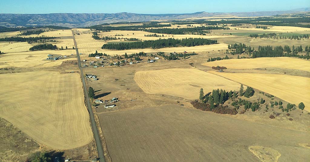
Promised land: Transfers to farmland to heirs create tenuous periods of ownership that can be exploited by developers. Photo: Sam Beebe/Wikimedia Commons


By Eva Jacroux. January 17, 2024. Farmland in the United States is under threat. About 31 million acres, a land mass equivalent to the size of New York state, has been lost to urban expansion in the last 20 years. By 2040, nearly 18 million more acres could be lost to development.

“Without farms, there’s not only no food, but there’s no future. We need farmland to feed us and sustain our economy—but also to help restore our planet” says American Farmland Trust president John Piotti.

Urban sprawl has been swallowing farms around the peripheries of our nation’s cities.

Oregon has a strong history of protecting its farmland, creating a leading land-use planning system to protect open spaces.

However, with growing pressure on land to both house and feed an expanding population, the state’s lawmakers are being pulled in multiple directions.

Now, a boundary isn’t enough. Farmland advocates must work across the rural-urban divide, tackling urban housing policy in the process, to protect the future the state’s food systems.

Rural gentrification

Rural America is experiencing a real estate crisis. Low density rural development and urban sprawl into rural areas continues to drive up land prices.

In agricultural areas, the conversion of farmland to non-farm uses deters the extended life of irrigation districts and processing facilities.

As profitability decreases, farmers are more likely to divide and sell land for development, deepening the cycle of conversion and slowly reducing the amount of farmland nationwide.

“It’s what we can call rural gentrification” says Brooks Lamb, American Farmland Trust, land access specialist.

Rising land prices and declining agricultural districts further restrict young farmers and underrepresented groups like women and BIPOC from entering the industry. Thriving agricultural food systems require a critical mass of farmland, and this land-intensive industry is framed by issues of equity, access and entry.

Roughly 370 million acres of farmland across the United States will change hands as the aging population of farmers retires in the next 20 years.

In Oregon, nearly two-thirds of the state’s agricultural land will change ownership in that time—farm owners aged 55 and older control 64% of agricultural land in the state, according to an Oregon State University study titled The Future of Agricultural Land.

Land transfers to heirs create tenuous periods of ownership that can be exploited by developers. In declining agricultural economies, property heirs are more likely to sell or be bought out by developers.

Some become victims of “forced partition sales.” Heirs can be bought out by a developer who then becomes an equal co-owner and forces the entire parcel to be put up for sale at a public auction for pennies to the dollar of the market rate.

SB 100 and contemporary challenges

In the 1970s, Oregon created one of the strongest land-use planning systems in the United States. Senate Bill 100 was passed to create urban growth boundaries designed to protect Oregon’s environment and open space.

Its secondary goal was to continually reevaluate housing production to meet statewide needs. This was an important tool for the conservation of Oregon’s farms, forests, natural resources, economic development and open spaces.

However, single-family zoning requirements have undermined both urban and rural housing affordability and land access, creating low-density expansion out of urban growth boundaries while simultaneously failing to build enough units to house a growing population.

While SB 100 has been influential in slowing suburban expansion, it failed to codify funding pathways for increased compact housing production.

As state policymakers grapple with how to meet housing demands without these avenues, the urban growth boundary is being chipped away.

Last year, Oregon’s controversial House Bill 3414 was narrowly defeated. If passed into law, the bill would allow cities to unilaterally expand urban growth boundaries.

Furthermore, while SB 100 remains a strong conservation tool, it has often failed to protect the state’s most valuable farmland, especially on the peripheries of cities.

Expanding residential development to the outskirts of cities through single-family homes rapidly raises the cost of living in rural areas while simultaneously exacerbating inequality in cities.

Now, Oregon is experiencing a statewide housing shortage.

People in all Oregon counties are concerned about affordability and homelessness. While Portland housing prices are expected to begin a slight decline from their recent historic heights, prices for Oregon farmland have continued to rise year after year.

Oregon has continually ranked at the top of federal measures for statewide homelessness.

In recent years, Oregon has made monumental moves to reform city zoning laws.

In 2019, it became the first state in the country to do away with single-family zoning requirements and has begun funding city-housing strategies to increase housing production of multi-use housing.

However, rural areas haven’t been allocated the same funding to create similar housing strategies.

Many rural county governments lack the resources to protect agricultural economies to resist the development of prime farmland.

How then should state, county and municipal governments create measured policies that don’t take productive farmland out of commission and decrease the expansion of single family-homes?

Advocates on concurrent fronts

Beneath the glow of warm lighting of Helioterra Winery in Southeast Portland, Oregon Agricultural Trust partners and farmers celebrated a successful 2023 year over locally sourced appetizers and vibrant Pacific Northwest wines.

Among many of its successes was work done to petition local, regional and national governments for more funding to protect agricultural land.

In Washington, American Farmland Trust has set a model of holistic urban sprawl prevention policy: working to reduce development pressure by advocating for middle housing options within Seattle.

By promoting affordable high-density housing in cities, American Farmland Trust is attempting to build bridges across the rural-urban divide by increasing affordable housing.

Land trusts are working to help educate farmers about the importance of succession planning.

Many use the “Buy, Protect, Sell” model to place easements on farmland to permanently remove development rights. They rely on public outreach to inform agricultural land owners about the importance of stewarding farmland, and how one plot of land sold can become millions of acres lost.

The nonprofit 1,000 Friends of Oregon spearheads the Portland for Everyone campaign.

The watchdog organization was formed by Governor Tom McCall, who was integral to the bipartisan push behind SB 100.

In the past, 1,000 Friends of Oregon has collaborated with LandWatch Oregon and American Farmland Trust for the Portland for Everyone program. Continuing this overlap and drawing in more agricultural land trusts to protect the urban growth boundary is a natural coalition.

The post Can Oregon protect its farmland against rapid development? appeared first on Columbia Insight.
How the recovery of a stolen plant helped one nation re-Indigenize tobacco

By Brian Bull

Mark Petrie knows tobacco. Both the good kind and the bad kind.

As a youngster, he witnessed commercially-processed tobacco with its additives and chemicals hook and ravage people in his family and tribe. Many believed they were practicing “tradition,” while nicotine and tar spurred addiction and ruined their lungs.

But outside the Coos, Lower Umpqua and Siuslaw Indians’ plankhouse in the coastal town of Coos Bay, Ore., the former tribal vice chair reverently holds a bulbous and gnarled strain called Nicotiana quadrivalis variety multivalis. Known more simply as Columbian tobacco, Petrie says this is the kind his distant ancestors raised, protected and used – well before the arrival of white settlers.

“When I started working for the tribe, I had the opportunity to work in commercial tobacco prevention,” Petrie said. “I really set my sights on looking for bringing back the traditional tobacco and how it was used.”

That was a tall order, given that Columbian tobacco practically disappeared from the banks of the Columbia River during the 1800s. The culprits were a Scottish botanist, the fur trade and the erosion of Indigenous protocols surrounding the plant.

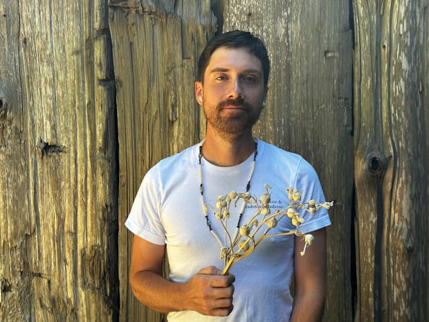
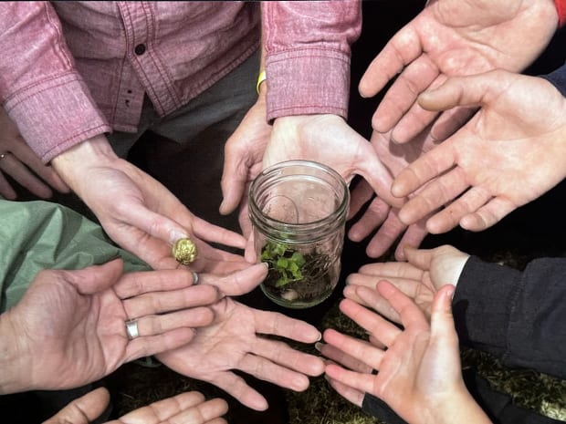
Mark Petrie holds a handful of tobacco outside the CLUSI plankhouse in Coos Bay, Ore. It’s the same tobacco his ancestors raised, protected and used – well before the arrival of white settlers. Brian Bull / Underscore News

The bartering thief

David Douglas – namesake of the Douglas fir – ventured into what became known as the Pacific Northwest in 1825, scouring the terrain for new and interesting plant life to share with the Royal Horticultural Society. He found tribes growing Columbian tobacco next to their plankhouses. It was carefully cultivated and didn’t grow in the wild forests.

When he asked to take the plant’s seeds back with him, Native people rejected the request.

“And so he came by way of night and took some seeds,” Petrie said.

He was caught in the act. But some fast-talking and exchanging of other materials, including European tobacco, allowed him to get away with the seeds.

“He took them back to Europe,” Petrie said. “So that’s really the story of those plants we lost. We weren’t able to cultivate them and maintain the environment where they were growing, because we were displaced.”

Another Native person familiar with the practices of pre-colonial Indigenous tobacco is Robert Kentta, retired cultural director for the Confederated Tribes of Siletz Indians.

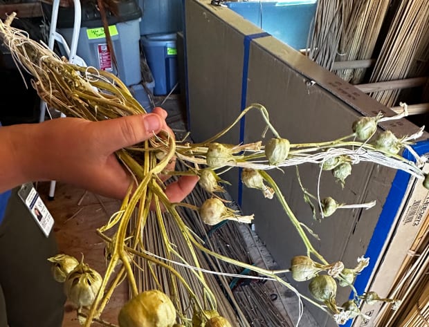
Over generations of careful cultivation, The Coos, Lower Umpqua, and Siuslaw Indians created the Columbian strain of tobacco. The larger pods don’t open on their own. In order for the seeds to spread, tribal citizens manually open the pods to disperse seeds themselves. Brian Bull / Underscore News

“There were real strong beliefs around if tobacco grew in the wrong place,” Kentta said. “There were strict protocols around where you grew it, how you used it, all of those things. Like if seeds sprouted from a tobacco offering in a cemetery, those things could be used as a poison.”

Throughout the 1800s, the fur trade saw Native Americans and European companies exchanging goods at a rampant pace. Of the many items the Hudson Bay Company brought into the continent that intrigued tribes, processed tobacco was among the most prized.

That appeal still confounds Kentta.

“It’s a little bit of a surprise that our elders picked it up that quick, because they had such protocols around tobacco,” Kentta said. “Trade tobacco did catch on, and it quickly replaced our traditional grown tobacco. People just kind of quit growing it.”

A Native tradition becomes Westernized…and weaponized

Over the following century and a half, the protocols and reverence for traditional tobacco dissipated like smoke. With commercially-processed tobacco supplanting both the Columbian and Indian (Nicotiana quadrivalvis variety quadrivalvis) varieties in the Native community, marketers were quick to target this demographic. One particularly influential brand is Natural American Spirit, which features a thunderbird, peace pipe, and Indian chief on its packaging. A 2021 study by the University of California-Merced showed Alaskan natives switched to the brand instead of quitting the habit, saying it was “healthy and natural.”

Generations later, this targeted marketing – as well as the propagation of the idea that all smoking is “traditional” – has paid off for tobacco manufacturers, though at a tremendous human cost. A long-term study by the Centers for Disease Control and Prevention showed higher rates of lung cancer in general for Native people, while the anti-smoking organization The Truth Initiative says nearly 23% of Native people smoke, compared to 13% of non-Natives. And 16% of Native American/Alaska Native high-schoolers smoke cigarettes – a rate nearly three times higher than average.

In 2017, CLUSI biologist John Schaefer found out about a tobacco germplasm collection in Pulaway, Poland that had Columbian tobacco seeds and requested some be sent back to the tribe. The seeds were perhaps the first ones back in the region – if not the entire U.S. – for generations. Brian Bull / Underscore News

“I talk about that,” said Scott Kamala, a certified prevention specialist with the Confederated Tribes of Warm Springs.

While currently focused on underage drinking, his previous focus for 12 years was on educating his fellow Natives about the difference between authentic tobacco practices and modern-day smoking, as well as addiction and commercial tobacco products’ negative effects on the community.

“Back in the day I did a smoke-free powwow and it was just to protect people from secondhand smoke,” Kamala said. “A lot of people would stand by the door and smoke cigarettes, and lots of dancers and singers were complaining about that.”

Kamala says there’s also a sequel legend about about what happened after Adam and Eve disobeyed the Creator’s command not to disrespect the Garden of Eden.

“You ate this apple, you know what? You guys are gonna be kicked out of the garden, you’re gonna go down to Earth,” Kamala said. “Then the man (Adam) got scared, ‘Well, how do I know how to communicate with you?’”

That’s when the Creator introduced them to tobacco.

“You’ll roll this tobacco up, we’re gonna use it like a landline, a telephone. It’s going to communicate with me, so you’re going to be serious. It’s going to bring your prayers up to the Creator.”

Kamala wants that message to return.

“You know, Natives, we forgot about that teaching and we use it in a different way,” Kamala said. “That’s where people are suffering from lung cancer, skin cancer. Because we’re not following that teaching.”

From a theft, revival

On a bright afternoon, Nicole Romine walked into a greenhouse at the headquarters of the Coos, Lower Umpqua, and Siuslaw Indians. She knelt next to a small cluster of the distinctive, large-bulbed tobacco plants that David Douglas stole Native people near the Columbia River almost two hundred years ago.

“So this is the strain that made its way from the Columbia River Gorge all the way over to London, and then all the way to Pulaway, Poland,” she said.

Romine serves as CLUSI’s tribal tobacco prevention program assistant, a role she cherishes as that makes her the steward for the traditional tobacco variants.

“I’m gathering some of this tobacco, it’s just ready now,” Romine explained, gently running a finger alongside the nearly foot-high plant. “I left it a few weeks ago, there’s still some light green on the stem that will mold if we don’t let them dry out completely.”

Next to Romine is a plant with a handwritten name tag, indicating it will be gifted to a tribal member. For the tribe overall, just having this strain of tobacco back is a gift that required years of effort.

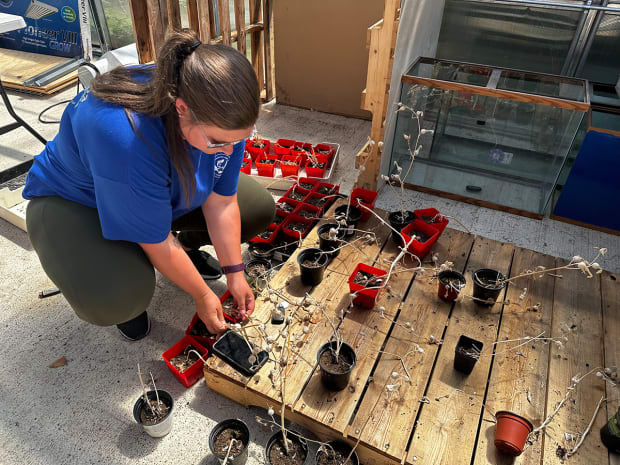
Nicole Romine examines a small cluster of the distinctive, large-bulbed tobacco plants in the greenhouse at the headquarters of the Confederated Tribes of the Coos, Lower Umpqua, and Siuslaw Indians. She says these are the same plants that David Douglas stole from Native people near the Columbia River almost two hundred years ago. Brian Bull / Underscore News

A CLUSI biologist, John Schaefer, managed to procure seeds for Indian tobacco from Thomas Jefferson’s Monticello plantation in Virginia back in 2006. But the real prize, Colombian tobacco, remained elusive. Inquiries were made at various seed banks and universities, but the chances of actually recovering seeds seemed meager.

Then in 2017, Schaefer heard from his contacts that there was a tobacco germplasm collection in Pulaway, Poland. That same year, a padded envelope arrived containing the long-awaited Columbian tobacco seeds.

They were perhaps the first ones back in the region – if not the entire U.S. – for generations.

“So these have been harvested and strung up,” Romine said, shaking a dried seed pod with a faint smile. “These will actually keep until we want to use them.”

Romine explained that when the tribe cultivated this strain, it resulted in larger pods that don’t open on their own. “So we have to go in and open the pods, for the seeds to spread. We’d go in and whack them, and disperse them ourselves.”

Giving back

In the six years since the Columbian tobacco seeds were sent from Poland, the tribe has actively grown and dried many plants. In May, CLUSI representatives gifted several to the other eight federally-recognized tribes within Oregon’s boundaries, and a few Native American organizations at the Sacred Tobacco and Traditional Medicine Gathering near Bend.

“At that event, we just really highlighted medicines, and talked about how those medicines bring healing into our communities,” said Petrie, who was among those presenting tobacco. “And sacred tobacco was one of those medicines.”

Altogether, there were 150 people at the event. Petrie recalls many were deeply appreciative to receive the tobacco.

“Having the ability to practice ceremony in ways that their ancestors have been practicing for so long, and with the plants that are special to our people,” Petrie said. “That was really wholesome to see and really brought good medicine to me.”

Organizers are planning another Sacred Tobacco and Traditional Medicine Gathering next summer in Grand Ronde. Petrie and Romine are dedicated to helping Native people reconnect with their special relationship with tobacco, and use it with the reverence and care they feel it deserves.

Authenticity returns to tribal ceremonies

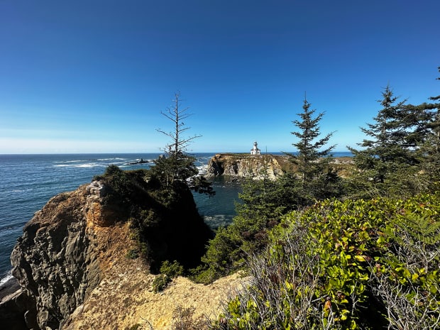
Baldich, or Gregory Point, is a ceremonial spot for the Confederated Tribes of Coos, Lower Umpqua and Siuslaw Indians. Elders say tribal members hid there during roundups and forced marches to reservations. Today, it’s where the annual salmon ceremony takes place. Now, the tribe will use the Indigenous tobacco of their ancestors during the ceremony. Brian Bull / Underscore News

Before my departure, the pair took me to a place on the Oregon Coast commonly known as Gregory Point. To area tribes, it’s called Baldich, and its history has seen Natives hiding from U.S. soldiers during the roundups and forced marches to reservations areas, as well as ceremonies.

“It’s a very sacred place for our people,” Romine said. She carried a jar of sacred Columbian tobacco, and gave a small blessing for this story amidst the crashing waves, keening gulls and cormorants.

Petrie explained that a salmon ceremony takes place here annually, where the remnants of a salmon feast are put back into the ocean. And part of that ceremony involves the offering of tobacco.

Now, the ceremony will include the pure, Indigenous tobacco of their ancestors, not a commercial brand filled with additives.

“We have been without the sacred tobacco for so long,” Petrie said, looking out beyond the craggy shoreline. “It brings a lot of happiness to our elders, myself and our families. We have that back with us.”

Our stories are worth telling. Our stories are worth sharing. Our stories are worth your support. Contribute $5 or $10 today to help ICT carry out its critical mission. Sign up for ICT’s free newsletter.

Persistent Wildfire Smoke is Eroding Rural America’s Mental Health

Persistent Wildfire Smoke is Eroding Rural America’s Mental Health

This story was produced through a collaboration between the Daily Yonder, which covers rural America, and Climate Central, a nonadvocacy science and news group.


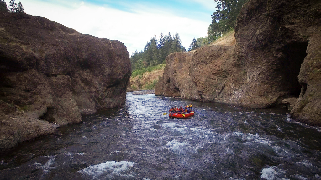
Will and Julie Volpert have led white water rafting trips on Southern Oregon’s Rogue and Klamath rivers for over a decade for their company Indigo Creek Outfitters, out of the small town of Talent, Oregon. The rafting season, which extends from May to September, is a perfect time to be out on the river where snowpack-fed cold water provides respite from the region’s hot summer.

Or it would be perfect if wildfire smoke weren’t a looming concern.

“We’ve been in operation here since 2011, and almost every year there’s some smoke that comes in and is noticeable on our trips,” Will Volpert said in an interview. If people have flexibility, he recommends that they schedule a trip before the third week of July when the likelihood of smoke in the air is lower.

Customers frequently cancel in late July and August because of the smoke, especially for day-trips. Federal data shows air quality tends to be more than four times worse on average in Jackson County, Oregon, during this period than earlier in the summer.

“We’ve gotten very used to saying, ‘Hey, it’s very likely going to be smoky on your trip. It might not be, but it could be.’” Volpert said. But as long as they’re not putting their participants at risk, Volpert said, they won’t cancel a rafting trip because of wildfire smoke.

Running a business affected by wildfire smoke has become normal for the Volperts, but it hasn’t come without its personal toll.

“I used to get very stressed out and paralyzed with the idea of losing our summer, which for us is, as the owners of this small business, our livelihood,” Volpert said.

While Volpert says he’s learned to manage that anxiety, wildfire smoke is a frequent source of stress for many people living in rural communities. The smoke harms farms and recreation-based businesses, can be psychologically triggering for wildfire survivors, frequently drives residents indoors, and recent research showed it’s associated with increases in rural suicides.

Wildfire smoke has become a pervasive form of air pollution released from intensifying fires due to the warming effects of heat-trapping pollution and a litany of other environmental changes.

Southwestern Oregon experienced unhealthy air from wildfire smoke nearly 13 days each year on average from 2013 through the end of 2022 — up from one to two days on average from 1985 through 2012, according to a report by Oregon’s Department of Environmental Quality that used data from the town of Medford, about 10 miles northwest of Talent where Indigo Creek Outfitters is based.

Smoke pollution exacerbates asthma, worsens infections and contributes to a variety of other physical maladies. Tiny smoke particles move from lungs into bloodstreams and can directly affect brain health, with research out of the University of Montana connecting smoke exposure to the development of dementia.

Its noxious effects on mental health, particularly on rural communities, tend to receive less discussion.

Hidden Dangers in Rural Valleys

Southern Oregon’s Rogue Valley is at the heart of a region synonymous with white water rafting, rock climbing, and other outdoor activities in the Klamath Mountains and Cascade Range. Vineyards and pear orchards dot the valley, and in the mid-size town of Ashland at the valley’s south end, the annual Oregon Shakespeare Festival boasts international recognition.

Wildfire smoke fills the air at an olive orchard on the North Umpqua River in Glide, Oregon, in September of 2020. (Photo by Jan Pytalski/The Daily Yonder) 

All these activities hinge on good summer weather, and during the past decade, they’ve been disrupted by wildfire smoke, directly affecting wages, profits and reducing overall quality of life.

“In rural areas there’s likely more people whose livelihoods are based on the land and working outside,” said Colleen Reid, a health geographer and environmental epidemiologist at the University of Colorado in Boulder who studies the health effects of wildfire smoke.

In the valley, wildfire smoke settles more easily and often sticks around longer than it does in the surrounding mountains and plains. Atmospheric conditions often arise in valleys that keep smoke close to the ground, where its effect is the strongest. This can trigger more than physical ailments like asthma.

“We’re increasingly seeing mental health impacts,” Reid said. While early research focused on the effects of flames from wildfires, she said “there are some more recent studies where even individuals who were just affected by the smoke could have mental health impacts.”

By trapping people inside homes and forcing the cancellation of outdoor social events like youth sports, smoke can contribute to loneliness, domestic quibbling and despair.

A study published last fall in the science journal Proceedings of the National Academy of Sciences linked smoke exposure with increases in suicides among rural populations, though not among urban ones.

“In rural areas, we find that smoke days are significantly associated with increases in suicide rates,” said David Molitor, a health economist at the University of Illinois at Urbana-Champaign who led the research, which drew on 13 years of smoke and federal suicide data to track mental health effects.

Because deaths from suicide are tracked by the federal government, they can be a useful measurement reflecting mental health, which is otherwise difficult to research and track. And that federal data shows that rural Americans are about a third more likely to die from suicide than those living in cities or suburbs.

“I think what’s different with rural people is they have access to guns, and they’re much more effective at succeeding in their efforts,” said Joseph Schroeder, a disaster response veteran and former mental health extension specialist at the University of Kentucky with experience  working at and running crisis hotlines for farmers and other rural residents.

Suicide ideation often arises from desperate needs for financial aid and other help, more so than poor mental health. This puts residents of rural communities that have been hollowed out following closures of timber, manufacturing and other employment-rich industries at greater risk.

“From my experience, the despair that has become suicidal ideation, or a suicidal threat, they’ve all come from conversations I’ve had with people who are calling me to get out of a situational problem — mostly financial,” Schroeder said. “It’s a poverty problem and it’s an isolation problem. And that looks differently in rural communities than it does in urban communities.”

The Almeda Fire

Come smoke or shine, Indigo Creek Outfitters – Volpert’s white water rafting company in Talent – always operates.

But on the morning of September 8, 2020, Volpert knew something was different about the wind whipping through the trees around his house outside of Phoenix, just three miles from Talent. The weather was so unusual he canceled the Upper Klamath rafting trip planned for that day.

“That is literally the only time that I can remember ever pulling the plug on one of our trips,” Volpert said. A few hours after making that decision, Talent and Phoenix were engulfed in flames.

The wildfire, known as the Almeda Fire, was the most destructive in Oregon history: About 3,000 buildings burned, most of them homes. Three people and many more animals died.

Analysis of weather station data shows the Almeda Fire broke out during a bout of fire weather — when conditions are persistently dry, warm and windy. The area was in extreme drought at the time, setting up conditions conducive for an extreme wildfire once winds strengthened. It took more than a week for firefighters to extinguish the flames completely.

After surviving a wildfire that completely changed the lives of so many in the Rogue Valley, there’s an added layer of grief that comes with the smoke season.

“For me, [smoke] causes a lot of anxiety,” said Jocksana Corona. The mobile home in Talent where she lived with her husband and two children burned down during the Almeda Fire. The family relocated to a suburban neighborhood in nearby Central Point, but haven’t been able to rebuild the kinds of strong community ties they had enjoyed in Talent.

“My kids grew up in the Latino community [in Talent] where there were always kids on their bikes, people on the streets walking their dogs,” Corona said. “In our new community and our new neighborhood, we don’t have that. It’s like we don’t know anybody.”

Even though Corona and her family were able to buy a house after losing their mobile home, she said three years later they’re still not fully recovered.

“We’re listed [by the state of Oregon] as a recovered family because we purchased the house and relocated,” Corona said. “But for me, for my own mental health and for my kids’ mental health, I wouldn’t say we’re recovered. I’m still experiencing triggers from the fire.”

Corona said she is bothered by the smoke in the air much more after her experience with the Almeda Fire, especially around its September anniversary.

A swing set at the Gateway Project in Talent, Oregon. The project provided more than 50 transitional housing trailers for people who lost their homes in the Almeda Fire. More than three years after the fire, people are still living in the trailers. (Photo by Claire Carlson/Daily Yonder)

Smoke is a constant reminder for wildfire survivors of their own harrowing experiences, and the potential for it to happen again.

“That grieving and that mourning is re-triggered by smoke season because it’s evident in the very air we breathe that their experience is not only real, but it hasn’t ended,” said Tucker Teutsch, executive director of Firebrand Resiliency Collective, a nonprofit created to support the area’s recovery from the Almeda Fire.

The nonprofit runs a peer support group that provides a safe grief space for Almeda Fire survivors to share recovery resources and talk through problems they’re having in the fire’s aftermath. The group has met weekly since the 2020 fire.

When Clean Air Is Impossible to Find

In the Methow Valley, a rural region in north-central Washington state, a coalition of community members has been supporting each other during smoke seasons since the 2013 Carlton Complex Fire, which destroyed 500 buildings.

The community coalition, called Clean Air Methow, spreads awareness about air quality safety. It also supports people struggling with the mental health toll of living with smoke.

“With this mental health and wellness piece, what we often don’t explicitly acknowledge is the threat of what the oppressive, opaque, physical heaviness of being under this white smoke for a prolonged period of time is like,” said Elizabeth Walker, director of Clean Air Methow.

“People kind of just say, ‘oh, it’s so bad, so smoky, I hate it,’” Walker said. “But when we ask people to actually give the words of their experience, they use ‘oppressive, heavy.’ They feel depressed.”

The number one clean air recommendation is for people to stay indoors, but this can contribute to feelings of social isolation when it’s smoky, according to Walker. Indoor air isn’t always cleaner than outdoor air, either. Older homes without modern windows, doors, ventilation and air conditioners can let in lots of smoke particles.

“Make sure you’re indoors, but also make sure you’re indoors with a HEPA filter or an air filtration system,” said Erin Landguth, a University of Montana at Missoula scientist who researches the health effects of wildfire smoke exposure. Because buying and maintaining such systems are expensive, a “key difference” from cities is that rural residents may be less able to afford them.

Clean Air Methow has been advocating for “cleaner air shelters” in the Methow Valley to provide public spaces with better indoor air quality for community members to visit when it’s smoky out. They’ve also provided air purifiers to people living in homes that let lots of smoke in.

Poor indoor air quality affects countless rural communities.

At Southern Oregon University in Ashland, access to clean indoor air during smoke season is hard to come by. The college’s older buildings don’t have updated indoor ventilation, causing workers and students there to be exposed to toxic smoke particles.

Willie Long stands in front of a climbing wall at a Southern Oregon University climbing gym. (Photo by Jan Pytalski/The Daily Yonder)

“I’m lucky enough that the building I work in was built in, I think 2016 or something like that, and it has a great HVAC system,” said Willie Long, assistant director at the outdoor program and climbing center at Southern Oregon University. “I generally have pretty good air quality when I get to go to work, but it’s not like that for most people who work at SOU.”

And when it’s smoky, colleges stay open. Southern Oregon University issued a policy in 2019 that states it will postpone all non-emergency strenuous activity, review filtration, and HVAC systems, and “encourage the use of N95 filtration masks or equivalent for personnel outdoors” when air quality exceeds the rate deemed by the U.S. Environmental Protection Agency as hazardous for everyone.

Trauma and Anxiety

Heidi Honegger Rogers spent 25 years working as a family nurse practitioner before shifting her focus as an academic at the University of New Mexico researching the health impacts of weather disasters and environmental change. She’s an active member with the Alliance of Nurses for Healthy Environments.  “Wildfire is a really intense and often traumatizing experience,” she said.

Though not everybody gets a diagnosis, Rogers said research shows that between a quarter and 60% of those directly affected by a wildfire will experience post-traumatic stress disorder (PTSD). About one in 10 people could still be affected a decade later, she said.

“Even after a trauma has dissipated and there’s no immediate emergency, the people stay in this agitated, super-alert state, which is characterized by anxiety,” Rogers said.

Smelling wildfire smoke or seeing another community burn can be triggering for those with PTSD, according to Rogers.

Smoke has become a trigger for Jocksana Corona, the former Talent resident who lost her mobile home in the Almeda Fire. She sought counseling after the fire to deal with her anxiety, in part because she didn’t want it interfering with her own work as a drug and alcohol counselor.

“I knew my physical and emotional reactions to the smoke could interfere with my ability to help my own clients with their own struggles,” Corona said.

She went to a mental health counselor for six months who helped her process her anxiety. Corona encouraged her two children to seek counseling as well, but for her daughter, the experience wasn’t helpful. Most of the mental healthcare providers in the Rogue Valley are white and only speak English, which can be a barrier for non-white or non-English speaking patients.

“I think that when it comes to mental health counseling for Latinos, it’s definitely lacking no matter whether you’re in Central Point or Medford, which are bigger towns,” Corona said.

When Corona worked as a drug and alcohol counselor, she said she was one of just a handful of bilingual counselors in Jackson County – which includes Talent and Phoenix – and neighboring Josephine County. She had clients come from Roseburg, 100 miles away, seeking her bilingual services.

Trauma manifests itself differently in every person through experiences like sleep loss, chronic worry, and grief, Rogers said. “People can do okay for a little bit and then they can be triggered by something that goes into their brain and reminds them of this scary experience that they had.”

Stress, anxiety, and sleeplessness can manifest in declining physical health. “It degrades our immune response. We end up with more inflammation. We end up with more pain. We end up with more cardiovascular problems, high blood pressure,” Rogers said.

And for those not directly affected by wildfires, seeing infernos on the news and smelling smoke hundreds of miles away can serve as reminders that the climate is changing. Rogers said that can lead to senses of hopelessness and anger that corporations continue to pollute the atmosphere despite decades of warnings and mounting impacts.

One of the consequences of atmospheric pollution has been stark increases in the number of days each year when fire weather occurs across the U.S. and the world. Fire weather is marked by windy, hot, and dry conditions.

The region torched by the Almeda Fire sees three to six more days on average every year during the past decade when fire weather conditions are present, compared with four decades prior, analysis shows.

“We can have anxiety and fear and worry about any of those injustices that we’re seeing, or any of those losses that we’re seeing,” Rogers said.

Walker, the clean air educator with Clean Air Methow, said it can be helpful to remember that “smoke season doesn’t last forever” during smoky days.

“I think that living with wildfire smoke can become this really lovely reinforcement of mindfulness,” Walker said. “This is what it is right now, whether it’s good or bad, it’s going to change.”


The National Suicide Prevention Lifeline can be reached by dialing 988 and the Crisis Text Line can be reached by texting HOME to 741741.

The post Persistent Wildfire Smoke is Eroding Rural America’s Mental Health appeared first on The Daily Yonder.

Condit Dam is gone. The fate of the land around it remains in question

The Lower White Salmon Coalition is pushing a new plan for conservation of fish and wildlife habitat. Will its PacifiCorp landowners listen?

Condit Dam is gone. The fate of the land around it remains in question

Land ho! Removal of the Condit Dam opened sections of the White Salmon River to recreation. But left decisions about surrounding property unresolved Photo: Wet Planet


By Kendra Chamberlain. November 27, 2023. Even before PacifiCorp began removing the 125-foot-tall hydroelectric Condit Dam in southwest Washington in 2011, speculation ran rampant about how the power company would dispose of the approximately 500 acres of land along the White Salmon River where the dam stood.

The dam’s removal left behind a giant, dried lakebed after the waters of the Northwestern Lake reservoir behind it were sent downriver.

Since then, questions and anxiety about the future of the land have only increased. PacifiCorp has yet to announce a decision regarding its intentions.

The lakebed and six-mile stretch of river in question, surrounded by protected Wild and Scenic designated land, has become popular among recreationalists: the newly restored river offers some of the best whitewater paddling in the state, and the area contains an established trail system.

Now, the Lower White Salmon Coalition (LWSC) has released a community-backed Vision Plan for the land. Not surprisingly, conservation is the group’s top priority.

Condit Dam

Gone, not forgotten: Condit Dam created electricity and blocked fish and other passage on the White Salmon River for a century. It was demolished in 2011. Photo: Wikimedia Commons

The LWSC was formed in 2016, amid concerns about how and when PacifiCorp might divest its land holdings in the Washington counties of Skamania and Klickitat. Its more than a dozen member organizations include Friends of the Columbia Gorge, Mid-Columbia Fisheries Enhancement Group, Mt. Adams Resource Stewards and Underwood Conservation District.

PacifiCorp had previously offered land leases for the construction of lakefront cabins. After the dam’s decommissioning, the lake is all but gone and cabin owners aren’t sure what PacifiCorp plans to do with the land underneath the cabins.

In 2019, the coalition was caught by surprise when PacifiCorp sold a 39-acre parcel to a developer that clear-cut a wooded area and built residential housing.

“No one knew that parcel existed except them,” LWSC member Pat Arnold told Columbia Insight, adding that the parcel contained high-value habitat. Arnold is also Chair of the Board of the Friends of the White Salmon River.

Lake bed land a priority

The LWSC has spent the intervening years developing its own plan for the land, with the hopes that the group will have a seat at the table of future decision-making.

The planning process included developing committees, conducting public surveys, holding discussions with adjacent landowners and meetings with stakeholders to identify a broad community-backed strategy for the land.

A grant from the U.S. National Park Service’s Rivers, Trails and Conservation Assistance Program helped fund the process.

PacifiCorp has already agreed to a Right of First Offer with the Yakama Nation for up to 289 acres from the former dam site south to the mouth of the river. Yakama Nation Fisheries staff, who have begun habitation restoration in parts of the lake bed, participated as observers in LWSC’s planning process and offered feedback to the coalition.

Lower White Salmon River map

Map: NPS Rails, Trails, Conservation Assistance Program

The LWSC would like to see the return of native riparian vegetation along the river corridor and salmon spawning areas protected. It also wants assurances that public access and recreational use of the area will remain in the future.

Arnold said the coalition is particularly concerned with the lake bed parcels, because that land would most likely draw developer interest.

“It’s very important for the coalition overall to see those parcels go into conservation ownership,” said Arnold. “The plan has areas where we feel we had a strong consensus and then some areas where we might not have such a strong consensus. But the conservation of those lake bed parcels is absolutely imperative [for the community].”

PacifiCorp has no obligation to take LWSC’s Vision Plan into consideration. But the groups have been in contact.

“We were in communication with PacifiCorp at the beginning of our NPS technical assistant grant,” said Arnold. “We needed to make sure we could access the land for the purpose of the developing the Vision Plan. They were okay with that. We met a couple of times. … We have asked to meet with them to discuss the Vision Plan, but do not have a date yet.”

Despite the lack of commitment, the LWSC remains cautiously optimistic.

“For no particular good reason, we feel that PacifiCorp is on board with the conservation emphasis of the Vision Plan,” said Arnold. “They did their due diligence years ago about finding which parcels could be sold profitably, and apparently after they sold the 39 acres there were not any more, without short platting and such. … We’re just hoping that we can continue to be a voice for what we feel is a pretty clear consensus as discussions go on.”

The Pacific Northwest’s only nonprofit, non-advertiser-driven news source devoted to environmental issues affecting the Columbia River Basin, Columbia Insight depends on support from readers like you. You can help us continue investigating critical stories by donating here.

The post Condit Dam is gone. The fate of the land around it remains in question appeared first on Columbia Insight.
A new idea could ease tensions between farmers and solar energy developers

Agrivoltaics integrates solar power and crop cultivation to the benefit of both. An OSU prof thinks it could be the future

A new idea could ease tensions between farmers and solar energy developers

Farm friendly? Agrivoltaics project at Oregon State University’s North Willamette Research and Extension Center in Aurora, Oregon. Photo: Dan Orzech


By Kendra Chamberlain. November 23, 2023. Solar energy and agriculture can play nice—in fact, solar panels might actually allow farmers to produce better crop yields.

It sounds counterintuitive, but that’s what Oregon State University Professor Chad Higgins is hoping to prove with a pilot agrivoltaics project in the Willamette Valley.

His project runs contrary to prevailing narratives in rural areas, where encroaching renewable energy facilities are seen as a threat to agriculture.

Higgins spoke about the project during a two-day conference held earlier this month in Corvallis by the nonprofit Sustainable Northwest.

“It’s not that the solar panels are impeding farm progress,” Higgins told the audience. “They are literally farming equipment that is used to manage a farm resource—light.”

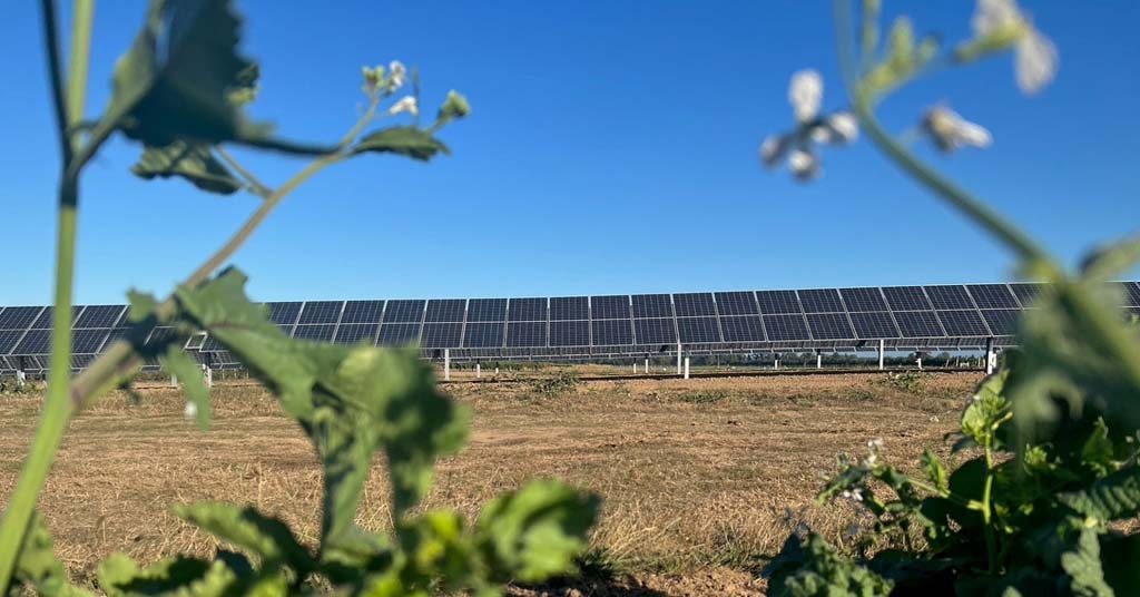
Solar Harvest, the agrivoltaics collaboration between Oregon Clean Power Coop and OSU’s College of Agriculture, is the first field-scale research station aimed at studying whether solar panels can improve things like soil health, water use and crop yields.

It’s also part of a community solar program serving electricity to OSU’s North Willamette Research and Extension Center.

Solar Harvest just completed its first growing season after coming online in April.

Higgins said his group celebrated with a big harvest meal, which included watermelon grown without irrigation.

Throwing shade

Vast tracts of open land make agricultural areas a great place to place solar arrays.

But can large panels coexist with crops or livestock?

Chad Higgins, associate professor in the College of Agricultural Sciences at Oregon State University

Sunny outlook: Chris Higgins. Photo: OSU

Higgins calls sunlight the “forgotten resource” on agricultural land.

“It’s the one that is least likely to be managed,” said Higgins, adding that sunlight is always in excess on a farm.

“It’s uncommon to realize how much energy is in sunlight. There’s so much energy in sunlight that the plants can’t take it all,” he said.

Placing solar panels on agricultural land can serve a dual purpose.

The panels generate energy that can be used by the farm—or delivered to residential homes.

Panels can also help plants and animals survive the hottest, driest parts of the year by providing shade. Shade can translate into reduced water demand.

“What is the plant to do when it gets too much energy? It heats up. What’s the only thing a plant can do to cool down? Drink water,” said Higgins. “So all of that excess solar that goes onto the plants is translated one-to-one to water draw from the ground—that goes into nothing productive. All you have to do is shade the plants and you save a proportional amount of water.”

Extra shade offers other benefits to the crops: cooler soils, increased humidity, less stress on plants and potentially increased crop yields.

The Solar Harvest project is testing a range of shade and water conditions to see what works best, “because somewhere—and I don’t know where it is, because no one’s studied this—somewhere there is the perfect combination of light and water to make the plants grow the best,” said Higgins.

Atypical array

There are limits to how much shade plants will tolerate—and not all plants can be optimized using shade.

But for crops such as alfalfa, beets, bok choy, cabbage, carrots, lettuce, spinach, sweet potatoes, turnips and yams, farmers could shade their plants up to 50%, depending on the species, with little consequences on output.

There’s nothing revolutionary about providing shade to crops. But farmers receive an additional bonus by using solar panels instead of more traditional means, such as shade cloth.

“Why not shade it with something that creates a tertiary farm product?” asked Higgins. “This is where you get into agrivoltaics: you engineer a system such that it removes the excess sunlight to optimally manage your farm resource for the benefit of the crop.”

Solar array and sheep

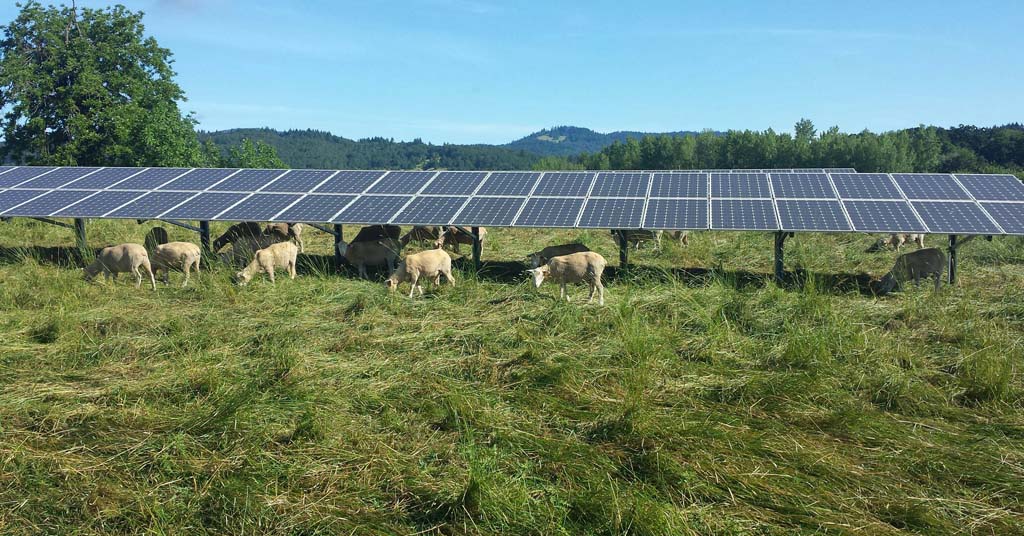
Shady acres: Sheep graze under the 35th Street Solar Array at Oregon State University. Photo by Mark Floyd/OSU

Solar Harvest is a 120 kW array. It uses bifacial solar panels that let some amount of light through to the ground, but provide enough shade to help plants cool off.

“These systems don’t look exactly like a standard solar array,” said Higgins.

The solar panels tilt upwards to allow farming equipment to pass between the rows, preserving 95% of the farm footprint.

Farmers can manage sunlight by moving the panels into different configurations, some up some down, for example, to reach specific outcomes.

“If you are at a deficit of 30% water, you can take 30% of the light away and not have to suffer,” said Higgins.

Some research shows that crops can actually help increase the efficiency of the solar panels, too. The panels operate better in cooler conditions, just like the plants do.

Taking agrivoltaics mainstream

Solar Harvest, which will provide research over a 20-year period, is one of the first pilot projects of its kind in the country. Higgins hopes his research will pave the way for more acceptance of solar energy among rural communities.

Nationally, the agrivoltaics industry is still nascent.

There are only a handful of commercial agrivoltaic installations across the country. But with wider adoption, the sector could help the nation meet its decarbonization goals.

An OSU study from 2020 estimates widespread adoption of agrivoltaics could put a dent of 330,470 metric tons in the agriculture sector’s greenhouse gas emissions annually.

There are obstacles to overcome.

In Oregon, permitting is one of the largest barriers. Under Oregon state law, areas with better soils for agriculture are not typically permitted for renewable energy installations.

“Willamette Valley is a Goldilocks zone for agriculture,” said Higgins. “It’s actually a fantastic place to do agri-solar, if the community wants it.”

The Pacific Northwest’s only nonprofit, non-advertiser-driven news source devoted to environmental issues affecting the Columbia River Basin, Columbia Insight depends on support from readers like you. You can help us continue investigating critical stories by donating here.

The post A new idea could ease tensions between farmers and solar energy developers appeared first on Columbia Insight.
In the Klickitat River Delta, a microcosm of Pac NW stakeholder clashes

Can salmon, steelhead, eagles, kiteboarders, Tribes, BNSF, the Forest Service and one tiny Washington town come together to share a unique piece of water?

In the Klickitat River Delta, a microcosm of Pac NW stakeholder clashes

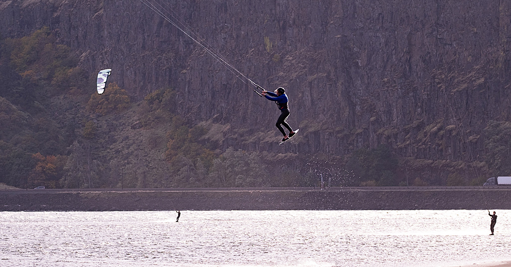
Tricky spot: Kiteboarders around the Klckitat River Delta are attracting attention. Not all of it good. Photo: Jurgenhessphotography


By Bill Weiller. October 26, 2023. Just east of its origin in Vancouver, Washington, State Route 14 is one of the most scenic and historic highways in the Pacific Northwest, if not the entire country.

Forming a section of the Lewis and Clark Trail Scenic Byway, the highway winds through the entirety of the Columbia River Gorge.

Heading east, where SR 14 enters the tiny town of Lyle (pop. 269), most motorists steal glances over their right shoulders across the Columbia River to marvel at the towering bluffs around the Rowena Crest Viewpoint on the Oregon side of the Gorge.

With such spectacular scenery, it’s easy to miss another remarkable feature of the area—one that’s recently emerged as a flashpoint for stakeholder conflict, and become a microcosm of similar issues playing out around the Pacific Northwest, as an increasing number of interest groups, government agencies, tribal nations and private citizens vie for access to and control over public resources impacted by climate change and steadily growing public usage.

On the outskirts of Lyle, the Klickitat River flows into the Columbia River, creating the Klickitat River Delta.

Klickitat River Delta

Delta don: Lyle, Washington, is located on the banks of both the Columbia and Klickitat Rivers. Photo: Jurgenhessphotography

Just below a highway bridge that passes over the river, the delta spreads out across the Columbia River like a broad and shallow fan, creating the point of Klickitat River access for migrating salmon and steelhead, and the birds that feed on them.

These same conditions also happen to make the delta perfect for kiteboarders. Lots of kiteboarders.

Therein lies, at least for now, a major challenge for the town of Lyle, conservationists, recreationists, the land-owning BNSF Railway and various government entities.

As president of the Lyle Community Council, I’ve been involved for several years with a public process undertaken to resolve issues surrounding legal access to the Klickitat River Delta.

Though work is ongoing, issues around the delta have proven tricky to sort out.

Fish and wildlife concerns

Once used for cattle grazing as part of a Starr Ranch operation, the Klickitat River Delta became a focal point of conservation efforts when the U.S. Forest Service bought the ranchland in 1994.

The USFS also owns the spit of land that stretches into the delta.

Bald eagle a Klickitat River Delta

Fish flight: Eagles converge on the Klickitat River Delta for winter feeding. Photo: Jurgenhessphotogrpahy

After its purchase of Starr Ranch land, the USFS constructed facilities and a loop trail leading to what it now accurately deems “a prime bald eagle viewing spot” in winter months. In winter, eagles from around the Pacific Northwest migrate to the area to feed on spawned-out salmon that wash up on the delta’s sand and gravel bars, making them easy pickings.

As I learned during an Oregon State University pilot class called Climate Stewards, which took place on the banks of the delta in September, salmon and steelhead migrating up the Columbia River are attracted to the delta’s cool waters.

Snow-melt water flowing into the Columbia from the Klickitat—which originates on Mount Adams in the high country of the Yakama Indian Reservation—makes the delta a vital cold water refuge for salmon and steelhead in the warming Columbia.

Three speakers in the Climate Stewards class—two from the Yakama Nation and one USFS staff—explained the challenges of maintaining the delta as a cold water refuge.

In recent years, the delta’s waist-deep waters have been warming. That’s a troubling trend for salmon and steelhead, which are sensitive to water temperatures.

What’s more, according to the USFS, it’s been a boon to freshwater bass, which prey on salmon smolts.

The Yakama Nation has championed federal research into deepening the channel by dredging the area where the Klickitat River flows into the Columbia. The hope is to keep water temperatures there relatively cool, and, thus, safer for salmon and steelhead.

Enter kiteboarders

The delta’s shallow, warming waters have also been a boon to another group—kiteboarders.

No one knows precisely when the delta became a magnet for kiteboarders—the area was the site of sailboarding speed trials in the 1980s, according to one local source—but their activity here has picked up considerably over the past decade.

“The Klickitat Delta has perfect launching conditions only found in two other locales … in the world,” according to Mike Evans, who works with the Columbia Gorge Wind & Water Association.

Those “perfect conditions” include a broad, shallow launch point leading to a wide body of water with reliable wind.

The undeveloped delta has been discovered.

Visitor data wasn’t collected during the 2023 summer recreation season, but Lyle Community Council members estimate that hundreds if not thousands of kiteboarders descended on the delta, likely even more so than in previous years when usage was heavy.

Part of that estimate is based on tickets for illegal parking issued by Klickitat County deputies.

Along the highway, a potholed, gravel turnout provides haphazard delta parking for about 15 vehicles. From there, one either runs across the busy highway then heads down a hill and across a set of railroad tracks to the delta, or (wisely) takes a footpath under the road then crosses the tracks to enter the site.

No signs mark the parking spot. No restrooms or other facilities are in sight. No fees are collected. Rashawn Tama of the USFS calls it an “unmanaged site.”

Many drivers resort to simply parking along the highway or in other unauthorized places.

Railroad no trespassing sign

Defiance: Kiteboarders are flying past the law. Photo: Jurgenhessphotography

The parking situation along SR 14 has also raised the hackles of the BNSF Railway, by some estimates the largest freight railroad in the United States.

BNSF owns tracks and a wide swath of land between the highway and Columbia River.

Despite visible signage forbidding the public from crossing the tracks, kiteboarders (and others) regularly trespass over railroad property in order to gain access to the delta.

The railroad has backed up its warnings to trespassers by issuing its own citations.

Adding intrigue, Klickitat County Prosecuting Attorney David Quesnel told the Lyle Community Council this summer he would not prosecute the railroad’s tickets. (BNSF did not respond to a request for comment for this story.)

Resolution efforts

It’s not clear what impact recreation is having on the fish and wildlife that depend on the Klickitat River Delta.

During the Climate Stewards class, one of the Yakama Nation speakers confirmed that the Tribe’s interest in the delta lies with conservation, not recreation. This presumably explained why the Tribe has shown little interest in engaging in conversations about access to the delta. (Yakama Nation Fisheries did not respond to a request for comment for this story.)

The effort to allow legal recreation in the Klicktat River Delta and settle ongoing access disputes will ultimately require cooperation from all interested parties. All voices are valid and should be heard and considered

In 2021, the Lyle Community Council formed a Delta Committee to resolve issues surrounding delta access. In the past year, participation has grown to include the USFS, kiteboarders, local citizens, Klickitat County, the Washington Utilities and Transportation Commission (which regulates the railroads) and Washington State Parks. To date, neither BNSF nor the Yakama Nation have joined official discussions.

Bringing BNSF to the table will likely require conducting a feasibility study that would recommend solutions. That process is costly.

Klickitat River Delta image by Google Earth

Fan base: Cool water flowing from the Klickitat (seen here in light green) into the Columbia River creates a cold water refuge for migrating fish. Photo: Google Earth

Another potential partner, the National Park Service, has a small recreation and trails grant program that provides free community mediation and can provide project funding. This year, the Lyle Community Council and USFS developed a joint grant proposal to the NPS, but the USFS decided not to submit the proposal when it became clear the Yakama Nation would not join the process.

Even if the railroad agrees to make public access to the delta legal, the fish-friendly dredging project could produce a tonnage of mucky spoils that would likely be placed on the delta’s sandbar and planted with native vegetation, potentially rendering the site unsuitable as a put-in location for kiteboarders.

While the Lyle Community Council is on record supporting salmon restoration at the delta, it’s unknown whether fish and kiteboards will ultimately be able to coexist on a small patch of delta that, at least in winter, remains a lonely and lovely place to walk … illegally.

The views expressed in this article belong solely to its author and do not necessarily reflect the opinions of anyone else associated with Columbia Insight.

The post In the Klickitat River Delta, a microcosm of Pac NW stakeholder clashes appeared first on Columbia Insight.
BLM has a plan to tackle booming recreation — at least in theory


BLM has a plan to tackle booming recreation — at least in theory
People with off-highway vehicles recreate at Anthony Sand Dunes, Idaho.
Bob Wick/Bureau of Land Management

People visited Bureau of Land Management land more than 80 million times in 2022, hiking, biking, driving, exploring, hunting, fishing, climbing, camping and otherwise recreating. That’s a 40% increase over the past decade. In the same time period, the BLM’s recreation budget rose by only 22%.

The combination translates into a vexing problem for public-land managers in the West: Popular areas risk being loved to death. On the ground, this means more cars, trucks and ATVs barreling over sensitive species, and more garbage littering more trails through winter wildlife range and campsites. Meanwhile, the agency lacks the resources to keep up.

“In the past, we’ve had the luxury of being passive, because our lands haven’t faced that much pressure,” says Joel Webster, vice president of Western conservation for the Theodore Roosevelt Conservation Partnership. “But now, if we’re not proactive, it’s going to have some serious consequences.”

In an attempt to head off those consequences, the BLM recently released a 28-page document called the “Blueprint for 21st Century Outdoor Recreation.” In it, the agency takes on persistent issues linked to recreation’s increasing popularity, including harm to sacred tribal sites, chronic funding shortfalls and barriers to equal use, such as limited outreach and lack of diverse staffing.

The plan itself reads at a high level, addressing four broad goals: bringing in more money, building partnerships across public and private sectors, improving outreach and inclusion, and protecting the land while meeting the demands of increased recreation. The public has until Sept. 30 to give feedback to the agency.

The document is not a formal plan, but Webster said its recommendations could help relieve some concrete recreational pressures, beginning with the fact that only about 30% of BLM lands have a basic travel management plan. That means new roads and trails pop up across landscapes from sagebrush to slickrock, with little regard for an area’s wildlife and cultural sites.


A trailhead at the 32,000-acre Cline Buttes Recreation Area in central Oregon.
Bob Wick/Bureau of Land Management

As a first step, the agency should account for existing trails and roads, said Megan Lawson, an economist for Headwaters Economics, a nonprofit research firm based in Montana. The BLM has successfully identified most of its natural resource development opportunities. Doing the same for its trails would not only help protect important sites, but also help local communities manage and benefit from recreation.

The agency also needs to figure out just how many people are using various sites and find ways to prevent crowding and overuse at the most popular areas.

Take Moab, Utah. Visitation exploded there with hikers, bikers, climbers and campers drawn by its famous swooping sandstone, wavy dunes and towering crags. But Moab is also heralded as an example of how to respond, with hikers, bikers — both motorized and non — and other community members working with the BLM diligently, year after year, to build and maintain trails able to handle the ever-increasing crush of visitors. The coalition has also helped ease the burden on nearby national parks by redirecting thrill-seekers to other vast tracts of public land.

But it takes money, Lawson said, to track trail-users and post signs, build outhouses and educate visitors in multiple languages, and not all communities have the financial resources of an outdoor mecca like Moab.

And the BLM’s recreation budget is “trending in the wrong direction,” said Kevin Oliver, BLM’s division chief for recreation and visitor services. Ten years ago, the BLM spent about 84 cents on each visit. Today that number has fallen to 74 cents.

The agency is seeking fundraising help from the Foundation for America’s Public Lands, its congressionally authorized charitable partner, Oliver said. This could include individual donations and possibly corporate sponsors. It is also hoping for a financial boost from federal laws like the Great American Outdoors Act, which set aside billions of dollars for access to and infrastructure improvements on public lands.

BLM officials aren’t complaining about having more visitors; Oliver called the recreation spike “fantastic.” But they acknowledge that, as things stand, they simply cannot cope with the increasing demands. They know that the 40% visitation bump isn’t an aberration: Americans want to get outside.

The new document stresses the importance of states, tribes and local communities working with the BLM to come up with solutions. But the coalitions they create need to be durable, Oliver said, given inevitable changes in administrations and political priorities.

Webster agrees. While the growing numbers of visitors have already damaged some popular areas and put pressure on wildlife from elk to sage grouse, especially in states like Colorado, the bulk of BLM lands are not yet recreation destinations. But that can change quickly, and Webster wants the agency to plan ahead.

“It’s a lot harder to pull things back in if you’ve made a mistake than it is to do it right from the beginning,” Webster said. “And there’s just more people in the West, and more people recreating on our public lands.”


A mountain biking trail on Bureau of Land Management land near Moab, Utah, offers views of Arches National Park. In recent years, the BLM and local community members have built new trails to help ease the burden on nearby national parks.
Leslie Kehmeier/International Mountain Bicycling Association/BLM

Christine Peterson lives in Laramie, Wyoming, and has covered science, the environment and outdoor recreation in Wyoming for more than a decade. Her work has appeared in National Geographic, Outdoor Life and the Casper Star-Tribune, among others. We welcome reader letters. Email High Country News at editor@hcn.org or submit a letter to the editor. See our letters to the editor policy.

Why Washington’s Tunnel 5 Fire is destined to be repeated

Without a major policy shift, more private homes will burn and more public money will be spent trying to protect them

Why Washington’s Tunnel 5 Fire is destined to be repeated

Not all can be saved: A Fire Boss amphibious air tanker dumps 200 gallons of water over the Tunnel 5 Fire. The house in flames (left) and directly beneath the water drop were completely destroyed. Photo: Jurgen Hess

By Jurgen Hess. August 3, 2023. On July 2, the Tunnel 5 Fire began in Underwood, Washington, about two miles west of the town of White Salmon in the Columbia River Gorge National Scenic Area.

Before being 80% contained by mid-July, the fire scorched 529 acres and destroyed 10 structures, mostly homes. At least 40 fire engines, 256 firefighters and other personnel, five helicopters, six dozers and 16 water tenders were employed to fight the blaze.

The cost is still being calculated, but a single retardant drop by jet airplane on the Tunnel 5 Fire cost as much as $12,400.

The expense for fighting the 2017 Eagle Creek Fire on the Oregon side of the Columbia River Gorge eventually reached $40 million.

For two weeks, the Tunnel 5 Fire provided a shocking and unsettling sight as flames and smoke billowed above a stretch of the Columbia River dotted with large, cliff-top homes.

But it was hardly unprecedented.

In 2007, the Broughton Fire burned 200 acres and seven structures (including five houses) in the precise location.

That fire was caused by the BNSF Railway Company’s grinding of nearby railroad tracks. “Track grinding” or “rail grinding” repairs deformities and corrosion of rail tracks due to heavy use. The process creates sparks.

The cause of the Tunnel 5 Fire remains under investigation.

Close call: The Tunnel 5 Fire blew up steep slopes carried by fuels of trees, shrubs and grass. This house was fortunate to be spared from the fire. Photo: Jurgen Hess

Two wildfires in the exact location in just 16 years—is this simply a coincidence, a supreme stroke of bad luck?

Unfortunately no.

The Broughton and Tunnel 5 Fires burned, proved so difficult to fight and were wildly expensive to contain for similar reasons.

Might another catastrophic blaze burn in the same area in the near future?

Unfortunately it’s likely.

The reasons have to do with the geography of the area around Underwood and particular regulations that govern private property in the National Scenic Area.

But they also point to broader issues involving the encroachment of residential homes in heavily forested areas, and the way the U.S. Forest Service currently prioritizes private real estate (i.e., houses) over public resources (i.e., trees and surrounding habitat) when fighting fires.

Is such a policy wise? Is it in the public’s interest?

With national insurance companies beginning to refuse to issue policies for homes in some parts of the country due to “growing catastrophic exposure,” is it time to reconsider the construction of houses in fire-prone areas and the way we fight nearby fires when they inevitably come?

Recipe for disaster

Located along Washington State Route 14 at the confluence of the White Salmon and Columbia Rivers, Underwood is an unincorporated community within the Columbia River Gorge National Scenic Area. Its position atop a set of bluffs commands fantastic views of the Columbia River Gorge and, across the river into Oregon, Mount Hood.

But the bluffs atop which the community sits are so steep they form a nearly vertical wall.

In summer, these slopes are covered with highly flammable dry grass, brush and trees. One source of ignition and a decent wind are all that’s needed to send fires roaring up the hillside. (In the first days of the Tunnel 5 Fire, winds gusted between 35 and 40 mph.)

Heaven meet Hell: Slopes below Cook Underwood Road burned right up to the hilltop houses. Photo: Jurgen Hess

At the bottom of the bluffs, SR-14 and adjacent railroad tracks—both proven and potent sources of ignition—parallel the river.

At the top of the bluffs, Cook Underwood Road is lined with over 50 houses, each surrounded by forest, trees and brush.

The recipe for disaster is obvious.

“We can’t stop the fires, [we] shouldn’t build there,” Robin Dobson, a retired U.S. Forest Service ecologist who worked in the Columbia River Gorge National Scenic Area for 24 years, told Columbia Insight after the Tunnel 5 Fire. “We need to use our common sense.”

“Nobody thinks [fire] can happen to them, but the reality is that it does,” said Dan Harkenrider, USFS National Scenic Area manager from 2001 to 2011.

How Firewise are we?

In 2002, recognizing the growing problem of wildfires in rural residential areas (especially California), the National Fire Protection Agency created an educational program called Firewise Communities USA. The idea was to teach homeowners best practices for how to live “fire wise” in Wildland Urban Interface (WUI) areas as a way to mitigate potential wildfire losses.

Firewise measures include removing shrubbery and trees close to home ignition points by creating a “lean, clean and green landscape” zone; using fire-resistant building materials; screening house vents; and keeping gutters free of burnable material.

Dan Richardson, Underwood Conservation District, Climate and Community Resilience lead, administers the Firewise program in Underwood by doing a wildfire home hazard assessment.

Firewise home review in Columbia River Gorge

Passing grade: Dan Richardson (right) conducts a Firewise review at the Columbia River Gorge home of Luci Walker and Kevin Widener. Photo: Jurgen Hess

On a recent visit to the home of Luci Walker and Kevin Widener (north of Cook Underwood Road, not in the immediate area of burned houses), Richardson walked around the perimeter of the home looking for vegetation too close the house.

After explaining that most house fires are started by glowing embers, he noted that all vents in the house were well screened and that the house siding was made of unburnable cement board. The gutters were largely empty of burnable debris. There was no bark dust, which is very flammable.

A small juniper plant was recommended for removal.

A question arose of what to do about a long line of large Douglas fir trees on the east property line. Those trees could carry a crown fire.

Richardson concluded that picking up limbs and debris, cutting branches to a height of 10 feet and thinning out smaller trees would help reduce fire risk.

Overall, the homeowners got a report that the house met Firewise standards, with a few recommendations for improvement.

Conflicting guidelines

The Columbia River Gorge National Scenic Area Management Plan includes provisions for implementing Firewise practices.

“The reviewing agency shall provide information on Firewise standards to landowners at the time of application (for a building permit),” states the plan. “Landowners shall be encouraged to incorporate Firewise standards in their proposal.”

Fire-risk directions are also included in the Gorge Commission’s recently adopted Climate Change Action Plan.

But Lisa Naas Cook, a planner with the Gorge Commission, says meeting National Scenic Area standards of scenic preservation and reducing fire risk is a tricky dance.

That’s because homeowners in the Gorge are bound by National Scenic Area Management Plan regulations that require houses be screened with trees or other vegetation to meet scenic-protection measures.

Air war: Black spots in the sky during the Tunnel 5 Fire are hot embers driven by upslope winds. During wildland fires, embers are the primary ignition source for house fires. Photo: Jurgen Hess

In a way it feels like a trap, with Firewise and National Scenic Area guidelines appearing to be at odds.

“Absolutely there is a conflict between fire safety (and scenic standards),” said ecologist Dobson.

Cook said the Commission plans to take a closer look at the issue during its next Management Plan review.

According to the Gorge Commission’s website, the Commission can amend its plan “if it finds that conditions in the National Scenic Area have significantly changed.”

At this time, however, there is no proposal on record to amend the plan.

During the public input phase of the Climate Change Action Plan development, several members of the public argued for more stringent standards to reduce fire risk.

Janet Wainwright, a former Gorge commissioner, wrote: “Mandate (not suggest) all new construction adhere to Firewise standards. Make this one of the requirements of application approval.”

But such measures can do only so much to prevent wildfires from burning homes built within forests and other wilderness areas.

“Homeowners who live in forested settings must take responsibility and prepare their property to survive wildfire rather than relying on firefighters to save their homes,” said Jack Cohen, a USFS research scientist. “Because during intense fire conditions firefighters will likely be overwhelmed.”

Private property vs. public treasure

When fighting fires, USFS policy dictates that saving human lives is the top priority, followed by saving property, such as houses and businesses.

This became a problem when the Tunnel 5 Fire struck. Firefighters weren’t sent onto the steep slopes below the Underwood houses due to safety risks.

“It’s just too hazardous for firefighters to work on the steep ground,” Bobby Shindelar of Northwest Incident Management Team 12 told Columbia Gorge News.

Instead, at a great financial cost, aircraft dropped water and retardant on the steep slopes.

Extreme slopes: It’s not just flames and smoke that imperil firefighters. Treacherous inclines, like those faced by these Tunnel 5 firefighters, introduce another level of danger. Photo: Wash. DNR

Firewise is good practice, but after an event like the Tunnel 5 Fire it’s reasonable to wonder how much homeowners can realistically do to prevent the loss of property constructed in such an obviously precarious place.

Shifting attitudes of insurance companies may also become a factor in the way we view fighting fires.

On May 26, State Farm Insurance announced it would no longer accept applications for home and business insurance in California due to “historic increases in construction costs outpacing inflation, rapidly growing catastrophe exposure and a challenging reinsurance market.”

Some of those increased construction costs and catastrophic exposures are related to high fire risk and requirements to make new homes fire-safe.

In conversations with Columbia Insight, County Commissioner Lennon, Scenic Area Manager Harkenrider and several Tunnel 5 firefighters said they believed insurance policies would be a “check” and on future construction in fire-hazard zones.

But David Waymie, director of the Skamania County Public Works and Planning Department, which administers building permits in the area of the Tunnel 5 Fire, said his department is unlikely to require fire-protection measures for homes being rebuilt in the wake of the fire.

But, he said, “there is a risk in living in the forest. While the view is tremendous, there is a fire danger.”

Homeowners in Skamania County have two years to start the process of replacing a burned house.

Same old, same old?

Another fire in Underwood is likely because conditions that led to the previous two fires will remain stable.

SR-14 isn’t going anywhere. Neither are the railroad tracks nor the steep, vegetated cliffs directly below the community.

For maybe 10 years or so after a fire, fuels and risks are lower. But with hotter and dryer weather fire risk is increasing, especially on these slopes,” said Lorretta Duke, South Zone fire management officer of the Gifford Pinchot National Forest, a portion of which is located in Skamania County.

Duke also points to rail-grinding operations. “Consider timing of grinding to not do that during high fire danger times,” she said.

“There needs to be conversations with Burlington Northern as to their track-grinding procedures,” Skamania County Commissioner Tom Lennon told Columbia Insight when asked about preventing future fires in the area.

Others are more blunt in their assessment of construction and rebuilding of houses destroyed or damaged in areas of high fire risk.

“It seems crazy to build a new house in this fire-risk zone,” said Harkenrider. “Where is the line where people shouldn’t be allowed to build?”

The post Why Washington’s Tunnel 5 Fire is destined to be repeated first appeared on Columbia Insight.

The post Why Washington’s Tunnel 5 Fire is destined to be repeated appeared first on Columbia Insight.

Why Washington’s Tunnel 5 Fire is destined to be repeated was first posted on August 3, 2023 at 9:19 am.
©2022 Based in Hood River, Oregon, Columbia Insight’s mission is to publish original, balanced journalism about environmental issues affecting the Pacific Northwest. Columbia Insight is a fully independent, registered nonprofit organization. To support environmental journalism “donate here” to Columbia Insight.

Oregon’s Greater Idaho movement echoes a long history of racism in the region

The latest movement, Greater Idaho, seeks to slice off almost everything east of the Cascade Mountains and add it to Idaho, uniting the right-leaning portions of the Beaver State with its more conservative neighbor. Nearly two dozen people conceived the idea over pizza and soft drinks in a La Pine, Oregon, restaurant in 2019.

Organizers frame Greater Idaho as a natural byproduct of Oregon’s “urban/rural divide” — shorthand for how populous cities can sway a state’s politics. The idea is far-fetched: In order for eastern Oregon to become Idaho, Oregon’s Democratic-dominated Legislature, Idaho’s Republican-dominated Legislature and the divided United States Congress would all have to agree. Still, the campaign has gained attention, garnering articles in national media outlets; in 2021, The Atlantic called it “Modern America’s Most Successful Secessionist Movement.”

But less attention has been paid to its underlying motives and how they fit into the Northwest’s long history of racially motivated secessionism. Over time, Greater Idaho has slowly revealed itself to be something of a poisoned apple: framed as a gift to discontented rural people, but actually a front for far-right culture war talking points, including racist ones.

The movement’s website and leaders echo Trumpian rhetoric about “illegals” and lambast Oregon for education programs about Black history and public health measures that prioritize communities of color. During the first year of COVID-19 restrictions, in 2020, Mike McCarter, a movement leader, told a regional website that Oregon “protects Antifa arsonists, not normal Oregonians.” He added, “It prioritizes one race above another for vaccines and program money and in the school curriculum, and it prioritizes Willamette Valley” — where Portland is located — “above rural Oregon.”

In 2021, Eric Ward, then-executive director of Western States Center, a Portland-based pro-democracy think tank, accused Greater Idaho of simply reviving what the Oregon Capital Insider described as a “white ethno-state dream.” The center’s advocacy arm later sponsored anti-Greater Idaho TV ads.

Over time, Greater Idaho has slowly revealed itself to be something of a poisoned apple: framed as a gift to discontented rural people, but actually a front for far-right culture war talking points, including racist ones.

McCarter pushed back: “Calling us racist seems to be an attempt to associate a legitimate, grass-roots movement of rural Oregonians with Hollywood’s stereotypes of low-class, ignorant, evil, ugly, dirty Southerners,” he said in a statement posted alongside photographs of Ward and Western States Center’s board — who are all Black — and the center’s staff. “(Ward’s) words mark anyone with a Greater Idaho sign or a Greater Idaho hat as targets for violent antifa members.”

Meanwhile, prominent racists were fired up about the idea. White nationalist leader Jared Taylor touted it on his podcast: “People who live out in the continents of rural sanity, they don’t want to be governed by the people who live on those islands of urban insanity,” he said. The audio was repurposed for a video on the far-right social network Gab — where former Fox News host Tucker Carlson is considered a trusted media source and no one would get banned for posting a swastika. Users buzzed about Greater Idaho.

Articles and clips on the anti-immigrant website VDARE also promoted it. One blog post said that Greater Idaho “would free eastern Oregonians from the anti-white, totalitarian leftists who rule the state.” A video warned that Oregon “won’t protect its residents from thugs, illegal aliens, communist rioters and other undesirables.”

Because Greater Idaho is unlikely to become a reality, “people dismiss it,” said Stephen Piggott, a program director with Western States Center. And that, he believes, is dangerous: “People are not connecting the dots,” he said. “The people who want to create a white homeland are backing it.”

WHEN OREGON WAS ADMITTED to the Union, its Constitution contained a clause banning Black people from moving there — the only state with such a provision. Even before its borders were drawn, people floated the idea of creating a slave-owning haven in what is now southern Oregon and Northern California, branding it the “Territory of Jackson,” after President Andrew Jackson. Confederate sympathizers considered several of the new state’s southernmost counties “the Dixie of Oregon.” Later, in the mid-20th century, the State of Jefferson movement emerged in the same area; it nixed owning slaves, but retained a slave owner as its namesake. Driven by people who felt they were over-taxed by Oregon and California, the movement still has supporters.

The secessionist torch passed from generation to generation. The phrasing changed, but the talking points remained the same.

In 1986, after migrating from California to North Idaho to build a racist refuge for his group the Aryan Nations, white supremacist Richard Butler hosted his annual Aryan World Congress — a national gathering of neo-Nazis, racist skinheads and members of the Ku Klux Klan. They agreed that, in the not-so-distant future, U.S. cities would become so overrun by minority groups that white people would be forced to flee to an “Aryan homeland” they envisioned in Washington, Oregon, Idaho, Montana and Wyoming.

Butler died in 2004. Eventually, his compound was fully bulldozed and his acolytes scattered, but his ideas remained and evolved. In 2011, survivalist blogger and New York Times best-selling novelist James Wesley, Rawles floated an idea called “The American Redoubt.” (According to the Anti-Defamation League, some individuals add errant punctuation to their names to distinguish their first and middle names from their government-imposed or family names.) He encouraged Christians of any race who felt alienated by urban progressive politics to relocate to the Northwest, writing: “I’m inviting people with the same outlook to move to the Redoubt states.” Recently, the Idaho Freedom Foundation, a right-wing political think tank, echoed this. “Are you a refugee from California, or some other liberal playground?” it asked on its website, welcoming those newcomers as “true” Idahoans.

Starting in 2015, then-Washington state Rep. Matt Shea, R, pushed to sever his state at the Cascades, rebranding the rural eastern half as “The State of Liberty,” which advocated against same-sex marriage, marijuana and environmental regulations. Shea distributed a document calling for Old Testament biblical law to be enacted. On its website, Liberty State organizers suggest that if Liberty becomes a reality, they would be open to merging with Greater Idaho.

Within the last two years, Vincent James Foxx, a white nationalist associated with the Rise Above Movement — a group the Southern Poverty Law Center described as “an overtly racist, violent right-wing fight club”— relocated to Post Falls, Idaho. “A true, actual right-wing takeover is happening right now in the state of Idaho,” Foxx declared.

Greater Idaho is driven by ideas similar to those behind past movements: fleeing cities, lauding traditionalist Christian values, pushing a far-right political agenda. “Ultimately, I think in some ways, Butler’s vision is coming true,” said David Neiwert, an expert on far-right extremism and the author of The Age of Insurrection.

What all these secessionist ideas have in common, Neiwert said, is that they are anti-democracy. Greater Idaho’s organizers “don’t really want to put up with democracy,” he said. “They don’t want to deal with the fact that if you want to have your position win in the political arena, you have to convince a bunch of people. They just want to take their ball and create a new playground.”

Gary Raney, former sheriff of Idaho’s Ada County, where Boise is located, disliked seeing his state “being advertised as an extremist haven.” In response, last year he founded Defend and Protect Idaho, a political action committee that fights political extremism. “Everybody’s entitled to their opinion, and I welcome that discourse and discussion,” he said. “But when people are wanting to overthrow our government or our republic or our democracy … there’s nothing healthy about that.”

What all these secessionist ideas have in common, Neiwert said, is that they are anti-democracy. Greater Idaho’s organizers “don’t really want to put up with democracy,” he said.

In 2023, the Idaho House of Repre-sentatives passed a nonbinding proposal calling for formal talks with the Oregon Legislature about moving the border, though no such talks occurred. Raney sees Greater Idaho as “driving a wedge” in rural communities, using resentment over urban power to recruit people to more extreme causes. “The good people of Oregon who are doing this for the right reasons: Be realistic that it’s never going to happen, and be more influential in the Oregon Legislature,” Raney said. “For the extremists who are simply using this to divide and create their right-wing haven?

“Stay the hell out of Idaho,” he said. “Because we don’t want you.”

BY GREATER IDAHO spokesman Matt McCaw’s telling, the movement is born out of opposites that run as deep as the land itself. “The west side of the state is urban. It’s green, it’s very left-leaning,” he said in an interview with High Country News. “The east side of the state is conservative, it’s rural, it’s very dry. It’s a different climate.

“Give me a topic, and I can tell you that the people in Portland feel one way about it and vote one way, and the people in eastern Oregon or rural Oregon feel one way about it and vote differently,” he said. “Stereotype is a word that maybe gets a bad rap.”

To become Idahoans, McCaw explained, would mean “to have traditional values that focus on faith, freedom, individualism and tradition.” He pointed to Oregon’s liberal voting record on gun control, abortion and drug legalization. “Broadly, the people (in eastern Oregon) are very like-minded, just like broadly the people in the Portland metro area are very like-minded,” he said. “On these issues, Portland has a very distinctly different set of values than rural America.”

Speaking of differences, there are big ones between Idaho and Oregon. In rural Oregon counties, minimum wage is $12.50; in Idaho, it’s $7.25. Marijuana is legal in Oregon; in Idaho, possession can be punishable with jail time. In Idaho, abortion is essentially illegal; earlier this year, Oregon Gov. Tina Kotek announced the state had acquired a three-year stockpile of mifepristone, a drug used for medical abortions. While there are no detailed plans on how Greater Idaho would bridge these gaps, McCaw said that “all of these things can be worked out.”

But is he upset by the white supremacist support for Greater Idaho? “I think that the extremist thing gets overblown,” he said. “In any group, there are going to be extremists that latch on, no matter if you want them or not.”

Nella Mae Parks, an eastern Oregonian, was raised in Union County, Oregon, and runs a farm there. She doesn’t recognize Greater Idaho’s portrayal of her home. “I think it’s a bought-and-paid-for narrative about what it means to be a rural American,” she said.

On the day Parks spoke to High Country News, she and a dozen other eastern Oregonians had just returned home after a 12-hour round-trip drive to Salem, Oregon’s capital, in an effort to get legislators to address nitrate water pollution. In 2022, commissioners in nearby Morrow County declared a state of emergency after high levels of nitrate — which is common in fertilizer and can cause cancer and respiratory issues  — were found in domestic wells.

Parks’ group came home unsure if they had accomplished anything. “The governor won’t meet with us on our issues, some of our own legislators don’t care about our issues,” Parks said. “I can understand why people feel left behind or left out, or in other ways sort of alienated from the more urban centers of power in Oregon. I think a lot of us feel that way, regardless of our politics.

“When we get blown off, that is widening this rural/urban divide,” she said.

But Parks’ solution is not to leave the state; it’s to fix it. And in May, it seemed like the effort had been worth it: Kotek told eastern Oregon leaders that she had asked the state for $6.2 million to address the nitrate issue. “It has taken a while to get here,” she admitted.

Gwen Trice, who grew up in eastern Oregon, is the executive director of the Maxville Heritage Interpretive Center, a museum in Joseph dedicated to the multicultural histories of Oregon’s loggers. She won’t call Greater Idaho a movement, or even an idea. Instead, she calls it “a notion.”

“I can understand why people feel left behind or left out, or in other ways sort of alienated from the more urban centers of power in Oregon. I think a lot of us feel that way, regardless of our politics.”

Trice founded the museum when she realized that the stories of the region’s Black loggers — including her father — had never been told. The logging industry once thrived in Maxville, now a ghost town. The Bowman-Hicks Lumber Company recruited skilled loggers from the South, regardless of race, despite laws that had long excluded Black people from settling in Oregon. “We’ve worked hard to tell, honor and even embrace the messy part of our history,” she said, “and really tell a truthful story.”

Speaking as a historian, Trice said there’s no difference between Greater Idaho and the previous, more explicitly racist movements. “It’s repackaged,” she said. “I don’t think that anything is being hidden, and it’s appealing to a certain group of people only.

“It’s symbolic of dominant culture saying, ‘We know what’s better for you than you do.’”

Pauline Braymen, an 85-year-old retired rancher in Harney County, called Greater Idaho ideological, and impractical — a way of going back in time. “The urban/rural divide is an emotionally based state of mind that distorts reality,” she said. “The changes and steps forward in our quality of life in the 20th century, during my lifetime, were amazing. I just see all of that progress and vision being destroyed.

“If I wanted to live in Idaho,” she added, “I would move there.”

ON A MAP OF THE NORTHWEST, Washington and Oregon nestle together in semi-rectangular sameness. Divided in part by the Columbia River, Washington eases its southern border into the curve of Oregon’s north, like two spoons in a drawer. But next door, Idaho asserts itself like an index finger declaring “Aha!” or a handgun aimed at the sky for a warning shot.

McCaw, the Greater Idaho spokesman, often says that borders are imaginary lines: “a tool that we use to group similarly minded people, like-minded people, culturally similar people.”

“That whole statement is absolute nonsense,” said former Idaho State Historian Keith Petersen, who wrote a book about the borders in question, titled Inventing Idaho: The Gem States Eccentric Shape. The Idaho-Oregon border, he said, simply made the most geographical sense.

In 1857, two years before statehood, delegates from across Oregon Territory gathered to determine the new state’s edges. They decided that Oregon’s border should run from Hells Canyon south into the belly of the Snake and Owyhee rivers, then drop straight down to the 42nd Parallel. Only one delegate championed the Cascade Mountains as the new state’s easternmost edge, fearful that people too far from the capital wouldn’t be effectively represented.

“This grievance that ‘the population is over there, it’s so far to get there, we’ll never have power and influence,’” Petersen said, “hasn’t changed.”

Earlier this year, at a virtual town hall, two of eastern Oregon’s own instruments of power and influence in Salem — elected Republican lawmakers — grumbled that Greater Idaho was actually siphoning authority away from them, making it hard to effectively govern.

“The Greater Idaho people keep saying we need to do this,” said Oregon State Sen. Lynn Findley, who represents people from the Cascades to Idaho. Greater Idaho supporters have proposed ballot measures across Oregon that would force county officials to hold regular discussions about joining Idaho. None of the measures actually call for moving the border. And support hasn’t exactly been overwhelming; the most recent measure, in Wallowa County, passed by just seven votes. Still, by spring 2023, voters in 12 eastern Oregon counties had approved similar measures. “I’m no longer working on gun bills, abortion bills and other infrastructure bills,” Findley said. “It’s taken time away that I think would be better spent working on tax issues, and a whole plethora of other stuff.”

“We understand the intent and we understand the frustration,” agreed Rep. Mark Owens. “But I’m not going to apologize for having not given up on Oregon.”

But by May, it seemed Findley was, in a way, giving up. He was one of a dozen Republican senators and one Independent who walked out of the Statehouse for several weeks to protest bills on abortion access, gender-affirming care and raising the minimum age to purchase semi-automatic rifles.

In the midst of the walkout, just before Memorial Day, as the rhododendrons in Northeast Portland erupted in magenta blooms, McCaw, in a blue suit and crisp white shirt, sat in front of a live audience at the Alberta Rose Theatre. He was participating in a public discussion hosted by Oregon Humanities, which facilitates statewide conversations “across differences of background, experience and belief.” The event was ostensibly about borders, but by the end it was clear that it was really about Greater Idaho. McCaw repeated his talking points: Eastern Oregonians and western Oregonians are fundamentally different; borders create tension.

“We have a permanent political minority on the east side of the state,” he said.

Beside him were two other panelists, who shifted uncomfortably in their seats. One was Alexander Baretich, who designed the Cascadia flag: a blue-, white- and green-striped banner with a Douglas Fir at its center. The flag represents the larger Cascades and Columbia River Basin bioregion, “a living space — a life space,” he explained. “Once you get into that consciousness that you are interconnected with everything around you … those political borders dissolve.”

It’s the antithesis of Greater Idaho: Cascadia unites, Greater Idaho divides. “That flag is to create that consciousness that we are one with the planet,” Baretich said. McCaw furrowed his brow.

The moderator, Adam Davis, interjected: “I actually get viscerally uncomfortable … when I hear, ‘There’s people on the east side are one way, people on the west side are another way.’” Tension, he said, is difficult, but crucial. “That tension holds what our democracy, if it’s going to be an inclusive democracy, kind of requires.”

McCaw said eastern Oregonians, in 2020, didn’t feel like Oregon was being inclusive when it issued statewide indoor mask mandates. It “super-charged our movement,” he said. “The people on the east side of the state did not want those restrictions.”

“To form a movement because other people aren’t feeling like they have a voice in the state, while completely disregarding this reality and how effective it’s been towards Indigenous people? That is the gaslighting part.”

“I’m just going to straight-up disagree,” said the other panelist, Carina Miller, a member of the Confederated Tribes of Warm Springs and chair of the Columbia River Gorge Commission. Miller lives east of the Cascades on the Warm Springs Reservation, which McCaw told High Country News would be excluded from Greater Idaho, along with the city of Bend, because of their liberal politics.

Throughout the night, Miller repeated one phrase — “societal gaslighting.” She described growing up Indigenous in Oregon, where she received an education that normalized racist policies toward tribes, and where a boarding school built to assimilate Native youth still operates.

“To form a movement because other people aren’t feeling like they have a voice in the state, while completely disregarding this reality and how effective it’s been towards Indigenous people? That is the gaslighting part,” she said. Miller asked McCaw a question: “Do you really think that people who are advocating for Greater Idaho are the most disenfranchised people in these communities?”

People clapped before McCaw could respond.

“A strong majority of people in eastern Oregon do want this to move forward,” he said.

“But is the answer yes or no?” Miller pressed. “Are they the most disenfranchised?”

“I have no idea,” McCaw said.

Miller got the last word: She encouraged people to “hold onto each other and work it out.” The room erupted in applause.

McCaw didn’t join in. Instead, he sat perfectly still, his hands clasped tightly in his lap.   

Leah Sottile was a former correspondent for High Country News. She is a freelance journalist, the author of When the Moon Turns to Blood and the host of the podcasts Bundyville, Two Minutes Past Nine and Burn Wild. Subscribe to her newsletter The Truth Does Not Change According to Our Ability to Stomach It.

We welcome reader letters. Email High Country News at editor@hcn.org or submit a letter to the editor. See our letters to the editor policy.

Oregon Leadership on Child Care Front and Center at White House Event

White House takes a page from the Oregon playbook with recent calls to cap child care payments at 7% of a family’s income and other improvements to increase access SALEM, Ore. – During last week’s White House’s States Convening on Child Care in Washington, D.C., State Representative Lisa Reynolds (D-Washington County) highlighted Oregon’s leadership to […]

The post Oregon Leadership on Child Care Front and Center at White House Event appeared first on Highway 58 Herald.