In Idaho, a controversial mine gets green light despite major concerns

Federal law gives mining interests an advantage in determining the best use of public lands in the Stibnite mining area

In Idaho, a controversial mine gets green light despite major concerns

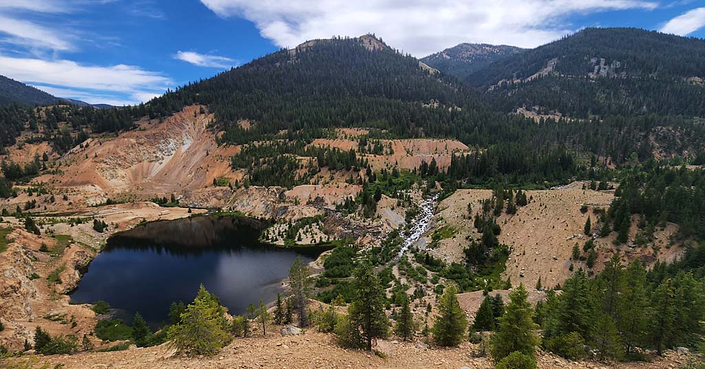
Dig it: The Yellow Pine mine pit in Idaho’s Stibnite Mining area in 2022. The area could once again be opened to mining. Photo: Nick Kunath


By Kendra Chamberlain. October 2, 2024. A proposal to build and rebuild open-pit mines in Idaho’s historic Stibnite mining district is moving forward, even as the U.S. Forest Service acknowledges it could have lasting, negative environmental impacts on the area. 

The Stibnite mining district, located at the headwaters of the South Fork Salmon River, was critical to the United States’ war effort in the 1940s as a rich source of gold, silver, antimony and tungsten. Operations ended in the 1990s and the site was abandoned. 

Perpetua Resources is hoping to reopen the mines, and build a few more, to resume extracting gold, antimony and silver. The Canada-based company, formally named Midas Gold, has been fine-tuning its proposal to the Forest Service for over a decade, as previously reported by Columbia Insight

The proposal has faced significant opposition from the Nez Perce Tribe and groups like Idaho Rivers United, American Whitewater and Idaho Conservation League. 

Last month, Forest Service released a final Environmental Impact Statement and a draft Record of Decision approving the mining proposal. 

Activity in the historic mining district, located in the Payette National Forest and the Boise National Forest, decimated the local environment, notably blocking fish passage and polluting surface waters.

Opponents of the project say the area needs more environmental remediation, not more mining, to help restore protected fish species in the area. 

Litigation expected

The Stibnite site is located next to the Frank Church-River of No Return Wilderness.

The area is also spawning habitat for bull trout and chinook salmon and includes treaty-reserved resources for the Nez Perce Tribe.

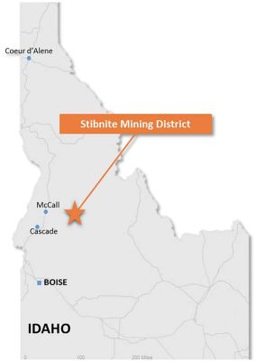
Stibnite Mining District map

Map: USFS


“The Forest Service is stuck in a hard place here,” Idaho Rivers United Conservation Director Nick Kunath tells Columbia Insight. “They need to do this analysis and are mandated to manage these resources, but they’re also governed by some incredibly old laws that essentially determined that mining was the best use of our public lands more than 150 years ago, and still have to treat these projects as such.”

The reference to “old laws” means the General Mining Law of 1872, which establishes hard rock mining as one of the most important uses for public lands in the United States.

Perpetua Resources’ proposal would nearly double the footprint of the existing mining site. But the company says it will remediate some of that legacy pollution, including restoring 450 acres of wetlands, filling in a mine pit and rebuilding sections of the river. 

Still, the project is expected to have significant, long-term impacts on the surrounding environment.

The USFS draft decision notes that despite the mitigation plans promised by Perpetua Resources, the no-action alternative would be the “environmentally preferable” action.

The agency also conceded that water temperatures downstream of the mining site may be impacted if the modeled temperature mitigation measures do not work as hoped. 

“When we look at even in the best case scenario that they’re really putting forward in this analysis, it’s more than 100 years before they think stream temperatures might come back to baseline levels,” says Kunath.

Opponents of the project are reviewing the draft decision and submitting objections.

The Forest Service will need to respond to those objections before releasing its final decision. Given the strong opposition to the proposal, it could be years before Perpetua Resources would be able to begin work. 

“I can’t confirm if [Idaho Rivers United] is going to litigate—or anybody else—but certainly Perpetua expects litigation, and so does the Forest Service, with a project as controversial as this,” says Kunath. 

The post In Idaho, a controversial mine gets green light despite major concerns appeared first on Columbia Insight.

As private interests turn profits on public lands, wildlife and taxpayers pay the price

Why does the public put up with corporate welfare, wildlife slaughter and other government policies it so clearly opposes?

Montage cows, cash and rangleland

Subsidy city: Politics haven’t kept pace with majority opinions on public lands. Photo illustration: Nicole Wilkinson


By Nick Engelfried. July 11, 2024. With a little imagination, Douglas Creek Canyon near the central Washington town of Palisades can call to mind the Inner Northwest before colonization.

Orange and yellow lichens encrust the basalt canyon walls. Sagebrush clings to the lower slopes, especially those too steep for people or livestock to reach easily. Cottonwoods and willows form a green corridor along the creek itself, which carved out the canyon over centuries.

Goldfinches sing from treetops while turkey vultures soar over cliffs.

Prior to colonization, the bio-diverse shrub-steppe of which Douglas Creek Canyon is part covered almost a third of Washington, creating habitat for animals like pygmy rabbits and sage-grouse that are now at risk of extinction.

Elk and pronghorns grazed native bunchgrasses and were hunted by wolves.

Today, a fraction of this ecosystem is left intact.

Over two-thirds of the shrub-steppe has been destroyed, mostly by agriculture, while much of what remains is degraded.

Many casual observers don’t notice the damage precisely because it’s so ubiquitous.

“Most Western lands are now so degraded, the average American thinks that’s what they’re supposed to look like,” says Erik Molvar of the Idaho-based Western Watersheds Project. “But when the first white explorers arrived here, they recorded grass growing up to their horses’ bellies, not the desertified remnants of those ecosystems we see today.”
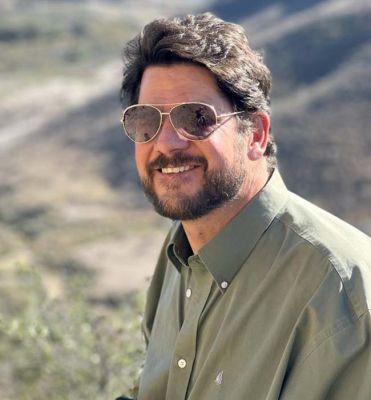
Erik Molvar is Executive Director of Western Watersheds Project

Erik Molvar. Photo: Western Watersheds Project

Compared with many parts of the shrub-steppe, Douglas Creek is in fair shape. In places, sagebrush intermixes with rabbitbrush and bitterbrush, members of the native shrub community.

But many gentler canyon slopes are covered in invasive cheat grass. In some areas, almost no native plants grow.

Given time, and the removal of pressures like livestock grazing, this spot could revert to something like its pre-colonial state.

Perennial grasses could return, making shade that inhibits cheat grass. Sagebrush could spread into gullies where it’s now absent.

Tall grass and shrub communities would create animal habitat while discouraging wildfires.

Perhaps most importantly, the deep roots of native plants would pump tons of carbon underground.

Millions of acres in the dry West, much of it on public lands, are similarly ripe for restoration, with big payoffs for wildlife and the climate.

Yet, federal and state agencies funnel money into programs that actively inhibit natural processes in these places.

From subsidizing grazing to exterminating predators, taxpayer dollars support private interests at the behest of ranchers and agribusiness.

“The livestock mafia has set itself up for business in the West,” says Molvar. “And it’s become a political machine that’s very good at perpetuating its interests on public lands at the expense of other uses.”

Taxpayer-funded killing

Wolves in the Inner Northwest. Beavers on agricultural lands. Historically important salmon streams.

Each of these is an animal or ecosystem adversely affected by taxpayer-funded programs that support agricultural interests.

There are numerous ways government actions benefit cows, sheep and crops. But one of the most direct is killing wild predators who interfere with livestock.

“Since the first European settlers set foot on this continent, they viewed predators as a threat to species humans hunt for game or raise for food,” says Camilla Fox of the California-based Project Coyote. “Public attitudes, science and ethics have evolved since then, but federal practices and policies haven’t kept up.”

In 2023, the federal agency known as Wildlife Services killed over 375,000 native wild animals, according to the Center for Biological Diversity.

Coyote Beaver Red-winged blackbird montage

Photo illustration: Nicole Wilkinson

These included tens of thousands of coyotes, hundreds of cougars and black bears, and 305 gray wolves, a species that remains endangered over much of its range.

Most of this taxpayer-financed carnage takes place far from the public eye.

“The vast majority of people have never even heard of Wildlife Services,” says Fox. “Of those who have, many confuse it with the Fish and Wildlife Service.”

While the USFWS works to restore endangered species, Wildlife Services deals with conflict between people and animals, often by killing the creatures in question.

“Wildlife Services’ role is not to manage wildlife populations, but to minimize damage caused by wildlife,” the agency told Columbia Insight in an email. “Wildlife damage management protects resources and safeguards human health and safety in a responsible and accountable manner.”

Still, critics say Wildlife Services, which is part of the U.S. Department of Agriculture, too often bends to the farming and livestock industries.

“Having a federal agency whose mandate is to mitigate friction between wild animals and livestock creates a conflict of interest,” says Fox. “Its main stakeholders are ranchers and farmers raising livestock in places where there are wild animals. That creates a built-in structure giving agribusiness an outsize influence.”

Wildlife Services doesn’t only kill predators. It also takes out birds that feed on grain and beavers whose dams are unwelcome by landowners.

In 2019, the agency killed over 360,000 red-winged blackbirds.

Traps set for predators may kill or maim pets and endanger people.

A notoriously opaque agency whose activities are difficult to track, Wildlife Services exemplifies how government programs can serve small groups of stakeholders at the expense of public resources.

However, some of the most managed animals in the Pacific Northwest now fall under the jurisdiction of not the federal government, but states.

This is increasingly true when it comes to one of the country’s most contentious predators: wolves.

Wolf politics

In 1947, a hunter collected a state bounty for shooting the last known gray wolf in Oregon.

The species was already virtually extirpated from Washington, and not until the 2000s would wolves start making their way across the Idaho border to re-establish themselves in the two states.

Soon after, Oregon and Washington created state-run apparatuses dedicated to preventing wolves from preying on livestock.
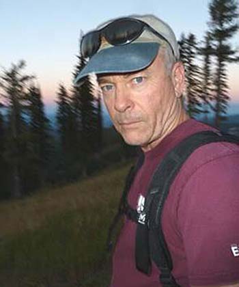
Jay Shepherd of Conservation Northwest

Jay Shepherd. Photo: Conservation Northwest

“It started with just trying to keep track of their whereabouts,” says Jay Shepherd of the Bellingham, Wash.-based nonprofit Conservation Northwest, who worked for the Washington Department of Fish and Wildlife when the first wolf was confirmed to have returned to the state in 2008.

Shepherd was assigned to monitor the animals in eastern Washington.

“Then we started getting calls from people saying they saw a wolf, or one attacked their dog,” he says. “Some of it was just nervousness. But as time went on there were conflicts, especially with cattle.”

Wolves in western Washington are listed as endangered by USFWS, which plays the lead role managing their populations there.

But in the eastern third of Washington, where most packs occur, wolves have been federally delisted and are now managed entirely by the state.

The scale of resources devoted to keeping wolves from livestock speaks to how agricultural interests determine the contours of debate about wildlife, partly by tapping into culture wars grounded less in economics than an idealized image of the past.

“There’s this prevailing romanticism of the cowboy myth in the West, and a desire to keep it alive by supporting ranching,” says Western Watersheds Project’s Molvar. The cowboy era, when large cattle drives occurred across much of the West, is generally considered to have lasted from about the end of the Civil War into the late nineteenth century. “Ranching has borne little resemblance to it since. The cattle industry plays the myth for all it’s worth, though, because of the political benefits.”

Livestock interests’ ability to align themselves with a fondly remembered era has helped cement a base of support beyond those who benefit directly from ranching.

“Early on after wolves returned to Washington, we encountered lots of really angry people,” says Shepherd. “Some weren’t even involved with agriculture themselves, but still wanted to vent about wolves.”

As packs became re-established, many ranchers came to accept wolves’ presence, even if grudgingly. Today Shepherd rarely encounters the kind of vitriol stirred up when wolves first reappeared in the state.

However, WDFW still puts immense effort into preventing wolf-cattle conflicts.

“Our focus is on nonlethal deterrents,” says Seth Thompson, assistant regional wildlife program manager for WDFW.

Camilla Fox is the founder and executive director of Project Coyote

Camilla Fox. Photo: ProjectCoyote.org

Methods the agency promotes include flashing lights and flagging used to scare predators away from cows. In many cases, ranchers pay to install deterrents on their land, while more expensive equipment may be supplied by the state.

Range riders, often employed by nonprofits, also help by scaring wolves away from cattle.

These strategies are largely effective. But when depredations do happen, wolves can be killed.

“To go lethal, there need to have been at least two nonlethal deterrents in place before a depredation occurred, and at least three depredations in 30 days or four in 10 months,” says Thompson.

Last year, WDFW authorized killing two wolves for preying on cattle. Another was killed in the act of hunting livestock.

Wolves are not, by any measure, a major source of livestock mortality.

Washington has around 1.17 million cows, of which 13 were confirmed or suspected to have been killed by wolves in 2023.

The predators are also believed to have killed two miniature donkeys and one alpaca.

Still, for some people wolves symbolize tensions between private interests and wildlife conservation.

This can obscure the fact that while large predators are a visible casualty of agribusiness influencing the management of public resources, they’re arguably not the most important.

“Cattle have an extensive presence on public lands,” says Shepherd. “There are lots of reasons to be concerned about that, and focusing solely on wolves means wolves will take the brunt of people’s anger. And the truth is, other impacts from livestock may be even more crucial.” 

Socialist ranching

“Before colonization, the Inner Northwest was much more ecologically productive than now,” says Molvar. “You had seas of sagebrush mixed with tall perennial bunchgrasses providing habitat for species like sage-grouse.”

Visual cover from shrubs and native grasses gave sage-grouse and rabbits a refuge from predators. These small creatures formed a link in a food web that included animals from wolves to elk.

When cattle and sheep arrived, they razed perennial grasses, creating openings for invasive, highly flammable cheat grass.
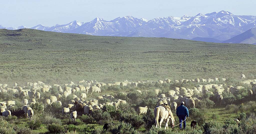
Sheep near Shoeshone, Idaho

Sheep move through public lands near Shoshone, Idaho. Photo: BLM

Meanwhile, the hooves of livestock destroyed natural soil crusts that inhibit weeds from germinating.

Cows wade in streams, causing erosion and polluting salmon habitat.

And livestock consume native plants at a rate that’s unsustainable in a dry landscape.

“An average public lands grazing lease authorizes livestock to remove 50-60% of available forage in a year,” says Molvar. “That leaves behind a degraded ecosystem.”

This grazing is heavily subsidized by taxpayers, with ranchers paying as little as $1.35 per month to keep a cow and calf or five sheep on BLM land.

By contrast, last year’s average monthly grazing rate for private lands was $16 in Washington and $19 in Oregon.

Nor do livestock on public lands benefit consumers by significantly lowering meat prices.

A paper in the peer-reviewed journal Environmental Management found less than 1.6% of grazing in the U.S. occurs on public land. 

While this is a tiny percentage of overall meat production/grazing, the amount of public land being grazed is enormous—well over 225 million acres, according to the American Farm Bureau Federation. While they don’t manage as many acres for grazing as the BLM, the USFWS, Forest Service, National Park Service and Department of Defense also allow grazing on their lands.

“Very little beef is from cattle who set a hoof on public lands,” says Molvar. “Which raises the question, why allow grazing there, given the ecological impacts?”
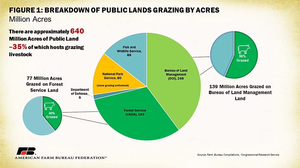
Grazing on federal lands chart

Chart: American Farm Bureau Federation

The cattle industry claims grazing has a positive effect on the landscape.

“We always say ranchers are the original environmentalists, and we stand by that,” says Chelsea Hajny, executive vice president for the Washington Cattlemen’s Association. “There are a multitude of benefits to grazing, from reducing fire hazards to adding manure to the soil. We’re so prone to fire in Washington State, and cattle remove forage that otherwise creates fuel.”

Environmental groups dispute the notion that grazing reduces wildfire risk.

“Cattle are a number one cause of the cheat grass explosion, which has led to an increase in unnaturally large fires,” says Molvar.

By removing livestock from public lands, the United States could make progress toward the goal captured in the Biden administration’s America the Beautiful plan, of protecting 30% of the country’s lands and waters by the year 2030.

A 2022 paper in the journal Bioscience examined ways to help actualize this “30 X 30” goal by protecting core areas on Western federal lands. The authors identify livestock grazing as by far the largest direct threat to biodiversity in these places, with 48% of imperiled species there being affected.

The study recommends retiring existing grazing allotments.

It also suggests focusing on the restoration of two key species—gray wolves and beavers, both of which are targeted by agencies like Wildlife Services—whose activities in the ecosystem produce a cascading series of positive effects.

Washington’s Douglas Creek Canyon is the kind of landscape that could produce immense biodiversity and climate benefits if allowed to regenerate.
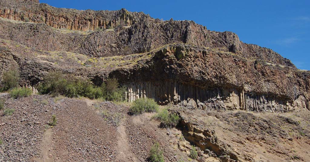
Douglas Creek Canyon in Washington

Not like it used to be: Douglas Creek Canyon. Photo: BLM

On both sides of the creek, barbed wire fences mark the boundaries of land that is or was formerly used for cattle, and the prevalence of cheat grass speaks to decades of grazing.

Some private land around the canyon is now protected.

For example, the Nature Conservancy’s Beezley Hills and Moses Coulee Preserves are located nearby.

However, the heart of the canyon is on BLM land.

In March, the BLM released a Greater Sage-Grouse Resource Management Plan that could limit grazing in the imperiled birds’ habitat across 10 western states, including Oregon. Washington is excluded because sage-grouse there occur mostly on private land.

Meanwhile, the BLM continues leasing land to ranchers throughout the West at rock-bottom prices, and agencies like Wildlife Services employ an approach to predator control resembling something from a previous century.

“The emphasis on lethal, indiscriminate killing of predators needs to change,” says Project Coyote’s Fox. “Not just from an ethical and humane standpoint, but based on what science tells us is effective. We need North America’s wild carnivores for healthy and diverse ecosystems.”

The use of public lands for subsidized grazing, and the continued persecution of wildlife, reflect an attitude on the part of responsible agencies that regards the public commons as a resource to be exploited by private business.

“One of most insidious ideas is that public lands should be viewed as agricultural land whose purpose is to maximize livestock production rather than ecological health,” says Molvar. “You have lands where cattle and sheep have become the dominant use, destroying wildlife habitat, recreational uses and the reasons the public values these places.”

The post As private interests turn profits on public lands, wildlife and taxpayers pay the price appeared first on Columbia Insight.

Supreme Court gives cities and towns power to criminalize homelessness

On Friday, the U.S. Supreme Court ruled that cities and municipalities can punish people for sleeping outside, even when they have nowhere else to go. In the case of The City of Grants Pass v. Johnson, the conservative majority sided in a 6-3 decision with Grants Pass, a small city in southern Oregon, finding that its broad public camping ban did not amount to cruel and unusual punishment

“This is the single most important case on homelessness in the past few decades,” said Nisha Kashyap, an attorney at the Lawyers’ Committee for Civil Rights of the San Francisco Bay Area. The organization, which joined several others in writing an amicus brief to the Supreme Court supporting the rights of unhoused people in Johnson, called the decision “devastating”.

“The decision risks opening the door to a whole slew of punitive measures that cities could enact in an effort to just push unhoused people out of their communities,” Kashyap said.

“This is the single most important case on homelessness in the past few decades.”

Writing for the majority, Justice Neil Gorsuch wrote that fines imposed by Grants Pass on people sleeping outdoors did not “qualify as cruel and unusual,” and thus did not violate the Eighth Amendment.

Gorsuch referred to briefs written by California Governor Gavin Newson, mayors of several Western cities, and conservative-led states, wherein city officials wrote that they need to be able to enforce public camping bans as part of the “full panoply of tools in the policy toolbox” to “tackle the complicated issues of housing and homelessness.”

The ruling removes a narrow but critical provision that had barred some Western states from fining, ticketing and jailing homeless residents for public camping when adequate shelter was unavailable. The decision comes as large cities across the West, facing an escalating crisis in homelessness, have passed a slew of anti-camping ordinances. Following the Supreme Court’s decision, such cities could pass stricter anti-camping ordinances.

Laura Gutowski holds a notice from the City of Grants Pass. Every week, the city passes out notices to residents to move their tent site. The Supreme Court has decided that cities can punish people for sleeping in public. Credit: Mason Trinca

Justices Sonia Sotomayor, Elena Kagan and Ketanji Brown dissented. In her dissent, Justice Sotomayor wrote that Grants Pass’s camping ban effectively criminalizes people for sleeping, a “biological necessity.” She wrote that the majority focuses “exclusively on the needs of local governments and leaves the most vulnerable in our society with an impossible choice: Either stay awake or be arrested.”

The Court did not rule out the possibility that the Grants Pass ordinances violate other protections afforded to unhoused people under the Eighth Amendment, such as the Due Process Clause or Excessive Fines Clause, affirming that the decision is narrow and does not give cities unchecked power to criminalize homelessness, Kashyap said.

The Supreme Court also overturned Martin v. Boise, a previous 9th Circuit decision that found that imposing civil penalties for camping when homeless residents lack access to any shelter amounts to cruel and unusual punishment. In the opinion, Gorsuch wrote that homelessness is not an involuntary condition and is not subject to Eighth Amendment protections.

“Anything that weakens Eighth Amendment protections is really, really concerning,” said Kashyap, echoing the response from housing advocates.

In a press briefing on the day of the decision, Ed Johnson, director of litigation at the Oregon Law Center and lead counsel for the respondents in Grants Pass v. Johnson, said the “troubling decision that is legally and morally wrong,” and could potentially worsen the homelessness crisis. Johnson has no relation to Gloria Johnson, one of the plaintiffs in the case.

GRANTS PASS IS a city of 40,000 people with a vacancy rate of 1%; roughly 600 of its residents experience homelessness at any given time. There is one shelter, the Grants Pass Gospel Rescue Mission, which has 138 beds. It is a high-barrier shelter, meaning that people who want to stay there are required to work full-time at the Mission, remain sober and attend church services daily. People who cannot or choose not to meet these strict requirements cannot stay there.

In a 2013 meeting, Grants Pass City Council members said they deliberately sought to adopt laws that would keep homeless people from staying in the city.

“The point is to make it uncomfortable enough … in our city so (homeless people) will want to move on down the road,” said Lily Morgan, the then-city council president. The same year, Grants Pass started enforcing a 24-hour camping ban. Law enforcement officers began aggressively ticketing unsheltered people city-wide, often fining them hundreds — even thousands — of dollars.

Helen Cruz, for example, was fined $2,000 for sleeping in a public park. Cruz had lived in Grants Pass for four decades before she lost her housing in 2016. Even though she was working two jobs, as a house cleaner and at a motel, she couldn’t afford the city’s steep rent.

“The community around here is scared,” Cruz said, who is currently living in a church. She added that she feels like her elected officials “have no kindness and compassion for the homeless.”

In 2017, the Oregon Law center filed a class action lawsuit on the behalf of Debra Blake, an unhoused resident of Grants Pass, who passed away in 2021. Gloria Johnson and John Logan stepped up as class representatives. In 2020, the San Francisco-based U.S. Court of Appeals of the Ninth Circuit sided with the plaintiffs.

Helen Cruz, who has experienced homelessness in Grants Pass, waves to the crowd after speaking during a rally during Johnson v. Grants Pass oral arguments at the Supreme Court on April 22, 2024 in Washington D.C. Credit: Kevin Wolf/AP Images for National Homelessness Law Center

In the past few years, many cities in the 9th Circuit’s jurisdiction — which includes California, Arizona, Nevada, Idaho, Montana and Washington, as well as Oregon — refrained from fining, ticketing and arresting individuals for sleeping in public, legislating with the lower court’s decision in mind. Now that the ruling has been overturned, Western cities like Bozeman, Montana, will be able to pass stricter ordinances.

“(This decision) removes the most basic protections that recognize the humanity of homeless folks,” Rankin said.

This has raised concerns among lawyers and housing advocates about an uptick in local anti-camping measures following the ruling.

In cities outside of the 9th Circuit that already have camping bans, such as Denver, legal protections for unhoused people will be unchanged, although Denver’s current policy is to offer shelter before sweeping residents.

But “it sends a very strong message that cities can choose to be less compassionate,” said Cathy Alderman, the chief communications and public policy at the Colorado Coalition for the homeless in Denver. “The ruling is basically saying, ‘Unhoused people, we owe you nothing.’”

Several ongoing, high-profile lawsuits involving homelessness also won’t be affected, including one in San Francisco, where a U.S. District Court judge in Oakland barred the city from destroying belongings and taking away tents from people living in encampments.

In Grants Pass and elsewhere, the material reality for homeless individuals will change very little, according to housing advocates. Sara Rankin, a professor of law at Seattle University and head of Seattle’s Homeless Rights Advocacy Project, stressed that the scope of Grants Pass v. Johnson is very narrow. Even before the ruling, cities could still legally sweep encampments and fine and arrest unhoused people. That hasn’t changed anywhere in the country. Under the previous decision, for example, unhoused residents in Grants Pass were still required to move every three days.

Now, “folks might have to disperse and leave the city. It might make it harder for us to find folks,” said Leah Swanson, the operations coordinator at MINT, a public health outreach organization in the Grants Pass area.

Jodi Peterson, the director of Interfaith Sanctuary Community Housing, a low-barrier shelter in Boise, said that the 9th Circuit’s decision on Martin v. Boise has had an impact, albeit a small one. It has not prevented the city from conducting daily sweeps, but it has created some stopgaps; now, for example, law enforcement is required to call the shelter to see if it has any beds before they ticket an unhoused person.

In the long term, experts expressed concern that additional local resources and public funding will be funneled into criminalizing homelessness, rather than in housing people in the first place. “There’s a lot of data saying that criminalizing unhoused people doesn’t work,” said Ann Oliva, the CEO of the National Alliance to End Homelessness, adding that criminalizing unhoused people only retraumatizes them and makes it harder for them to eventually find stable housing. “Criminalization is actually more expensive than just housing people.”

Legal experts and advocates stressed that the court’s decision will not address the homelessness crisis in the United States. In the long term, affordable housing is the solution, but “we need interim strategies, things like housing-focused shelter, making sure that outreach is robust, and keeping people as safe and healthy as possible,” Oliva said.

“We may not have a home, but we’re still people. We deserve to be respected, just like anybody else does,” Cruz said.

The post Supreme Court gives cities and towns power to criminalize homelessness appeared first on High Country News.

Four-year-old Oregon report identifies missing Native American women as a ‘emergency’ — but progress has been limited

Main recommendations remain unfinished, governor has not read the report, and critics say Indigenous voices…

The post Four-year-old Oregon report identifies missing Native American women as a ‘emergency’ — but progress has been limited first appeared on InvestigateWest.

The post Four-year-old Oregon report identifies missing Native American women as a ‘emergency’ — but progress has been limited appeared first on InvestigateWest.

Why no one knows exactly how much old-growth forest we have left

To use older trees to fight climate change, we need to know where they are. But new maps created by the Forest Service aren’t that detailed

Old growth logging

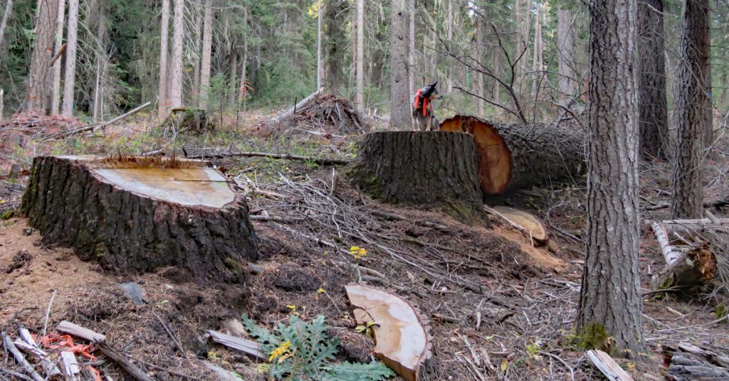
Old story: Big trees, like these remnants of a 2021 “public safety thinning” project along Oregon’s Lostine Wild and Scenic River Corridor, aren’t so easy to find. Just ask the Forest Service. Photo: Oregon Wild


By Nathan Gilles. April 18, 2024. It’s said that the map is not the territory.

This statement, say critics, is especially true of the maps created by the U.S. Forest Service to inventory the nation’s largest carbon sinks: its mature and old growth forests.

In April 2023, under pressure from the Biden administration, the Forest Service completed its first-ever nationwide inventory of mature and old growth forests found on federal lands.

This inventory of older trees is part of an ambitious Biden administration plan to harness the power of our nation’s forests as a nature-based solution to the climate crisis.

The idea is simple: rather than cut older trees down, the Biden administration is proposing we leave many of them standing, allowing them to do what years of scientific research has shown older trees do very well: take climate change-causing carbon out of the atmosphere and store it for long periods of time.

Announced in December 2023, the awkwardly named “Land Management Plan Direction for Old-Growth Forest Conditions Across the National Forest System” has been widely lauded by environmentalists and many scientists as a long-overdue step to help address the nation’s over-sized carbon footprint.

The nationwide forest plan is expected to lead to revisions of local forest plans throughout the country, including the Northwest Forest Plan governing Washington, Oregon and sections of Northern California.

But whether the nation’s older trees will be enlisted in the fight against climate change and spared the chainsaw could depend on knowing where those trees are.

And that, according to both critics of the Forest Service and the Forest Service itself, is not something the Forest Service’s inventory and mapping can do, because these maps are just not detailed enough to be used for management purposes on a stand-by-stand basis.

A study written by Forest Service scientists and published in August 2023 in the journal Forest Ecology and Management hints at this fact.

The study’s authors write that although the maps they created contain “a high degree of accuracy. … Identifying mature and old-growth forests in a stand management context will likely require additional measurements, adjustments to criteria at local scales, and incorporation of social and traditional knowledge within a consistent definition framework.”

In other words, the maps show the forest but not the trees, per se.

‘Low-res’ maps

The Forest Service’s mature and old-growth inventory used data on trees collected at individual forest plots that are part of the agency’s Forest Inventory and Analysis, a long-term scientific monitoring effort designed by the Forest Service to assess the health of the nation’s forests.

Data from the FIA program goes back decades. These data, and the FIA program generally, are widely respected and used by scientists both in and out of the Forest Service.

Nonetheless, FIA has its limitations, according to Richard Birdsey, retired Forest Service scientist turned senior scientist at the nonprofit Woodwell Climate Research Center.

Dr. Richard Birdsey

Dr. Richard Birdsey. Photo: Woodwell Climate Research Center

Based in Massachusetts, the Woodwell Climate Research Center funds scientific research related to climate change. Many of its scientists have been critical of the Forest Service and its practices.

“The FIA data is adequate for looking at large areas, maybe a whole state or a group of national forests. But there’s just not enough FIA sample plots in the typical old-growth stand to characterize it or monitor it carefully,” says Birdsey, who in addition to spending 15 of his 40 years at the Forest Service working on the FIA program has also conducted his own analysis of the carbon-storing potential of America’s older forests.

“[FIA is] a terrific program and really is a backbone for policies,” says Birdsey. “But it’s a little less effective when trying to monitor what’s happening at smaller scales or at the project scale. And that’s where a lot of public interest is.”

Here’s the problem. While the Forest service has 355,000 FIA plots (on public and private lands) in forests across the United States, the FIA plots themselves are small, covering approximately two-and-half acres each.

The plots are also miles away from each other, with one plot every 6,000 acres, or nine square miles, of forested land.

This leaves big gaps in the available data set, gaps that need to be filled with scientific guesswork that has to come from other sources of data.

What you get from this is a big picture look at the forest, but not a detailed one.

And this, says Birdsey, is exactly what the Forest Service ended up producing in 2023.

The Forest Service mature and old-growth forest inventory maps were created at what’s called a “fireshed” scale.

Firesheds are 250,000 acres each, or roughly 390 square miles.

This means a single 390-square-mile fireshed gets a single classification, for instance, “Moderate Mature, High Old Growth” or “High Mature, Moderate Old Growth,” as can be seen on an interactive online map displaying the agency’s mature and old-growth data.

By most scientist standards, this “resolution” is considered “low” or “coarse,” according to Birdsey and other scientists.

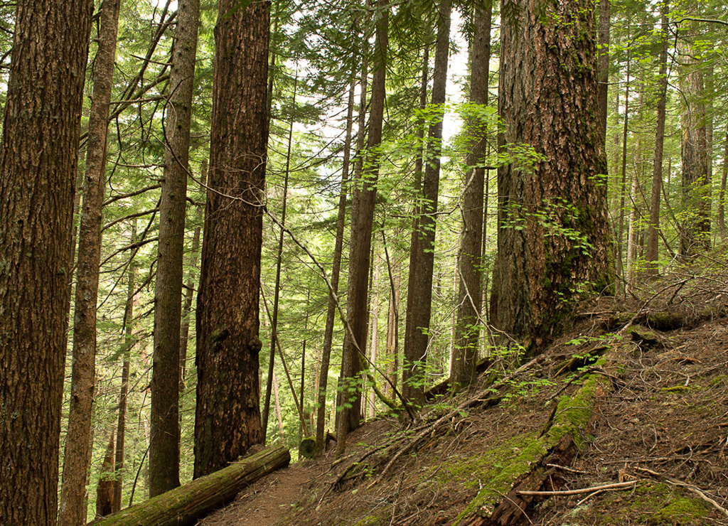
Mature, not old: This stand of Douglas fir (and other species) includes trees of multiple ages. Photo by Jurgen Hess

This low resolution has been widely criticized not only by scientists but also by environmentalists hoping to protect mature and old-growth forests, says Steve Pedery, conservation director at the Oregon-based environmental nonprofit Oregon Wild.

“The Forest Service maps did give a total picture in terms of the volume [of mature and old-growth trees], but they were so vague that you couldn’t actually identify any particular specific stand of old-growth anywhere,” says Pedery.

Pedery says the low-resolution maps could make protecting older trees more difficult.

For its part, the Forest Service admits its maps are vague and can’t be used to manage individual stands, but the agency doesn’t necessarily see this as a bad thing, according to Jamie Barbour, assistant director for adaptive management at the Forest Service’s Monitoring and Analysis Team, which oversaw the implementation of the mature and old-growth inventory.

“We didn’t want to create the impression that we knew exactly where these clumps of old forest were because that would have ramifications that might not be very useful,” says Barbour, adding that the agency wanted only “to present an idea of where large accumulations of older forests were.”

Asked what he meant by “ramifications,” Barbour responded, “People misinterpret things. If we’re saying that a specific small area is mature old growth and it’s not, then that could lead to disputes about how to manage it.”

Barbour says high-resolution mapping of mature and old-growth forests should ideally happen at the local level. Though, he says, the Forest Service is also exploring using a NASA-led effort called “GEDI,” a project that is literally out of this world.

GEDI: Monitoring old-growth from space

“GEDI” stands for the Global Ecosystem Dynamics Investigation—which, yes, is a reference to “a galaxy far, far away” and is pronounced “Jedi.”

Befitting its namesake, GEDI uses a high-resolution laser system known as LiDAR to map the Earth’s surface.

The project’s LiDAR system is located on the International Space Station.

The GEDI system can observe “nearly all tropical and temperate forests.”

The project’s goal is to “provide answers to how deforestation has contributed to atmospheric CO2 concentrations, how much carbon forests will absorb in the future and how habitat degradation will affect global biodiversity,” according to its website.

The NASA-led effort has been used to map old-growth trees in Australia but was not used as part of the Forest Service mapping project, despite the fact that GEDI data for U.S. forests were available at the time.

However, GEDI might be used by the Forest Service to continue monitoring older forests, at least according to promotional material posted by NASA on its website and on YouTube.

This material suggests that adding GEDI to the Forest Service’s mapping effort will “soon” enable the public to “view some of these [old-growth] forests like never before” and help “fill in those spatial gaps” that FIA data and the Forest Service’s current inventory was unable to fill.

Exactly if and when GEDI will be used by the Forest Service is unclear.

GEDI project lead, Ralph Dubayah, professor of Geographical Sciences at the University of Maryland, couldn’t be reached for comment.

The project’s LiDAR system is also currently not in use on the ISS. Instead, it’s being stowed away to make room for a Department of Defense project, according to Barbour.

GEDI data won’t provide a complete picture of what’s out there, says Barbour, but echoing NASA’s promotional material, he says it could help fill in the gaps between FIA plots.

‘Mature’ trees needs protection, too

Beverly Law, a retired forest ecologist at Oregon State University’s College of Forestry and leading researcher on how to harness the carbon-capturing power of older trees, says she was also disappointed with the Forest Service’s inventory of mature and old-growth trees.

In 2018, Law came under fire from the timber industry following the publication of her study in the Proceedings of the National Academy of Sciences.

The study demonstrated that the state of Oregon could sequester more carbon and slow climate change if it slowed the rate at which it harvested its forests.

Beverly Law

Beverly Law. Photo: Lawrence Berkeley National Laboratory

Law is impressed with the Biden administration’s efforts to push the Forest Service in the direction of carbon storage.

But she worries about how the plan will be implemented by an agency that historically has had to be ordered to conserve rather than log the nation’s trees.

“It’s the best move that’s been made by any administration, ever,” says Law of the old-growth forest plan. “But the devil’s in the details in how it’s carried out.”

In February, Law was one of over 190 scientists who study the carbon-capturing potential of older trees to sign an open letter to the Biden Administration requesting it immediately “direct the Forest Service and BLM to suspend all timber sales in mature and old-growth forests, and refrain from proposing new timber sales in these forests” until the environmental impact statements required by law to implement the old-growth forest plan are completed.

One of those devilish details Law and others are concerned about is the possibility that the Forest Service is now trying to sidestep its obligation to protect both mature and old-growth trees.

As critics pointed out in December 2023, when it was published, the Land Management Plan Direction for Old-Growth Forest Conditions Across the National Forest System, while creating nationwide protections for old-growth forests, fell short of also providing broad protections for mature forests.

Because many mature tree stands are now old enough to be carbon-capturing powerhouses in their own right, and because many are now just decades away from being classified as old-growth, many scientists, Law among them, argue that the lack of protections for mature trees is a major loss both for trees and for fighting the climate crisis.

Leaving out mature trees, they say, also violates the intent of the larger push to use the nation’s forests to sequester carbon, a push that doesn’t originate with the Forest Service but with two executive orders issued by the Biden Administration.

The first executive order, EO 14008, was signed shortly after President Biden’s inauguration in 2021. It directs federal agencies to protect 30% of the nation’s lands and waters by 2030.

The second executive order, EO 14072, was issued in April 2022 and directs the Department of Agriculture (which contains the Forest Service) and the Bureau of Land Management to create a national inventory of mature and old-growth forests found on federal lands as part of a larger effort to use these forests to, among other things, “retain and enhance carbon storage.”

According to the Forest Service’s own estimates, while old-growth forests cover just 17% of the federal lands they inventoried, mature forests can be found on 45% of surveyed lands.

Barbour, however, takes issue with claims that his agency is no longer concerned with mature forests as a way to fight climate change.

“We would like to manage [forests] for a suite of conditions, some of which are older forests, and we’re trying to understand where we can maintain forests for a very long period of time,” says Barbour.

Barbour says ultimately the goal of carbon storage needs to be balanced against the need to “provide economic opportunities in rural communities” through ongoing forest management.

As for the Forest Service’s inventory of mature and old-growth forests, Law, who helped design the Forest Service’s FIA program, says one important question is why it took so long for the Forest Service to develop official mature and old-growth maps when the scientific community more generally has been doing this kind of analysis for decades.

“We’ve been waiting for this since before [President George W.] Bush, and even now it’s like, what the heck took so long?” says Law.

The post Why no one knows exactly how much old-growth forest we have left appeared first on Columbia Insight.

Whitebark pines are in trouble. That means our water supply is, too

A nationwide effort to save the whitebark pine in underway. Much of the story is happening in the Pacific Northwest

Clark's nutcracker foraging on whitebark pine cones

Super spreader: Whitebark pines depend on Clark’s nutcrackers to distribute their seeds. Photo: Jackson Chase


By K.C. Mehaffey. April 11, 2024. At the Dorena Genetic Resource Center near Cottage Grove, Ore., scientists are collecting whitebark pine cones, growing seedlings, examining them for resilience to disease and then gathering cones from the strongest survivors.

Those select seeds are then used to grow hundreds of thousands of baby trees in nurseries and plant them across the West.

It’s a job meant for the Clark’s nutcracker, a gray-and-black bird in the crow and raven family with a long sharp beak designed to crack open the toughest of nuts.

Mostly, he uses that beak to dig into the tough cone of a whitebark pine, pick out the seeds, eat a few and stash away several more in the ground to eat later.

Over the course of a year, a Clark’s nutcracker will cache thousands of seeds, many of which will go uneaten and become the next generation of whitebark pines.

While it appears to be their favorite food source, Clark’s nutcrackers aren’t wholly dependent on these high-elevation trees. In the Cascade Range, they also eat Douglas fir and ponderosa pine seeds.

But whitebark pine trees do depend on the nutcracker to disperse their seeds throughout their range that stretches across 80 million acres in seven western states and two Canadian provinces.

Whitebark Pine, Grandmother Tree, Crater Lake National Park

In good standing: Whitebark pine Grandmother Tree in Oregon’s Crater Lake National Park. Photo: Quinn Lowrey/QLCeramics

Now, one of the West’s few tree species able to survive on cold, windy ridgetops and steep slopes at alpine and subalpine elevations is in serious trouble.

It’s not that Clark’s nutcrackers aren’t doing their job—they are.

But a nonnative fungus that causes white pine to blister rust has entered the scene and become an existential threat to the pines, says Diana Tomback, one of the foremost researchers of the unique relationship between whitebark pines and Clark’s nutcracker.

Tomback is professor and interim chair of the Department of Integrative Biology at the University of Colorado Denver. She also helped found the Whitebark Pine Ecosystem Foundation with several colleagues and now serves as its outreach coordinator.

She says there’s no cure for the disease, which continues to spread and threaten whitebark and other five-needled pines in the West. Many of these forests have also lost trees to mountain pine beetle infestations and wildfires that are becoming more frequent and more severe with the climate crisis.

“We’ve got this disturbing downward spiral,” Tomback tells Columbia Insight.

When a lot of whitebark pine die off, Clark’s nutcrackers—which are extremely mobile—sometimes move to new locations and find alternative seed resources.

And when the nutcrackers leave, the remaining whitebark pine trees—those that are resilient to blister rust—lose their means of dispersing seed.

“Whitebark pine clearly needs human intervention to come in and break this downward spiral,” says Tomback.

No ordinary tree

According to the Federal Register listing, “Whitebark pine is considered both a keystone and a foundation species in western North America, where it increases biodiversity and contributes to critical ecosystem functions.”

Its large and high-calorie nut is a critical food source for Clark’s nutcracker, and for 18 other animal species ranging from grizzly bears to red squirrels.

Individual trees can live to be hundreds of years old and become craggy and gnarled as they appear to thrive in the harsh mountain environment.

In many western landscapes, its beauty is secondary to the immense importance of these forests for sequestering snowpack.

“Whitebark pine forests exist in the headwaters regions for several large western river systems (e.g., Snake, Columbia and Missouri). High elevation forests like those featuring whitebark pine help redistribute, shade and retain snowpack, and their root systems stabilize soil and prevent erosion, especially on steep, rocky slopes where they thrive,” says Wash. D.C.-based American Forests.

The nonprofit group deems them “vital to the health of western watersheds, helping sustain ample stream flows that human and natural communities depend on.”

When not exposed to a foreign fungus, these trees are ultra-hardy.

They tolerate poor soils and can exist in rocky and shallow soils over bedrock. They grow in mountain ecosystems with vastly different climates, with annual precipitation amounts ranging from 20 inches to 100 inches of rain—most of which falls as snow.

But they’re also slow growing and can be outcompeted and replaced by more shade tolerant trees, such as subalpine fir.

Tomback says having these rugged trees at high elevations stabilizes the snowpack and allows it to melt at a slower rate, providing water to lower elevations during the summer.

In a short documentary about saving the whitebark pine, she says, “If we fail to do anything for whitebark pine, we are going to end up with many regions of our high mountain areas without it and we lose the ecosystem services, the wildlife food, the habitat protection, the watershed protection. It will be very apparent that some cataclysm affected our western forests mightily on a large scale.”

In January 2023, the whitebark pine was listed as threatened under the Endangered Species Act. It is the most widely distributed forest tree under ESA protection, according to the Whitebark Pine Ecosystem Foundation.

According to U.S. Forest Service researchers Sara Goeking and Deborah Izlar, there are now more standing dead whitebark pine trees than live ones.

They estimate that more than 325 million trees have died.

Because whitebark pine is a high-elevation species, the vast majority of its range is on public land. Tomback says between blister rust and mountain pine beetle, some places—like Glacier National Park—have lost the majority of whitebark pine trees.

There, she says, 80-90% of the living trees now have blister rust. Along with the northern Rocky Mountains, the Pacific Northwest is among the areas that have seen widespread decline from this unprecedented combination of threats.

Just how bad the rust is varies widely across Washington and Oregon, according to Robyn Darbyshire, regional silviculturist for the Forest Service’s Pacific Northwest office in Portland.

She says some places, like the Warner Mountains in southern Oregon, have no rust. Others, like the Gifford Pinchot National Forest seem to have a fairly high degree of resistance.

But trees in some areas seem to have very little resistance to the disease.

Desolation Wilderness, California

High and dry: Prime whitebark pine habitat in California’s Desolation Wilderness. Photo: Quinn Lowrey/QLCeramics

Still, there’s plenty of whitebark pine around, Darbyshire says. And some of the trees—at least individual ones that appear to be resistant to blister rust—can be protected from mountain pine beetles by using pheromone patches.

“We can protect good trees and high-value stands, and make sure we have a variety of age classes,” she says.

Additionally, having white pine blister rust isn’t always a death certificate. In some cases just a branch tip will die off, and the tree is able to prevent it from getting to its trunk.

“Trees can have rust for quite some time, and just because they have rust doesn’t mean they’re going to die from it. When we get worried about rust is when it girdles the mainstem of the tree,” says Darbyshire.

Those trees that are surrounded by the disease but seem to resist it have become the foundation for recovering this majestic conifer.

“In nature, these things would sort themselves out over time,” says Tomback.

Resistant trees would survive, and their seeds would eventually become the next generation of whitebark pines. But whitebark pine cones don’t open on their own, Darbyshire notes. And if Clark’s nutcrackers leave to find food in new areas, it could become too difficult for the next generation of trees to become established.

Human intervention

Scientists working to save the whitebark pine are playing the long game.

Many likely won’t be around—or will at least be retired—by the time the seedlings they’re cultivating produce cones.

Darbyshire says that a Douglas fir or ponderosa pine can start producing cones as young as 10 years old.

Diana Tomback working with whitebark pine in the Custer-Gallatin National Forest

Pine solve: Diana Tomback studies whitebark pine across the West. Photo: E.R. Pansing

It takes whitebark pine trees 30 to 50 years to mature.

To find the resistant trees, people go into whitebark pine stands where rust is occurring, and look for trees that appear to be resisting the disease.

“We do a fairly thorough evaluation of the degree of rust resistance. We’re not necessarily looking for the perfect tree that has no rust at all, but ones that have some sort of defense system that keeps rust from getting to the main stem,” says Darbyshire.

They collect cones from those trees, grow the seeds in a greenhouse, and subject them to rust spores to test whether they are truly resistant.

“You might have to test 100 trees to find five that are resistant enough. It’s a lot of work narrowing it down and finding those resistant trees,” she says. “Then we want to go back and collect seed from those trees that have the rust resistance.”

The cones from each resistant tree have to be carefully marked so the seedlings can be planted back in the same geographic areas.

And they can’t all come from the same rust-resistant tree.

“We want to make sure we have at least 25 parent trees in a seed lot, so there’s genetic diversity,” says Darbyshire.

The seedlings are grown in greenhouses in containers.

And true to this slow-growing tree’s nature, it takes two to three years to get a seedling that’s big enough to plant, whereas most conifers would be ready to plant after a year.

The whole process takes several years, just to find the right seeds, ensure there’s enough genetic diversity and grow seedlings to an age where they can be planted.

Final restoration plan

Tomback says work on the National Whitebark Pine Restoration Plan started in 2016—six years before the tree was listed as threatened.

It’s a collaborative inter-agency and tribal plan based on identifying a subset of the whitebark pine range for priority restoration, developed by the Whitebark Pine Ecosystem Foundation and American Forests and advised by the Forest Service.

“We think it will be highly compatible with the U.S. Fish and Wildlife Service Recovery Plan for whitebark pine, which is now under development,” says Tomback.

The pandemic and a government shutdown delayed the process, but the draft National Whitebark Pine Restoration Plan went out last summer.

“I’m in the middle of incorporating minor suggestions and updates. The revision has just been submitted to the Forest Service,” she says.

Restoration is a challenge—29% of the whitebark pine’s range is in wilderness areas.

The draft plan got high marks from American Forests, which is working with the National Park Service to restore the trees within national parks. Its website says, “The National Whitebark Pine Restoration Plan is a science-driven, collaborative strategy to restore whitebark pine across its U.S. range. The plan is designed to work with nature—by using the seed dispersal capabilities of the Clark’s nutcracker to restore whitebark pine populations.”

The plan suggests that agencies identify 20-30% of the range of whitebark pine within a given jurisdiction—such as a national park, a Forest Service region, a Bureau of Land Management state office or a tribal reservation—to focus initial recovery efforts.

Because of the logistical and financial challenges of recovering a species that is so far ranging and often so remote, these core areas would receive the highest priorities and eventually serve as dispersal centers for adjacent areas.

Tomback says Region 6 of the U.S. Forest Service—which comprises national forest land in Oregon and Washington—has been proactive in selecting core areas and coming up with its restoration strategy.

Identifying those core areas was more challenging than Darbyshire thought it would be.

“We looked at places where there was a need—places that had burned or places with bark beetle mortality, and then we also wanted to identify places where we need to go collect seed for resistance testing, because we haven’t done that everywhere yet,” she says.

Part of the challenge is the ecological diversity across Washington and Oregon—from the Olympics to the North Cascades to the Selkirks. Darbyshire notes that the Forest Service region hasn’t gotten feedback on its core-area selection from the national office.

“These things aren’t set in stone. We’ll see how other regions did the process and learn from each other.”

Even without a finalized plan, the Forest Service is continuing its work to replant stands of new rust-resistant trees.

Mimicking Clark’s nutcrackers

A big part of the restoration challenge has to do with where whitebark pine grow. Tomback says 29% of their range is in wilderness.

Here in the Northwest, 60% of their range is in wilderness, and an additional 20% is in roadless areas, according to Darbyshire.

“So accessibility is pretty challenging in many cases,” she says, adding, “It’s important to protect the cone-bearing trees that we have inside and outside of wilderness and to establish new rust-resistant trees wherever we can.”

Within the wilderness, the Forest Service can’t use invasive technical or mechanical means to plant trees. Even taking cones out, growing them and brining seedlings back to plant is not fully supported, says Tomback.

She and other researchers are trying to figure out if humans can essentially mimic what Clark’s nutcrackers do.

“That means going in with bags of seeds harvested within the same seed zone and methodically planting them in caches, just like the nutcrackers,” she says.

The method is still experimental.

“We need to monitor it and get results to figure out whether this is going to be adequately productive and learn how to modify where we put the seeds” and discourage rodent thefts, she says.

But since it’s one of the few things they can do in wilderness areas, the Forest Service, Park Service and BLM are all seriously looking at the option.

While scientists are doing some of the work that Clark’s nutcrackers do, the long-term plan is to eventually give the job back. But in areas that are highly devastated, if nutcrackers have moved on to find better food sources, that may not happen until enough rust-resistant trees have grown old enough to start producing cones.

“It’s sort of a you-build-it-and-they-will-come idea,” says Tomback. “If we can restore these areas where whitebark pine were once abundant, we believe the nutcrackers will come back.”

The post Whitebark pines are in trouble. That means our water supply is, too appeared first on Columbia Insight.

What rural homelessness looks like

Though it’s often less visible and rarely discussed, rural homelessness is rising six times faster than homelessness overall. One person who’s been sounding the alarm for years is Julie Akins, a veteran journalist and former mayor of Ashland, Oregon, who now serves as senior housing director at AllCare Health.

Her latest report on rural homelessness, which came out last month, is based on hundreds of conversations throughout southern Oregon over a six-month period. At times, Akins has even embedded with the people she interviewed: sleeping in her car or a tent, enduring scabies and head lice. We called her up to ask what she’d learned — and what the lessons might be for the rest of the rural West.

This interview has been edited for length and clarity.

High Country News: In your latest report, you noted that people in rural areas often deal with lower pay and a more limited housing stock than those in urban areas. How else does rural homelessness differ?

Julie Akins: Urban homelessness looks like a bunch of tents in a centralized space, because people are trying to access transportation and services. In the rural West, services are spread out, and sometimes it can take people hours to walk from one part of their community to another.

In rural communities, you see people trying to tuck away in places where they can be unseen. I interviewed people living at rest stops. Families in their cars, driving all night with the heat on to keep their kids warm. Grandmothers and grandfathers, walking with walkers to rundown RVs where they don’t have hot water. A woman living under the crawl space of an Airbnb that she cleaned. People on Bureau of Land Management land, trying to hide out in a vehicle. It’s scattered and pervasive.

Julie Akins, senior housing director at AllCare Health.  Credit: Courtesy photo

HCN: There are many stigmas surrounding homelessness: that everyone experiencing it is lazy or has issues with substance abuse or mental health. What did you find? 

JA: That was the main thing people asked me to do: They spoke to me in exchange for reporting that they are not a “bum,” a “drug addict” or mentally ill. Breaking through the concept that if you don’t have enough money, you’re somehow a failure and don’t deserve a hand up is really the hardest point to drive home, right? Because those stereotypes exist.

HCN: A “living wage” is the amount an individual needs to earn to cover their basic needs. In Oregon, it’s $24 an hour. Readers may be surprised to learn that 60% of the people you spoke to were employed. Can you break down the math of poverty? 

JA: Well, Taco Bell pays $15 an hour. You could work there full- time and have another part-time job and still not have a roof over your head.

I met this young man, very smart. Halfway through college, he started having seizures; he discovered he had epilepsy. So he had to quit school, he couldn’t drive anymore. (He and his mother) were living in an RV. He wound up working at Taco Bell, but he can only work a certain number of hours. Because if he gets over a threshold, then he no longer is qualified for Medicaid. And without Medicaid, he couldn’t afford his anti-seizure medicine. The way we have it set up, you kind of have to stay in poverty if you have an illness.

At what point do we accept that? That you can be a working person and still homeless? That you can be a retiree who worked your entire life — and now you’re unhoused because your wife died, and only one Social Security benefit is not enough? At what point can we say the American dream has become a nightmare?

At what point can we say the American dream has become a nightmare?

HCN: According to the National Alliance to End Homelessness, “a chronically homeless person costs the taxpayer an average of $35,578 per year.” When that person is placed in supportive housing, those costs are cut nearly in half. Can you talk about the cost of homelessness?

JA: I’ll use Susan as an example. She’s 71 now. She had a blister on her calf; she couldn’t keep it clean and dry because she was spending an Oregon winter in her truck. So this wound got worse and worse, to the point where it was so badly infected it was filled with maggots. She wound up in the intensive care unit for, I believe, eight days. The expense of that is astronomical: $3,000 a day. I mean, you could have housed her for how long for that kind of money?

Kunisha Fernandez with two of her four children in their tent of Bureau of Land Management land near Carbondale, Colorado. Fernandez, her husband, Steven Fitch, and their family are part of a growing contingent of Americans living nomadically on U.S. public land amid high housing costs. Credit: Blake Gordon/High Country News

HCN: What has changed since your first reporting trip in 2016? 

JA: There seems to be a marked loss of hope. When I first went out, people seemed to believe it was a blip. There was some sort of optimism. Now they’re looking around and realizing it’s mathematically impossible to pull yourself out of homelessness without help. That’s very discouraging. People want to be independent, to be proud of themselves. They want a good job, a place to live; they want to progress in their life. And when you do everything you can and that still doesn’t happen, how can you avoid losing hope?

HCN: What are the solutions?  

JA: Homelessness is a housing problem. When you’re hungry, you don’t sit around and think: Hmm, what would be a cure for hunger? You’re like, I’m hungry, I’m going to eat something. I’m unhoused, I need a place to live — it’s really that direct.

HCN: How has this reporting changed you? 

JA: I don’t think I can ever not be grateful that I can lock my door and get in my bed and pull the covers up and drift off to sleep. It’s such a small thing, but it’s also a huge thing.

Until you’re (sleeping in your car), you don’t understand how terrifying it is. Even in small towns, there’s a lot of commotion at night that you might not ever know about if you live in a house. There’s the terror of: What if I have to go to the bathroom? And then just the general sense of being so out of touch with what you think of as normal life.

Now, I am really aware of what being ostracized in society can do to you from a psychosocial perspective. It’s so traumatizing. And this is what it’s like for people (experiencing homelessness) day in and day out. That is a moral failing. And it’s not the moral failing of the people who are unhoused; it’s the moral failing of this country.

The post What rural homelessness looks like appeared first on High Country News.

In Washington, a missing wolf mystery baffles officials

What happened to the female half of Klickitat County’s two-wolf Big Muddy Pack?

Wolf in Klickitat County, Wash.

Half-pack: Wildlife biologists collared gray wolf WA109M in January 2021 in Klickitat County. Now his mate has gone missing. Photo: WDFW


By Dawn Stover. February 27, 2024. In April 2023, Columbia Insight reported that Southwest Washington had its first gray wolf pack in a century.

The Big Muddy Pack formed when a collared male that wandered into Klickitat County was joined by an un-collared female.

Together they met the Washington Department of Fish and Wildlife’s minimum for recognition as a pack: at least two wolves traveling together in winter.

The state wildlife agency’s wolf biologist Gabe Spence told Columbia Insight it was a “big deal” to finally find a pack in the southwestern third of the state.

It seemed likely the pair would produce pups in 2023.

Now wolf experts with the agency aren’t sure the pack still exists.

And some locals are wondering if the wolf may have been intentionally killed.

Missing in action

Since October 2023, the wildlife department’s monthly updates have repeatedly noted that agency experts “conducted monitoring activities” in the Big Muddy Pack’s territory. Those activities have thus far failed to detect the female member of the pack.

The collar on wolf WA109M, the pack’s male, usually transmits his location twice a day. When he’s in rocky or heavily wooded terrain, it can take longer to receive that data.

The state’s wolf team uses the collared wolf’s last known location to look for tracks in snow and check game cameras in the area.

They can also circle over the location with an airplane or helicopter.

The team’s aircraft were grounded by freezing fog and freezing rain for a few days, and team members are still finishing their surveys of all packs in the state.

Data from survey counts, camera footage and reported sightings will be compiled into an annual wolf report that will be released in mid-April, said WDFW statewide wolf specialist Ben Maletzke.

When Columbia Insight spoke with Maletzke on Feb. 14, the team had one more flight to do and some cameras to check, but they hadn’t yet been able to pick up the Big Muddy female wolf.

“We have not been super successful at finding that wolf, but that doesn’t mean she’s not out there,” Maletzke said. It’s possible she is on a hunting foray, he said, or “she may be more camera-shy” than her collared mate.

Maletzke acknowledged there is a “lot of animosity toward wolves in certain areas,” but he said there is no evidence of foul play involving the Big Muddy female.

Staci Lehman, a spokesman for the department, said “the wolf world can be a rough one. It’s not unusual for a wolf to go on a temporary or permanent road trip to new territories or to run into trouble along the way.”

New model for species recovery

If Southwest Washington’s only known pack has split up or the female has died, that would be “a big loss for sure,” said Maletzke.

In the short term, the loss of one wolf may have an impact for the next year or so, he said, “but over the next two to five years, I think we’ll see an influx of wolves down into the South Cascades.”

Maletzke said the state documented a lot of wolf mortalities in 2023 but is still seeing the species recovering in Washington.

The statewide population of wolves and the number of breeding pairs has been increasing for 14 years.

In its Periodic Status Review for the Gray Wolf dated February 2024, the Washington Department of Fish and Wildlife recommends that the state reclassify wolves from “endangered” to “sensitive,” bypassing the intermediate designation of “threatened.”

The agency says wolves no longer face a serious risk of extinction throughout a significant portion of their range in Washington.

The Wolf Management and Recovery Plan adopted in 2011 calls for the state to consider downlisting wolves from endangered to threatened when there are at least two successful breeding pairs in each of the three recovery regions for three consecutive years.

But that hasn’t happened yet.

Known wolf packs and single wolf territories in Washington at the end of 2022. Map: WDFW

The Southern Cascades and Northwest Coast recovery region currently has no successful breeding pairs and, with the absence of wolf WA109M’s partner, might have lost its only known pair.

However, the state is proposing to jettison those recovery criteria and rely instead on a new model that estimates current and future population dynamics of Washington wolves.

The model estimates a 100% probability that wolves will “colonize” the southwest recovery region by 2030—meaning at least one wolf territory with two or more adults in it.

The downlisting proposal will be presented to the state’s Fish and Wildlife Commission at a meeting next month, and a decision is expected in June.

Both the draft proposal and the final version published this month note that “the first known pack was documented in [the southwest] region as of 2022.”

For now, that “pack” appears incomplete.

The post In Washington, a missing wolf mystery baffles officials appeared first on Columbia Insight.

With limited resources, an Oregon town plans for climate change

This story was produced through a collaboration between the Daily Yonder, which covers rural America, and Nexus Media News, an editorially independent, nonprofit news service covering climate change.

One of the most iconic landmarks in downtown Grants Pass, Oregon, is a 100-year-old sign that arcs over the main street with the phrase “It’s the Climate” scrawled across it. 

To an outsider, it’s an odd slogan in this rural region, where comments about the climate – or rather, climate change – can be met with apprehension. But for locals, it’s a nod to an era when the “climate” only referred to Grants Pass’ warm, dry summers and mild winters when snow coats the surrounding mountains but rarely touches down in the city streets. 

Now, the slogan takes on a different meaning.

In May 2023, the Grants Pass City Council passed a one-of-a-kind sustainability plan that, if implemented, would transition publicly owned buildings and vehicles to renewable energy, diversifying their power sources in case of natural disaster.

While passing the sustainability plan in this largely Republican county was an enormous feat on its own, actually paying for the energy projects proves to be Grants Pass’ biggest challenge yet. 

Grants Pass
The exterior of City Hall in Grants Pass on November 28, 2023.
Claire Carlson / The Daily Yonder

“There are grants out there, but I don’t think we’re the only community out there looking for grants to help pay for some of these things,” said J.C. Rowley, finance director for the city of Grants Pass. Some project examples outlined in their sustainability plan include installing electric vehicle charging stations downtown and solar panels at two city-owned landfills, and converting park streetlights to LED. 

Rural communities face bigger hurdles when accessing grant funding because they don’t have the staff or budget that cities often do to produce competitive grant applications. This can slow down the implementation of projects like the ones laid out in the Grants Pass sustainability plan.

And time is not something Grants Pass — or any other community — has to spare.

Global climate models show the planet’s average annual temperature increasing by about 6.3° Fahrenheit by 2100 if “business-as-usual” practices continue. These practices mean no substantive climate change mitigation policy, continued population growth, and unabated greenhouse gas emissions throughout the 21st century — practices driven by the most resource-consumptive countries, namely, the United States. 

In southwest Oregon, this temperature increase means hotter summers and less snow in the winters, affecting the region’s water resources, according to a U.S. Forest Service analysis. This could mean longer and more severe wildfire seasons. 

A blue "It's the Climate" sign stretches across a quiet street.
The “It’s the Climate” sign was first hung on July 20, 1920, to promote the temperate weather of Grants Pass.
Claire Carlson / The Daily Yonder

In Roseburg, Oregon, about 70 miles north of Grants Pass, a 6.3°F increase would mean the city’s yearly average of 36 days of below-freezing temperatures would decrease to few or none, according to the analysis. Grants Pass would suffer a similar fate, drastically changing the climate it’s so famous for. 

Grants Pass has a population of 39,000 and is the hub of one of the smallest metropolitan statistical areas in the U.S. The metro contains just one county, Josephine, which has a population of under 90,000, nearly half of whom live outside urbanized areas. Over half of the county’s land is owned by the Bureau of Land Management or National Forest, and it contains a section of the federal Rogue River Scenic Waterway.

“In the event of a natural disaster, we are far more likely to get isolated,” said Allegra Starr, an Americorps employee who was the driving force behind the Grants Pass sustainability plan. “I’ve heard stories of communities that were less isolated than us running out of fuel [during power outages].”

Building resilience in the face of disaster is a main priority of the plan, which recommends 14 projects related to green energy, waste disposal, transportation, and tree plantings in city limits. All of the projects focus on improvements to city-owned buildings, vehicles, and operations. 

In partnership with Starr and the Grants Pass public works department, a volunteer task force of community members spent one year researching and writing the sustainability plan. In spring 2023, it was approved by the Grants Pass City Council. 

Now, the public works department is in the grants-seeking stage, and they stand to benefit from the influx of climate cash currently coming from the federal government. 

Money for sustainability, if you can get it

In 2022, the Biden administration passed the single largest bill on clean energy and climate action in U.S. history: the Inflation Reduction Act, which funnels $145 billion to renewable energy and climate action programs. The Bipartisan Infrastructure Law, passed in 2021, allocates $57.9 billion to clean energy and power projects. 

“It’s almost like drinking through a fire hose with the grant opportunities, which is a curse and a blessing,” said Vanessa Ogier, Grants Pass city council member. Ogier joined the council in 2021 with environmental and social issues as her top priority and was one of the sustainability plan’s biggest proponents. 

Grants Pass city council member Vanessa Ogier at City Hall on November 28, 2023.
Claire Carlson / The Daily Yonder

But competing against larger communities for the grants funded through these federal laws is a struggle for smaller communities like Grants Pass. 

“I really don’t want to look a gift horse in the mouth, but when a small community only has one grant writer and they have to focus on water systems, fire, dispatch, fleet services, and they’re torn in all these different ways, it can be difficult to wrangle and organize all these opportunities and filter if they’re applicable, if we would even qualify,” Ogier said. 

Having a designated grant-writing team, which is common in larger cities, would be a huge help in Grants Pass, Ogier said. 

A 2023 study by Headwaters Economics found that lower-capacity communities – ones with fewer staff and limited funding – were unable to compete against higher-capacity, typically urban communities with resources devoted to writing competitive grant applications. 

“[There are] rural communities that don’t have community development, that don’t have economic development, that don’t have grant writers, that may only have one or two paid staff,” said Karen Chase, senior manager for community strategy at Energy Trust, an Oregon-based nonprofit that helps people transition their homes and businesses to renewable energy. Chase was a member of the volunteer task force that put together the Grants Pass sustainability plan.

When the Inflation Reduction Act money started rolling in, many of the rural communities Chase works with did not have plans that laid out “shovel-ready” energy and climate resiliency projects, which is a requirement of much of the funding. Grants Pass’ sustainability plan should give them a leg-up when applying for grants that require shovel-ready projects, according to Chase.

“Most of my rural communities pretty much lost out,” she said. 

This is despite the approximately $87 billion of Inflation Reduction Act money classified as rural-relevant, rural-stipulated, or rural-exclusive funding, according to an analysis from the Brookings Institute. Rural outreach is part of the Biden administration’s larger goal to put money into rural communities that historically have been left out by state and federal investments.

But this outreach isn’t perfect. Most of the federal grants available to rural communities still have match requirements, which are a set amount of money awardees must contribute to a grant-funded project. 

The Brookings Institute analysis, which also looked at rural funding from the Infrastructure Investment and Jobs Act and the CHIPS and Science Act, found that “over half [of the rural-significant grants programs] require or show a preference for matching funds, and less than one-third offer flexibility or a waiver.” 

Of the rural-exclusive and rural-stipulated programs, less than one-third of the total grants offer match waivers or flexibility to reduce the match requirement. This makes getting those grants a lot harder for rural communities with smaller budgets. 

Help from the outside

To address limited staffing, in 2021 the Grants Pass public works department applied to be a host site for an Americorps program run out of the University of Oregon. 

The program, coined the Resource Assistance for Rural Environments (RARE) program, assigns graduate students to rural Oregon communities for 11 months to work on economic development, sustainability planning, and food systems initiatives. An Americorps member was assigned to Grants Pass to work as a sustainability planner from September 2022 to August 2023. 

Kyrrha Sevco, business operations supervisor for the Grants Pass public works department, at City Hall on November 28, 2023.
Claire Carlson / The Daily Yonder

Without the Americorps member, Grants Pass officials say there’s no way the plan would have been written.

“She came in and learned about the city and the operations and the technical aspects of it and was able to really understand it and talk about that,” said Kyrrha Sevco, business operations supervisor for the public works department. “That’s hard to do.”

Bringing outsiders in can be a tricky undertaking in a rural community, but RARE program director Titus Tomlinson said they collaborate with the host sites to make the transition for their members as smooth as possible. 

“When we place a member, we place them with a trusted entity in a rural community,” Tomlinson said. “[The site supervisor] helps them meet and engage with other leaders in the community so that they’ve got some ground to stand on right out of the gate.” 

Each participating community must provide a $25,000 cash match that goes toward the approximately $50,000 needed to pay, train, and mentor the Americorps member, according to the RARE website. Communities struggling to meet this cash match are eligible for financial assistance. 

Grants Pass paid $18,500 for their portion of the RARE Americorps grant.

A man with a goatee and glasses, wearing a bright blue button down shirt and black tie, stands in front of a map.
Director of public works Jason Canady at City Hall on November 28, 2023.
Claire Carlson / The Daily Yonder

Allegra Starr, the Americorps employee, no longer works in Grants Pass since completing her 11-month term. In her stead, a committee of seven has been created to monitor and report to the city council on the progress of the plan’s implementation. 

Much of this implementation work will fall on the director of the public works department, Jason Canady, and the business operations supervisor, Kyrrha Sevco. 

“There has to be that departmental person who’s really carrying that lift and that load,” said Rowley, the Grants Pass finance director. “It’s the Kyrrhas and Jasons of the world who are leading the charge for their own department like public works.”

Now, Canady and Sevco are laying the groundwork for multiple solar projects. Eventually, they hope to bring to life what local high school student, and member of the original volunteer sustainability task force, Kayle Palmore, dreamed of in an essay titled “A Day in 2045,” which envisions bike lanes, wide sidewalks, solar panels, and electric vehicle charging stations on every street corner. 

“A smile spreads across your face as you think of how much you love this beautiful city,” Palmore writes. 

This story was originally published by Grist with the headline With limited resources, an Oregon town plans for climate change on Feb 18, 2024.

Can Oregon protect its farmland against rapid development?

Nearly two-thirds of the state’s agricultural land will change ownership in the next 20 years. It’s ripe for development

Oregon farmland

Promised land: Transfers to farmland to heirs create tenuous periods of ownership that can be exploited by developers. Photo: Sam Beebe/Wikimedia Commons


By Eva Jacroux. January 17, 2024. Farmland in the United States is under threat. About 31 million acres, a land mass equivalent to the size of New York state, has been lost to urban expansion in the last 20 years. By 2040, nearly 18 million more acres could be lost to development.

“Without farms, there’s not only no food, but there’s no future. We need farmland to feed us and sustain our economy—but also to help restore our planet” says American Farmland Trust president John Piotti.

Urban sprawl has been swallowing farms around the peripheries of our nation’s cities.

Oregon has a strong history of protecting its farmland, creating a leading land-use planning system to protect open spaces.

However, with growing pressure on land to both house and feed an expanding population, the state’s lawmakers are being pulled in multiple directions.

Now, a boundary isn’t enough. Farmland advocates must work across the rural-urban divide, tackling urban housing policy in the process, to protect the future the state’s food systems.

Rural gentrification

Rural America is experiencing a real estate crisis. Low density rural development and urban sprawl into rural areas continues to drive up land prices.

In agricultural areas, the conversion of farmland to non-farm uses deters the extended life of irrigation districts and processing facilities.

As profitability decreases, farmers are more likely to divide and sell land for development, deepening the cycle of conversion and slowly reducing the amount of farmland nationwide.

“It’s what we can call rural gentrification” says Brooks Lamb, American Farmland Trust, land access specialist.

Rising land prices and declining agricultural districts further restrict young farmers and underrepresented groups like women and BIPOC from entering the industry. Thriving agricultural food systems require a critical mass of farmland, and this land-intensive industry is framed by issues of equity, access and entry.

Roughly 370 million acres of farmland across the United States will change hands as the aging population of farmers retires in the next 20 years.

In Oregon, nearly two-thirds of the state’s agricultural land will change ownership in that time—farm owners aged 55 and older control 64% of agricultural land in the state, according to an Oregon State University study titled The Future of Agricultural Land.

Land transfers to heirs create tenuous periods of ownership that can be exploited by developers. In declining agricultural economies, property heirs are more likely to sell or be bought out by developers.

Some become victims of “forced partition sales.” Heirs can be bought out by a developer who then becomes an equal co-owner and forces the entire parcel to be put up for sale at a public auction for pennies to the dollar of the market rate.

SB 100 and contemporary challenges

In the 1970s, Oregon created one of the strongest land-use planning systems in the United States. Senate Bill 100 was passed to create urban growth boundaries designed to protect Oregon’s environment and open space.

Its secondary goal was to continually reevaluate housing production to meet statewide needs. This was an important tool for the conservation of Oregon’s farms, forests, natural resources, economic development and open spaces.

However, single-family zoning requirements have undermined both urban and rural housing affordability and land access, creating low-density expansion out of urban growth boundaries while simultaneously failing to build enough units to house a growing population.

While SB 100 has been influential in slowing suburban expansion, it failed to codify funding pathways for increased compact housing production.

As state policymakers grapple with how to meet housing demands without these avenues, the urban growth boundary is being chipped away.

Last year, Oregon’s controversial House Bill 3414 was narrowly defeated. If passed into law, the bill would allow cities to unilaterally expand urban growth boundaries.

Furthermore, while SB 100 remains a strong conservation tool, it has often failed to protect the state’s most valuable farmland, especially on the peripheries of cities.

Expanding residential development to the outskirts of cities through single-family homes rapidly raises the cost of living in rural areas while simultaneously exacerbating inequality in cities.

Now, Oregon is experiencing a statewide housing shortage.

People in all Oregon counties are concerned about affordability and homelessness. While Portland housing prices are expected to begin a slight decline from their recent historic heights, prices for Oregon farmland have continued to rise year after year.

Oregon has continually ranked at the top of federal measures for statewide homelessness.

In recent years, Oregon has made monumental moves to reform city zoning laws.

In 2019, it became the first state in the country to do away with single-family zoning requirements and has begun funding city-housing strategies to increase housing production of multi-use housing.

However, rural areas haven’t been allocated the same funding to create similar housing strategies.

Many rural county governments lack the resources to protect agricultural economies to resist the development of prime farmland.

How then should state, county and municipal governments create measured policies that don’t take productive farmland out of commission and decrease the expansion of single family-homes?

Advocates on concurrent fronts

Beneath the glow of warm lighting of Helioterra Winery in Southeast Portland, Oregon Agricultural Trust partners and farmers celebrated a successful 2023 year over locally sourced appetizers and vibrant Pacific Northwest wines.

Among many of its successes was work done to petition local, regional and national governments for more funding to protect agricultural land.

In Washington, American Farmland Trust has set a model of holistic urban sprawl prevention policy: working to reduce development pressure by advocating for middle housing options within Seattle.

By promoting affordable high-density housing in cities, American Farmland Trust is attempting to build bridges across the rural-urban divide by increasing affordable housing.

Land trusts are working to help educate farmers about the importance of succession planning.

Many use the “Buy, Protect, Sell” model to place easements on farmland to permanently remove development rights. They rely on public outreach to inform agricultural land owners about the importance of stewarding farmland, and how one plot of land sold can become millions of acres lost.

The nonprofit 1,000 Friends of Oregon spearheads the Portland for Everyone campaign.

The watchdog organization was formed by Governor Tom McCall, who was integral to the bipartisan push behind SB 100.

In the past, 1,000 Friends of Oregon has collaborated with LandWatch Oregon and American Farmland Trust for the Portland for Everyone program. Continuing this overlap and drawing in more agricultural land trusts to protect the urban growth boundary is a natural coalition.

The post Can Oregon protect its farmland against rapid development? appeared first on Columbia Insight.